
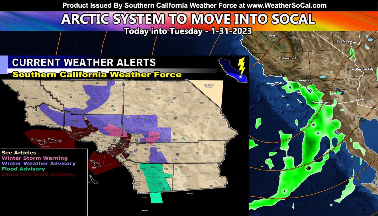
A cold storm system will move through the region, starting today and going into at least Monday evening for the most part, but hanging onto the Low Desert zones into Tuesday. This rare system will show you how diverse Southern California really is and how hard it is to forecast zones because Santa Ana Winds will be in progress at the same time rain/snow is falling in other parts so for the SCWF rain and snow maps read on for details and click any highlighted link for additional information.
I am getting a lot of notices that these updates are not showing up a lot on Facebook when I add it as a link so I will be posting them as images with a link embedded in the descriptions until this issue is fixed.
This system is a cutoff system, which means there will be focus spots I only will talk about and leave the SCWF rain/snow models for the rest.
- The system will be strongest around Monday, giving the coldest air.
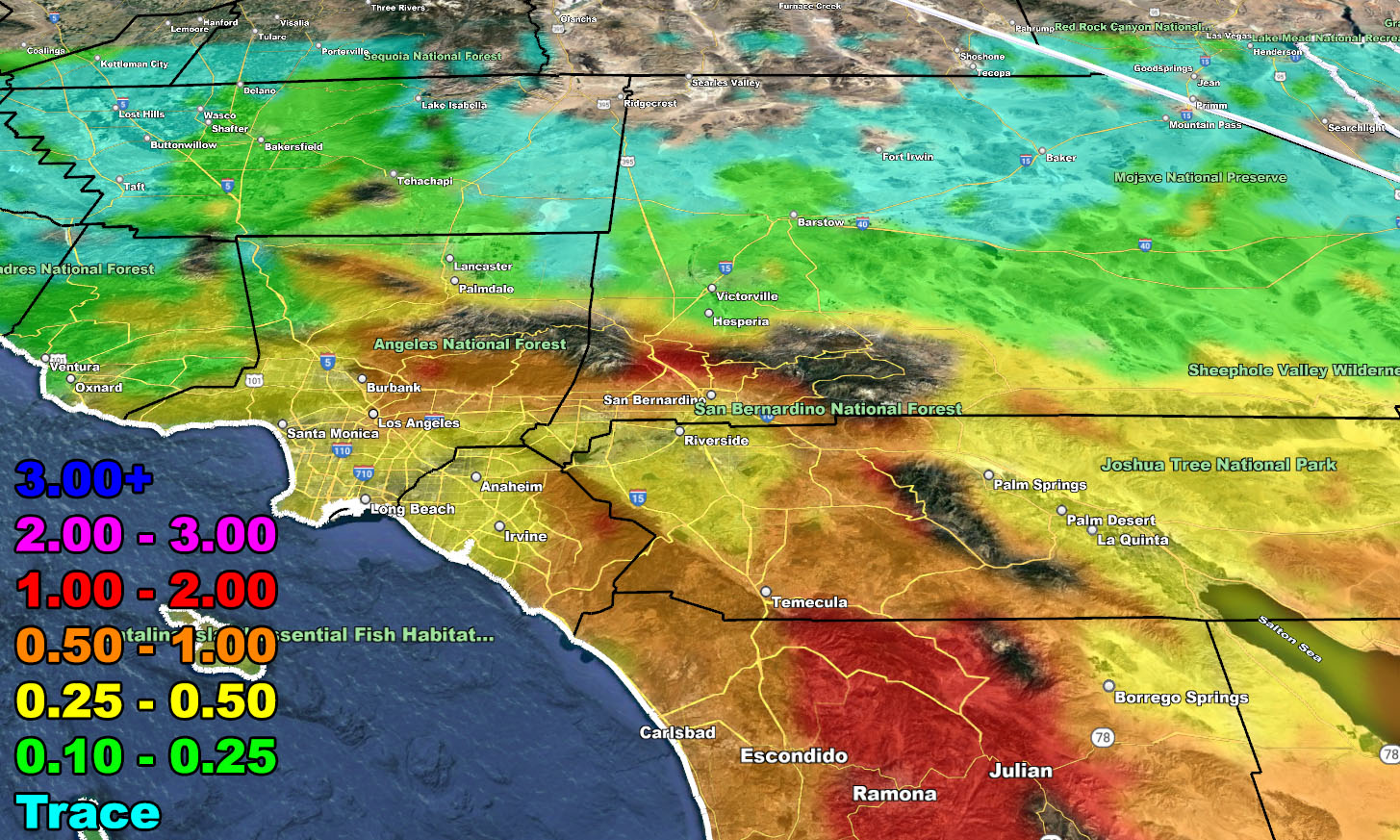
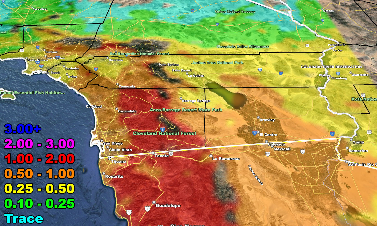
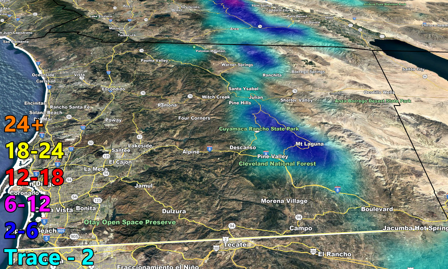
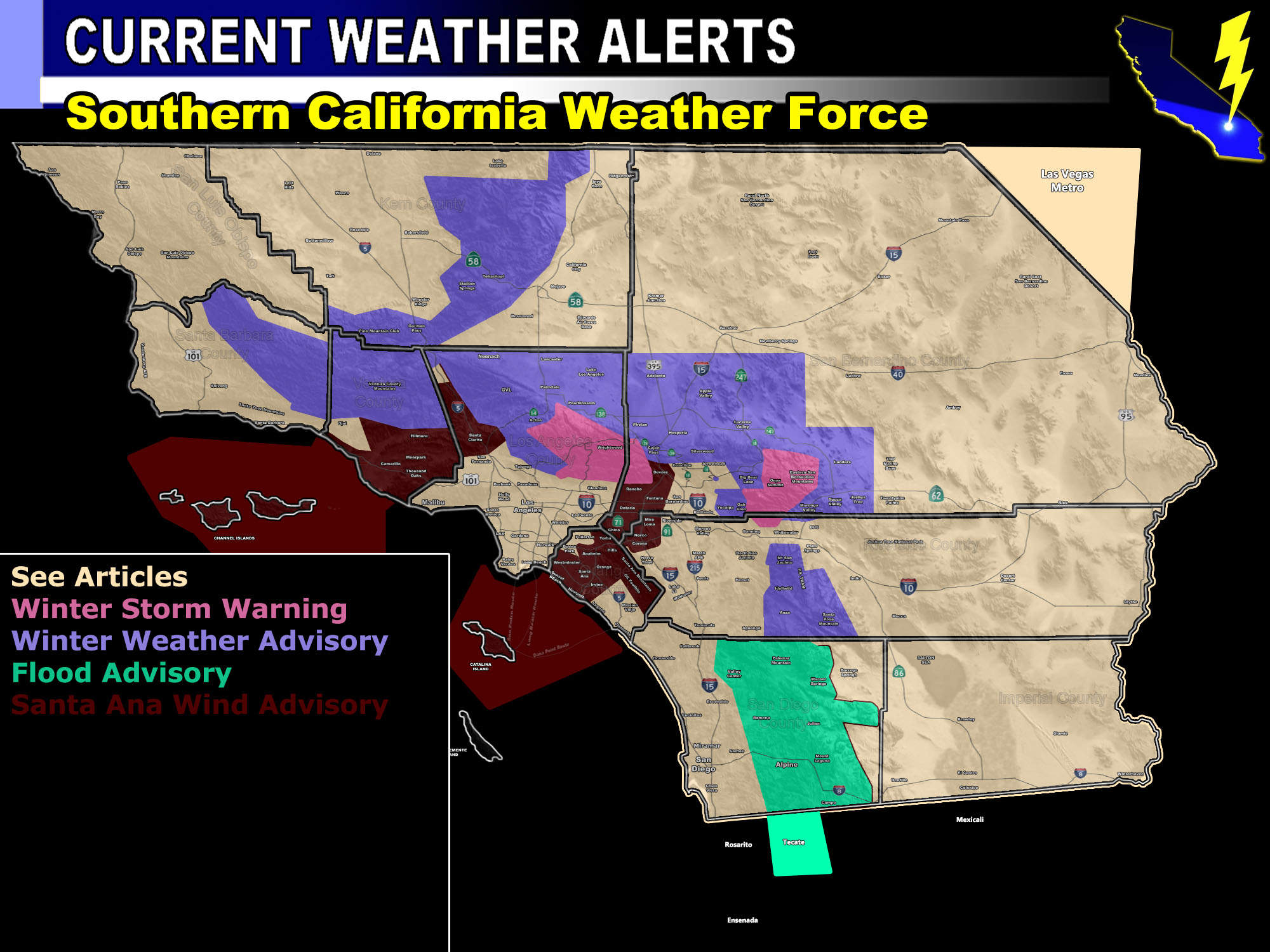
- San Diego County will see the most precipitation from this event, owning up to my Flood Advisory in the foothill/mountain zones.
- This is the type of pattern for Imperial County to see rain, which is more than just a sprinkle or light rain event for those zones.
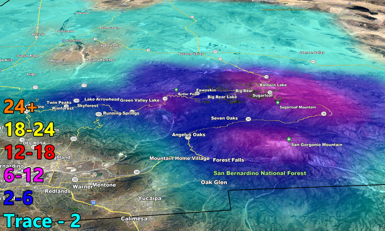
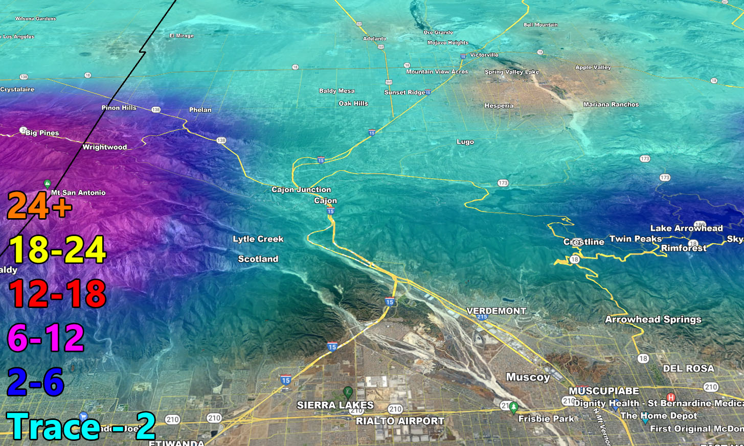
- More snow will Fall east of Big Bear Lake than in town due to the wrap-around event on Monday.
- I’ve put winter weather advisories for the High Desert / AV areas, but I will stress that while a dusting can happen, I would bet more of sleet and no travel issues out there.
- Yucaipa, Upper, is in the winter weather advisory for the same as the High Desert reasons. Don’t expect much.
- West of Los Angeles will see far less than Downtown, and Downtown Los Angeles will see less than San Diego.
- Numerous cold air alerts will be needed across the region as the cold/dry airmass after the storm departs will affect many.
SANTA ANA WIND ADVISORY: As the system dips south of the forecast area Monday evening into Tuesday, it will suck in air from the desert, which is the offshore Santa Ana Wind dynamic. This will mainly be for areas from the Cajon Pass down I-15 through to parts of the Norco/Corona areas as well, southwest through parts of the Orange County zones as well. This also will jet through Highway 14 into the SCV/Ventura County zones as well, but will miss the San Fernando and LA Basin/Coastal areas. Use the SCWF ALERT MAP BELOW FOR DETAILS ON LOCATIONS
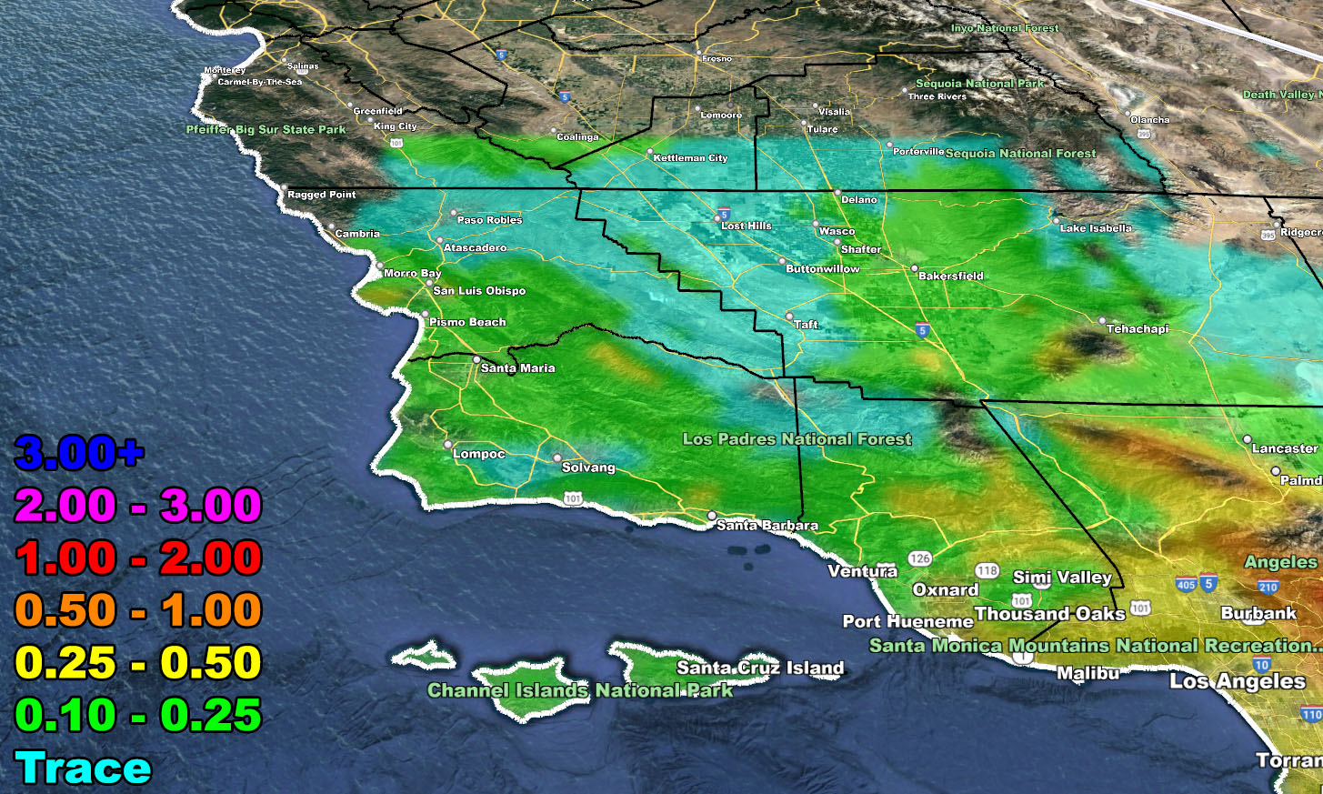
So, with that being said, please use the rain and snow models below and DO NOT FORGET TO LOOK AT THE VALID TIMING IT IS FOR
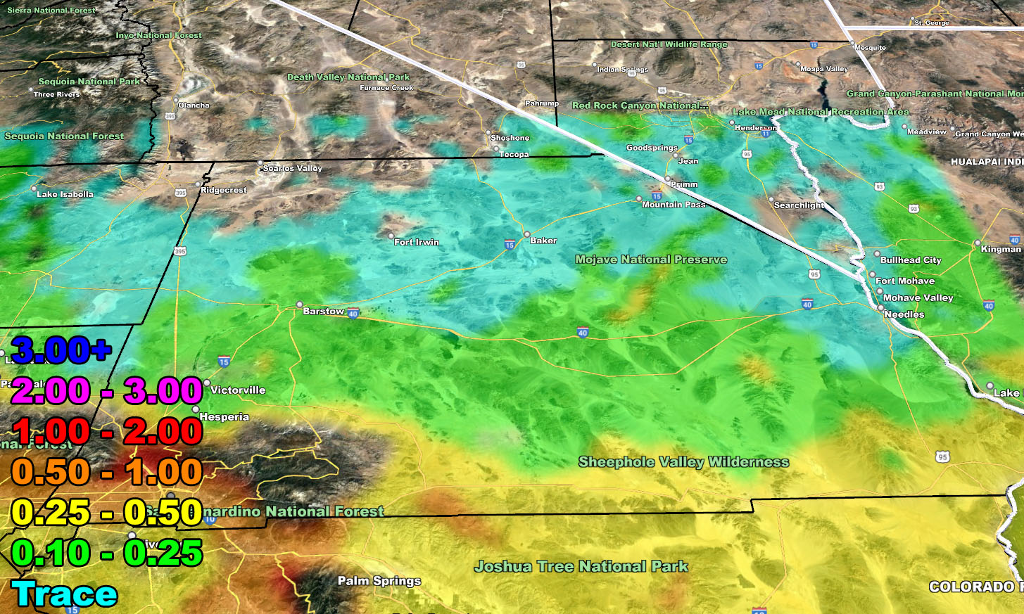
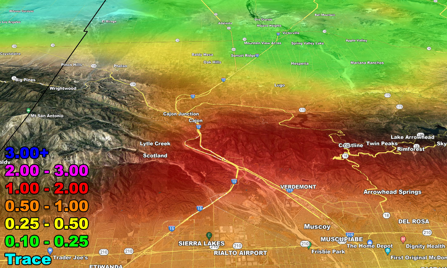
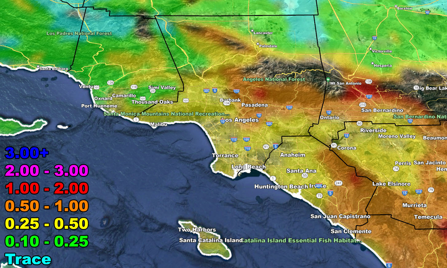
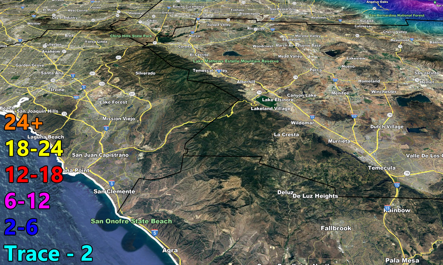
Rain Model – VALID TODAY THROUGH TUESDAY MORNING – 1-31-2023
SUPPORTING MEMBERS: Click Here To See The GPS Version Of This Model In Your Member Section Tab.
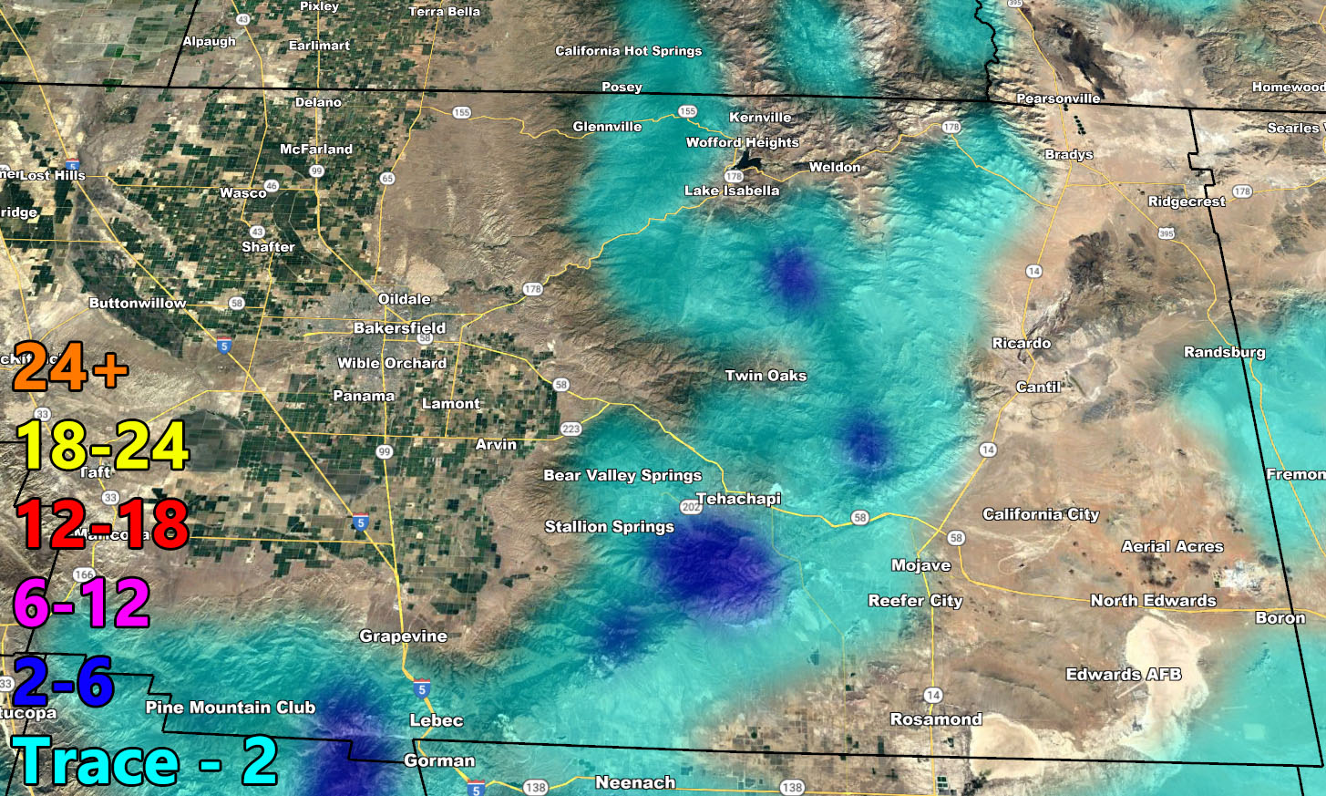
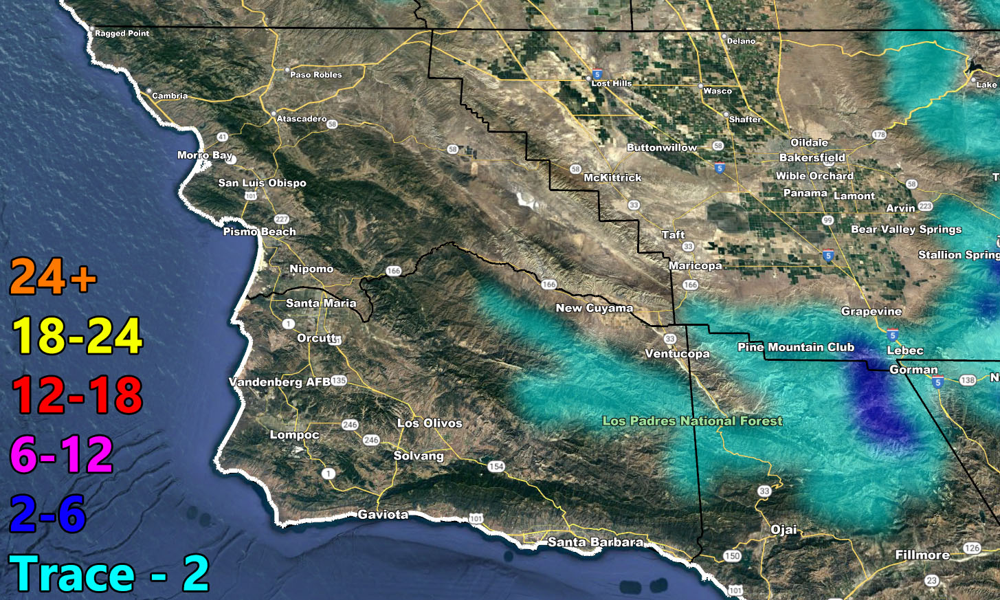
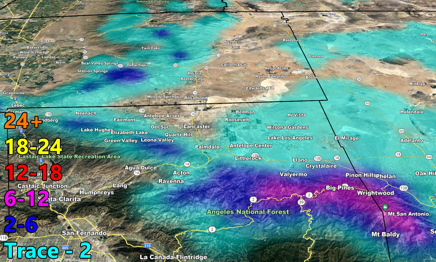
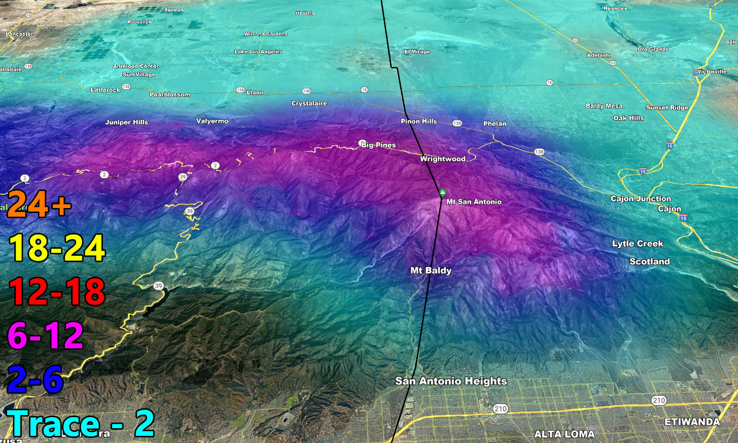
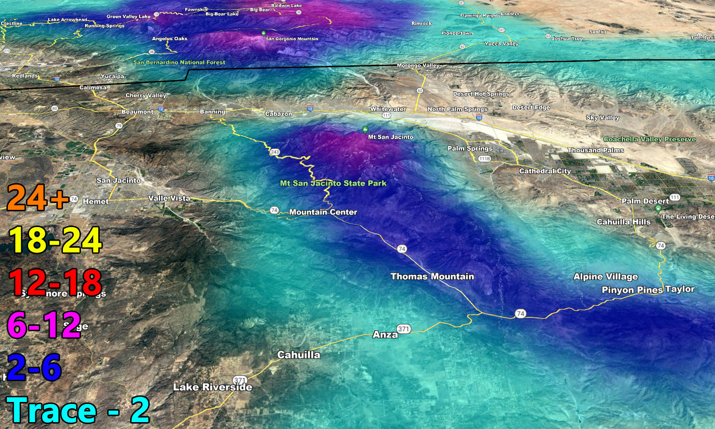
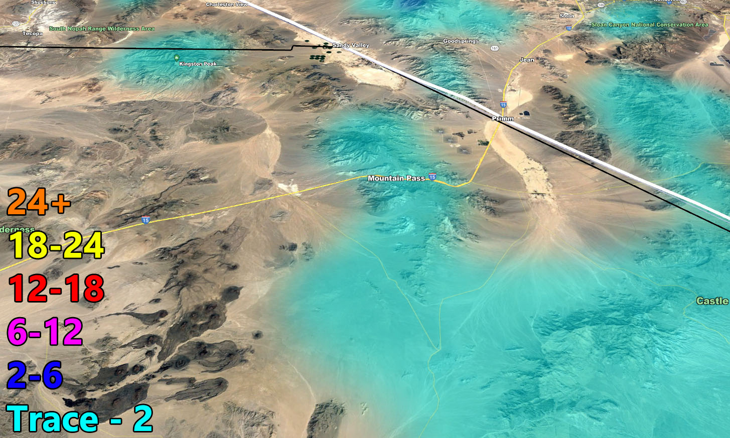
Snow Model – VALID TODAY THROUGH TUESDAY MORNING – 1-31-2023
SUPPORTING MEMBERS: Click Here To See The GPS Version Of This Model In Your Member Section Tab.
SCWF ALERTS FOR THIS SYSTEM
Join the Facebook Page for Further Updates If You Have Not Yet!
SOUTHERN CALIFORNIA WEATHER FORCE MAIN:
Southern California Weather Force Twitter – CLICK HERE
WANT THESE DELIVERED WITH ALL THOSE PERKS INCLUDING BEING ON THE MICRO-CLIMATE ALERT SYSTEM AND MODELS DURING EVENTS BECAUSE NOT EVERY ALERT IS POSTED ON SOCIAL MEDIA FROM THIS WEATHER OFFICE – JOIN TODAY BY CLICKING HERE – Southern California Weather Force Subscriber System – Southern California Weather Force