
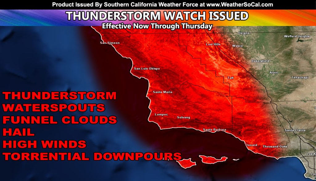
Issued Zones: San Luis Obispo and Santa Barbara County … Western half of Ventura and Kern County …
Site: Southern California Weather Force has issued a Thunderstorm Watch effective now through Thursday
Date Issued: 12/20/23 at 12:20pm local
Forecast: A cutoff low is impacting the region through the watch period. As more lift associated on the eastern periphery is enhanced further, thunderstorms will be likely. Thunderstorms will move from south to north, off the ocean and across the affected zones.
These storms will nail Santa Barbara proper, and flooding is expected. This will be a prolonged event, with numerous storm cells moving across the watch zones even into the overnight hours and into Thursday as well.
Get these alerts over the new Android and Iphone app and/or e-mail service by becoming a full member subscriber today and never miss an update from this office. Remember, you cannot just make an account on the app and get notifications. You must select your zones and then go through the payment process.
Click here to learn more.
10 mile rule: These alerts issued on this site means that within your zone and 10 miles from you will see the event forecast for. You may or may not see the event but it means you are in the zone or 10 miles from where someone will.
Southern California Weather Force is a custom weather alert service that began in September 1999 off and is regarded as the most accurate weather service in the region, offering custom alerts, maps, and models to help save life and property. The work done here is never 100% accurate, but it comes pretty close. Southern California Weather Force runs on zones, so if an event happens in a zone that is 10 miles from the border of your zone, the forecast is still valid to activate your zone’s alert system. A company quote to the public is that of “The Joker” and tells other agencies in weather this all the time… “This world deserves a better class of meteorologist… and I’m gonna give it to them”… out-forecasting even the National Weather Service with lead-time and precision, which makes this service a focus of ridicule and envy in the weather community due to having such accuracy. Alerts issued here are issued custom from this office and this office alone. You may not even hear it elsewhere, but if one is issued near or in your area, listen up because “if you do not wish to die in weather, follow, it’ll save your life one day.”