
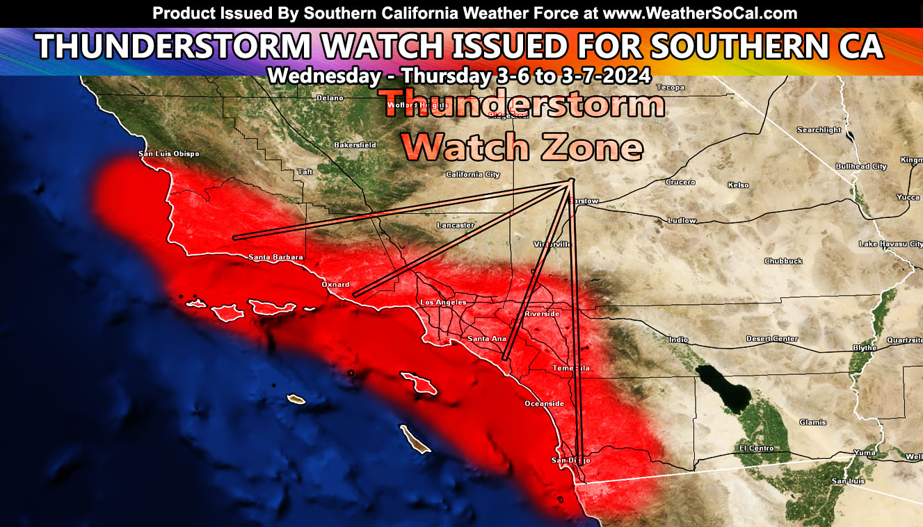
Southern California Weather Force has issued Thunderstorm Watch effective now through Thursday morning for the metro areas of Santa Barbara, Ventura, Los Angeles, Orange, San Diego and some of the Inland Empire zones.
A storm system coming out of the Pacific has come further south than usual for this time of year. In doing so, it has gathered warmer air in the low-levels and also bringing in colder air in the upper-levels. In doing so, it has created the perfect ingredients for thunderstorm dynamics with the low-level warm air rising to the colder air and condensing to clouds. As that happens, a snow level of 6000 FT will allow for ice crystals to form and hit each other in the process, therefore creating friction (static electricity) for a charge in the cloud, and when met with the charge of the Earth, you get lightning.
Now, not all of you will see it, most likely most toward and 20 miles from the coast and along the coast, but it still warrants a full Southern California Weather Force Thunderstorm Watch.
A Southern California Weather Force Thunderstorm Watch will contain the probability of wind, hail, heavy rain, and even the potential of tornadoes during the watch period specified.
Yesterday (Tuesday) morning, Southern California Weather Force‘s Winter Weather Watch went out for the San Bernardino Mountains (Reference – A). The snow-level will be around 6,000 FT and a bit lower within the passage of this system. The Winter Weather Watch issued here at Southern California Weather Force shows the snow-model developed in-office, showing Big Bear Lake’s lake and town level will see between 2-6 inches of snow, more in Moonridge than the lake level of course. Still, the watch is warranted, and we will see that margin reported with pictures Wednesday night into Thursday.
References A – https://www.southerncaliforniaweatherforce.com/2024/03/05/winter-weather-watch-15/
For all previous forecasts, please use Reference B for the call on thunderstorm probabilities –
Long Range – Not much happening right now. We will move our clocks forward on Sunday, and warmth will come. If something is going to happen, as always you will hear it from me. Till then … have a nice day/night/ wherever you are ….
Stay tuned to Southern California Weather Force for more updates on this and other future events.
– Raiden Storm –
https://www.southerncaliforniaweatherforce.com
Master General Meteorologist – is a consulting meteorologist for over 50 companies, including energy, agriculture, aviation, marine, leisure, and many more areas. He has certs from Mississippi State for broadcast met and Penn State forecasting certs MET 101, 241, 341 and 361 as a meteorologist, but before then was completely self-taught, barely learning a thing from the schools that he did not already know.
Both short and long-range is very important to know in those jobs so you can bet on accuracy here. He is versed in fields like Western USA, Tornadoes, Floods, Hurricanes, High Winds, Fire Behavior, Snow and Blizzards, Short Range, Long Range, Seasonal, and Life-Threatening decisions with over 25 years’ experience, out forecasting all weather services available today with lead-time and precision, which makes him a focus of ridicule and envy.
NOTE: Alerts are posted on here, be it a tornado watch, etc, and these alerts are issued from this office and nowhere else. At times, which is often, you will see an alert forecast posted on here that you do not see elsewhere