
Southern California Weather Force has issued the final forecast for a system that will enter the forecast area on Wednesday, lasting into Wednesday night and into some of Thursday as well. Rain models have been finalized, which could also bring thunderstorm risks.
A system in the Pacific Ocean within a split flow pattern will move across Southern California on Wednesday. For now, it will be scheduled by me to go through Vandenberg‘s forecast area a few hours before noon, and then into Ventura later in the day, and Los Angeles, Orange, San Diego, Inland Empire zones Wednesday evening and lasting through the night.
Upper-level dynamics suggests this upper-level low will have enough instability and lift for a risk of thunderstorms as well across all of the metro areas from Santa Barbara, Ventura, Los Angeles, Orange, Inland Empire, and even San Diego’s forecast area.
Earlier this morning, Southern California Weather Force‘s Winter Weather Watch went out for the San Bernardino Mountains (Reference – A). The snow-level will be around 6,000 FT and a bit lower within the passage of this system. The Winter Weather Watch issued here at Southern California Weather Force shows the snow-model developed in-office, showing Big Bear Lake’s lake and town level will see between 2-6 inches of snow, more in Moonridge than the lake level of course. Still, the watch is warranted, and we will see that margin reported with pictures Wednesday night into Thursday.
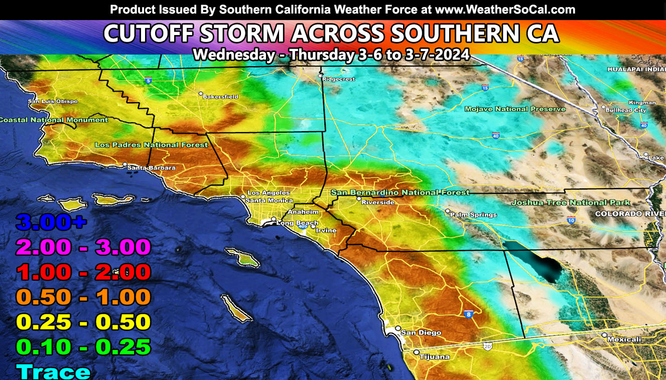
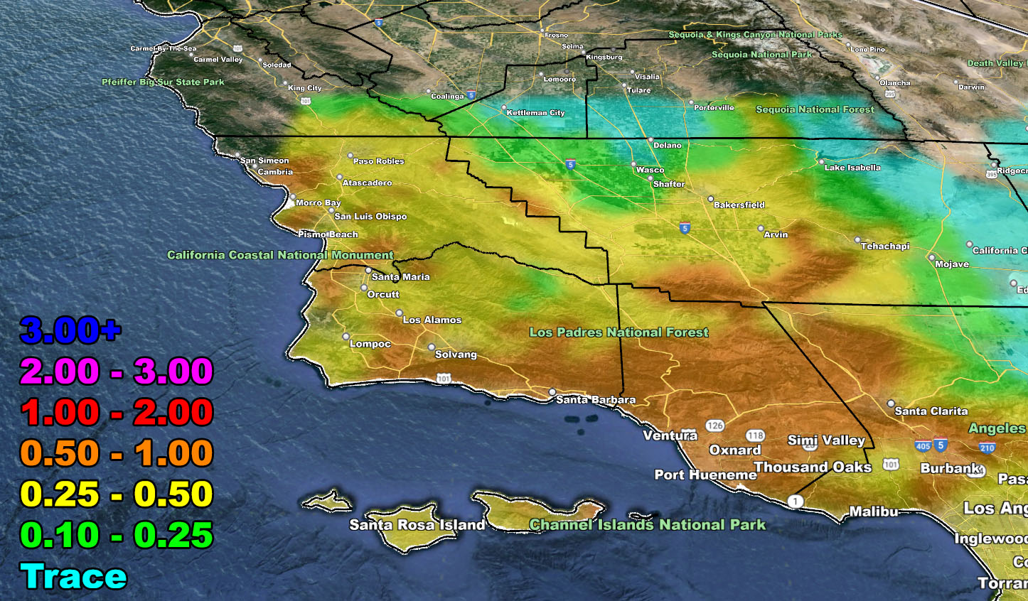
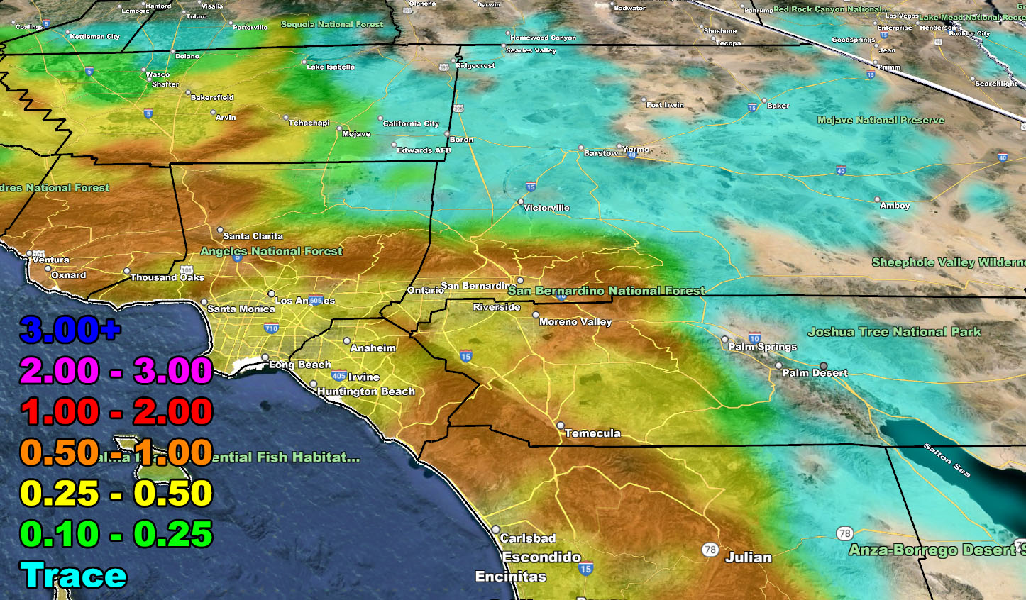
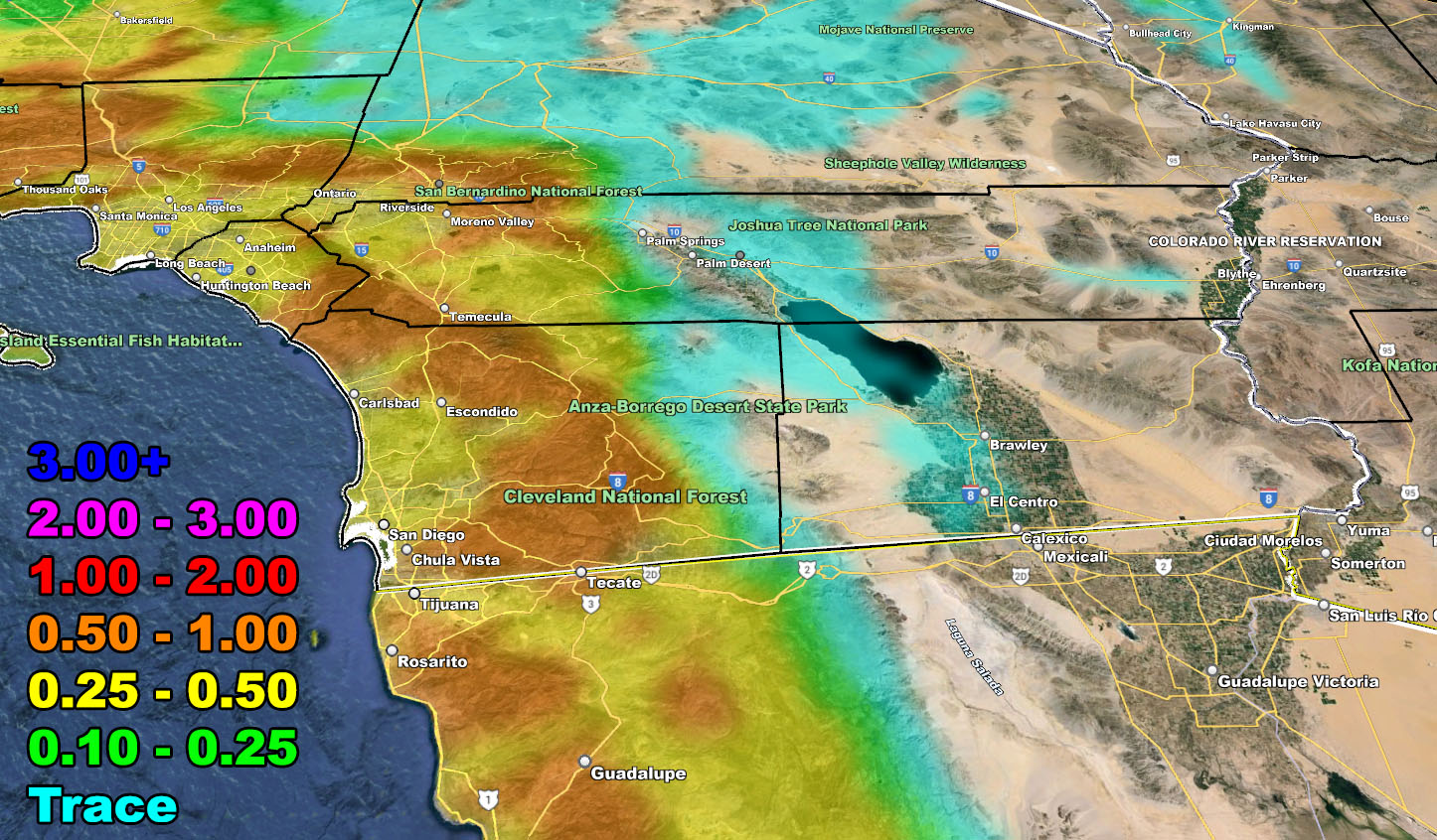
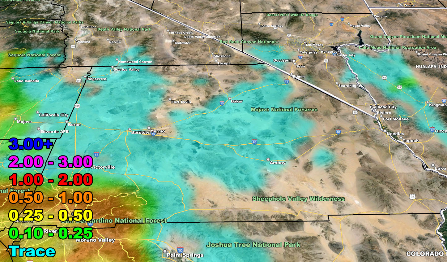
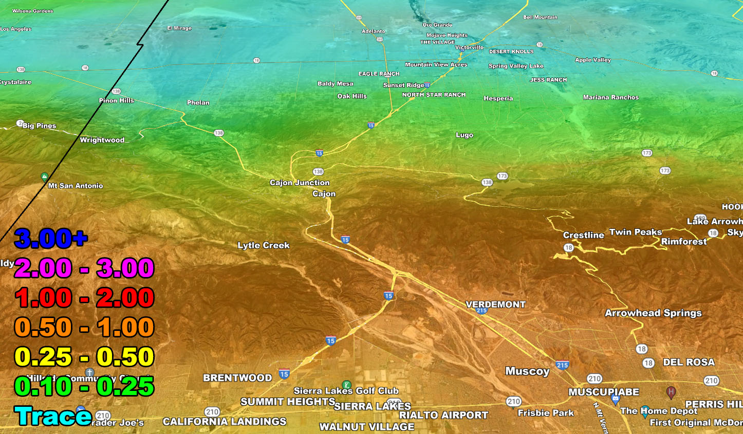
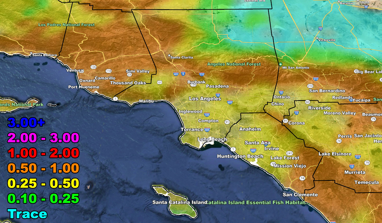
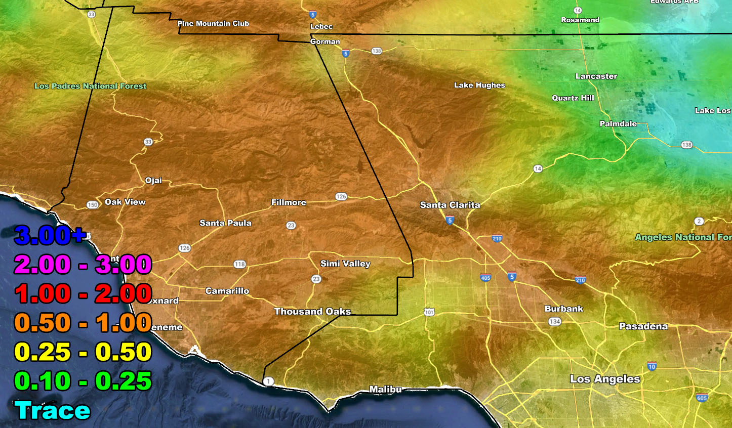
For now, use the rain model images below for the rest of the forecast area, valid Wednesday into Thursday. This will not bring a lot of wind with it, unlike the last system that brushed us from the north.
References A – https://www.southerncaliforniaweatherforce.com/2024/03/05/winter-weather-watch-15/
RAIN
Stay tuned to Southern California Weather Force for more updates on this and other future events.
– Raiden Storm –
https://www.southerncaliforniaweatherforce.com
Master General Meteorologist – is a consulting meteorologist for over 50 companies, including energy, agriculture, aviation, marine, leisure, and many more areas. He has certs from Mississippi State for broadcast met and Penn State forecasting certs MET 101, 241, 341 and 361 as a meteorologist, but before then was completely self-taught, barely learning a thing from the schools that he did not already know.
Both short and long-range is very important to know in those jobs so you can bet on accuracy here. He is versed in fields like Western USA, Tornadoes, Floods, Hurricanes, High Winds, Fire Behavior, Snow and Blizzards, Short Range, Long Range, Seasonal, and Life-Threatening decisions with over 25 years’ experience, out forecasting all weather services available today with lead-time and precision, which makes him a focus of ridicule and envy.
NOTE: Alerts are posted on here, be it a tornado watch, etc, and these alerts are issued from this office and nowhere else. At times, which is often, you will see an alert forecast posted on here that you do not see elsewhere.