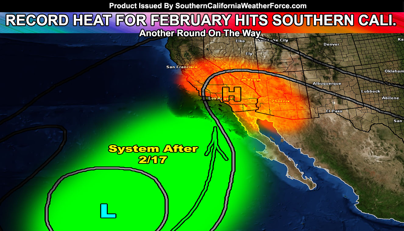
A round of record breaking temperatures for the month of February hit Southern California, hotter temperatures projected after the weekend along with a system being monitored after the 17th.
A large ridge of high pressure situated over the Western United States is providing the region with the hotter temperatures, temperatures giving some a chance to take a ‘winter swim’ in their pools. These temperatures will drop 5-10 degrees as the ridge breaks down … however will return by the weekend. The temperatures with this go around haven’t been broken in spots since the 1800s … a big eye opener.
Over the weekend, expecting the ridge to be overhead and this will cause an offshore flow (Santa Ana Winds) for the prone areas … along with hotter temperatures again. Temperatures could be 5-8 degrees hotter than the temperatures that hit with this last event.
So where’s the rain? The ridge would bring moisture in from the south-southwest after February 17th and this would cause a risk of showers and maybe even some thunderstorms, similar to September weather … rather than February.
El Nino values have jumped back up to +2.6c … and my theory suggests we need this between +1.6c and +2.4c and that has yet to happen … but it will soon.
As it does, the ridge will break and allow low pressure to dominate and storms to drop in. Of course, as stated before … this is likely a late-season impact and a prolonged El Nino.
So hang in there, large high pressure systems like this means that storms are on each side of it … east and west. The western side is what will impact us after the warmer weather is over.
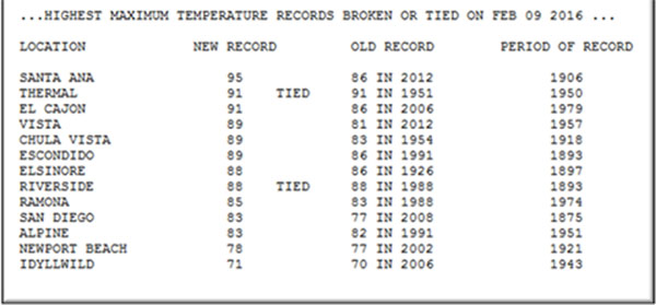
A Record High Temperature Of 89 Degrees Was Set At Los Angeles
Downtown (Usc) Ca Today. This Breaks The Old Record Of 85 Set In
2006.
A Record High Temperature Of 90 Degrees Was Set At Ucla Today. This
Breaks The Old Record Of 85 Set In 2006.
A Record High Temperature Of 88 Degrees Was Set At Los Angeles
Airport (Lax) Ca Today. This Breaks The Old Record Of 85 Set In 2006.
A Record High Temperature Of 92 Degrees Was Set At Long Beach Ca
Today. This Breaks The Old Record Of 86 Set In 1991.
A Record High Temperature Of 91 Degrees Was Set At Camarillo Ca
Today. This Breaks The Old Record Of 88 Set In 2006.
A Record High Temperature Of 90 Degrees Was Set At Oxnard Ca Today.
This Ties The Old Record Of 90 Set In 2006.
A Record High Temperature Of 68 Degrees Was Set At Sandberg Ca
Today. This Breaks The Old Record Of 67 Set In 1951.
A Record High Temperature Of 85 Degrees Was Set At Santa Barbara
Airport Ca Today. This Breaks The Old Record Of 81 Set In 2006.
A Record High Temperature Of 87 Degrees Was Set At Santa Maria
Airport Ca Today. This Breaks The Old Record Of 83 Set In 2006.
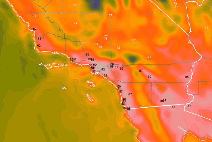
The image below is our projection (could be hotter than shown) of Monday, February 15, 2016 … The black numbers are potential ties or record breakers for that day.