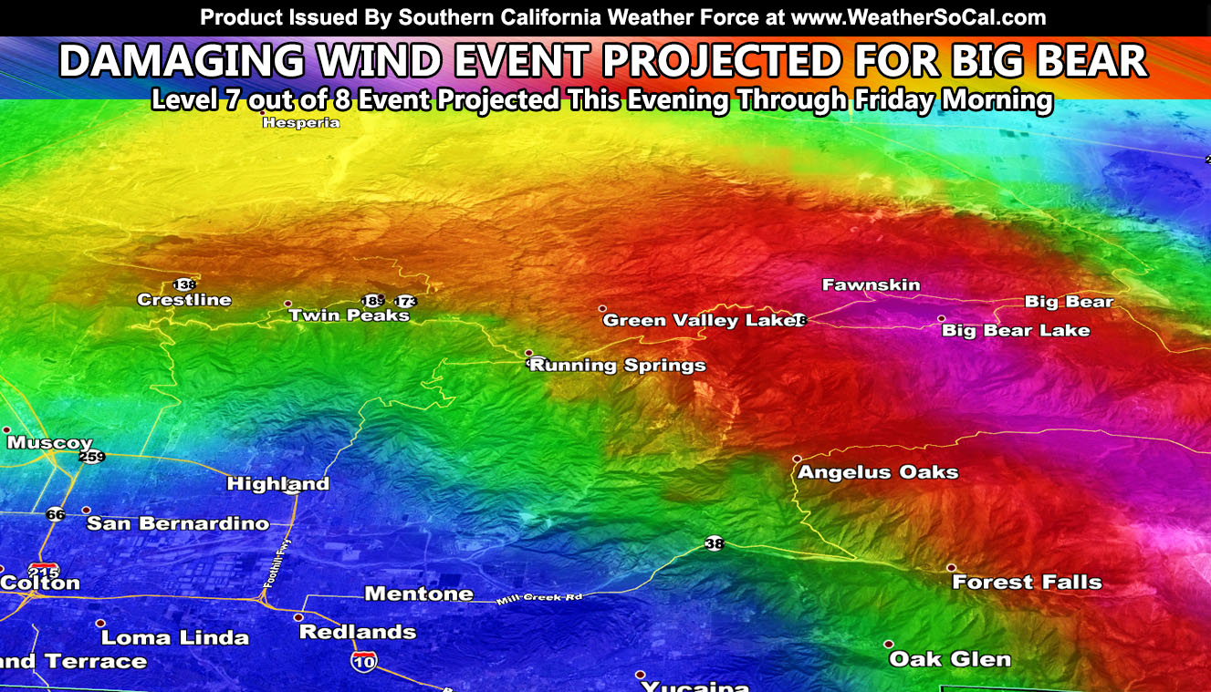
In what is known as a mountain wave will strike Big Bear Lake with damaging winds starting this evening until Friday morning. The Southern California Weather Force Hurricane Wind Gust Warning remains is in effect. How much snow will you receive? Read on for details and the snow model exclusive.
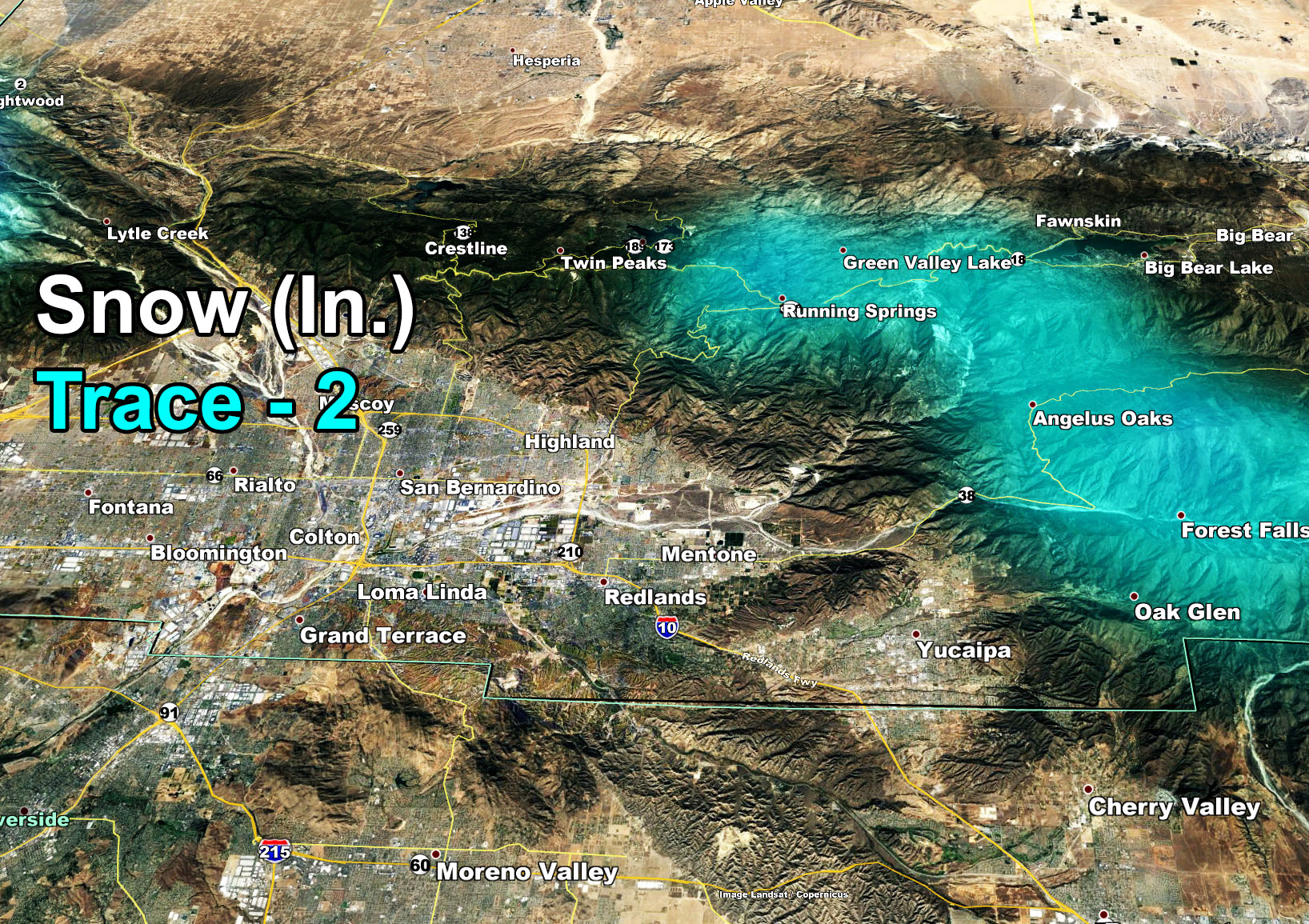
The frontal zone hasn’t hit the forecast area yet. It will surge across San Luis Obispo / Santa Barbara County this evening and spread through the rest of the area overnight. This is a night-owl event so unless you are a night-owl you won’t even know it passes because it passes overnight and it is gone by morning. What I am seeing right now is a Winter Weather Advisory from NOAA in the San Bernardino Mountains. Kindly ignore it as only a trace to 2″ of snow is expected on the rim on my model and barely a flake in Big Bear Lake. The reason my model is showing no snow accumulations in town is because the air is dry above around 8,000 FT so in reality the clouds over Big Bear Lake would be only 1,000 FT thick and that isn’t enough for precipitation.
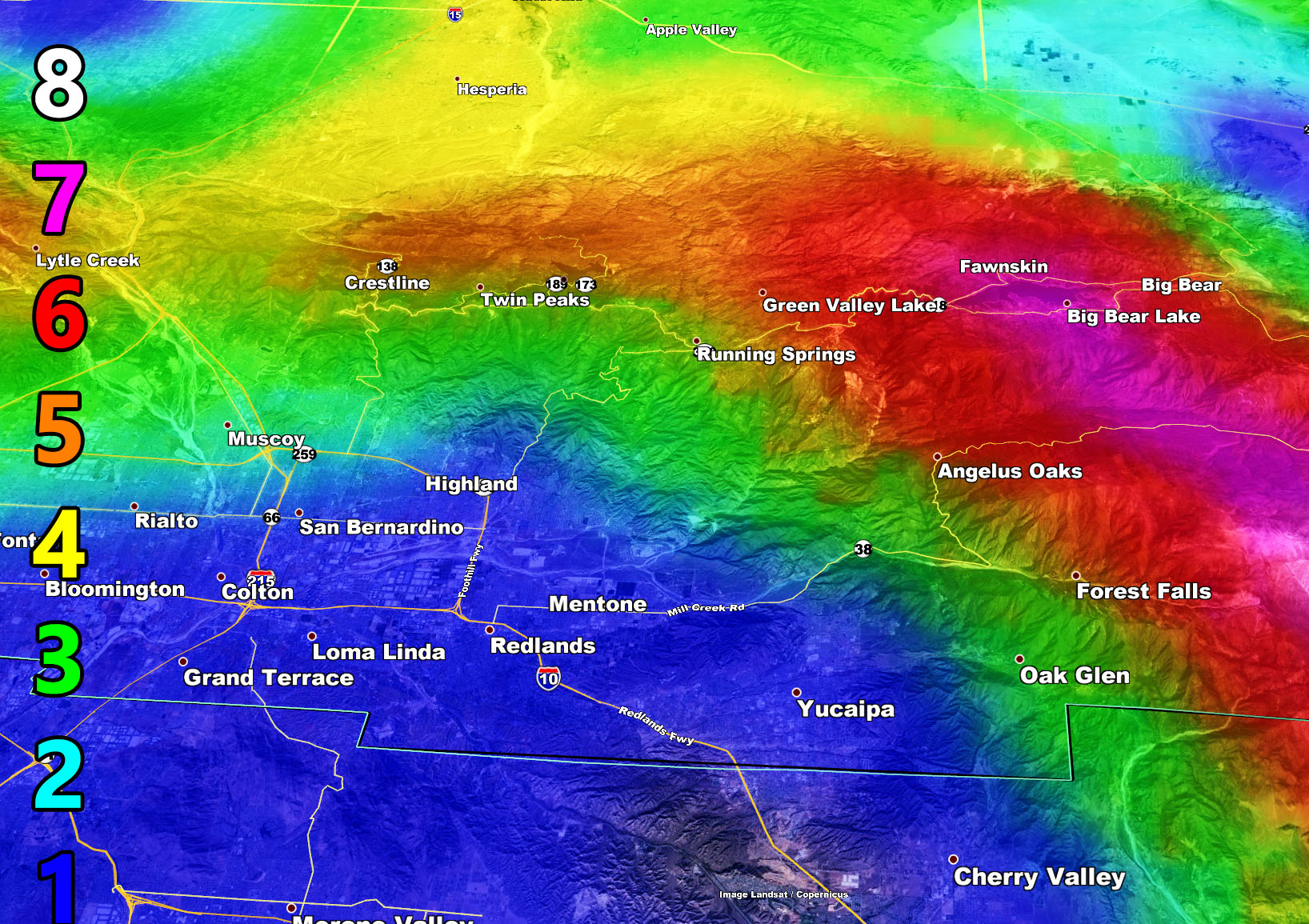
This event is not mainly a snow event for the San Bernardino Mountains. With the dry air working over the top of the front tonight, wind gusts will surge to 60 and even 70 mph in town with sinking cold air behind the front in what is called a mountain wave event. My wind gust models are the most accurate around so use the model to your advantage. I do not know how you fair in near 70 mph wind gusts but the model has a level-7 wind event and those are the types that cause damage.
Martin Wind Gust Intensity Scale –
8. Extensive widespread damage.
7. Trees are broken or uprooted, building damage is considerable. – High Profile Vehicle Roll-Over CERTAIN.
6. SOME Trees are broken or uprooted, building damage is possible. – High Profile Vehicle Roll-Over Likely, Do NOT recommend Traveling in this zone
5. Slight damage occurs to buildings, shingles are blown off of roofs. HIGH WIND WARNING CRITERIA – High Profile Vehicle Roll-Over Possible if weight is not corrected.
4. Twigs and small branches are broken from trees, walking is difficult.
3. Large trees sway, becoming difficult to walk. POWER SHUTDOWN THRESHOLD WIND ADVISORY CRITERIA
2. Large tree branches move, telephone wires begin to “whistle”, umbrellas are difficult to keep under control.
1. Small trees sway.