
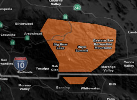
Issued Zones: Eastern San Bernardino Mountains, including Big Bear Lake …
Site: Southern California Weather Force has issued a Hurricane Wind Gust Warning effective now for Thursday – This is a dangerous event incoming …
Date: 1/14/20 at 12:10pm PT
Forecast: A strong mid/upper level jet stream will move through on Thursday giving some snow to the region and strong winds. The snow isn’t going to be the issue here, the winds will be.
The mid-level jet is very strong, probably the strongest in a couple years and what this will do is with the drying behind and along the front, cold air surging downward will bring gusts over the 70 mph mark and the level 7 out of 8 for Big Bear Lake on the Martin Wind Gust Intensity Scale means trees are broken or uprooted, building damage is considerable.
Be advised to prepare for this wind storm starting Thursday afternoon and going through Friday morning … Use the model below to see where on the mountain you are to the intensity scale.
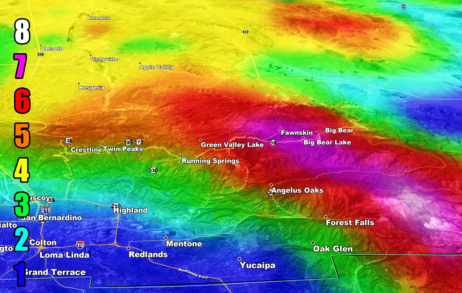
Martin Wind Gust Intensity Scale –
8. Extensive widespread damage.
7. Trees are broken or uprooted, building damage is considerable. – High Profile Vehicle Roll-Over CERTAIN.
6. SOME Trees are broken or uprooted, building damage is possible. – High Profile Vehicle Roll-Over Likely, Do NOT recommend Traveling in this zone
5. Slight damage occurs to buildings, shingles are blown off of roofs. HIGH WIND WARNING CRITERIA – High Profile Vehicle Roll-Over Possible if weight is not corrected.
4. Twigs and small branches are broken from trees, walking is difficult.
3. Large trees sway, becoming difficult to walk. POWER SHUTDOWN THRESHOLD WIND ADVISORY CRITERIA
2. Large tree branches move, telephone wires begin to “whistle”, umbrellas are difficult to keep under control.
1. Small trees sway.
How to get these alerts with a premium subscription? (100 percent delivery time)
Click Here For Options
Join A Micro-Climate Group On Facebook For These Alerts? (50 percent delivery time)
Click Here To Find Your Location Served By SCWF Today!
NOTE: If you read this from a SCWF micro-climate Facebook Group, keep in mind that forecast ARTICLES are NOT posted there unless it directly affects you. You will want to go to the MAIN SCWF Facebook Page and to go there you CLICK HERE.
10 mile rule: These alerts issued on this site means that within your zone and 10 miles from you will see the event forecast for. You may or may not see the event but it means you are in the zone or 10 miles from where someone will.
Forecaster: KM