
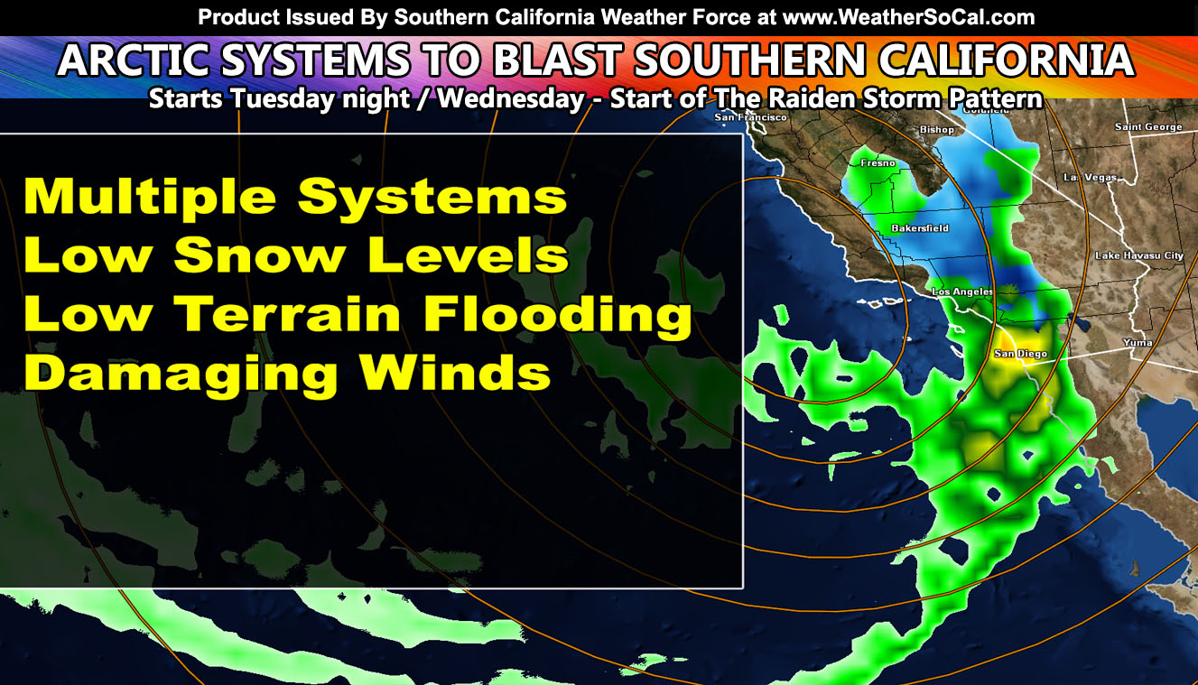
The Raiden Storm Pattern of February 2023 will come with a number of arctic storm systems into Southern California, bringing heavy snow above 3,000 FT, low terrain flooding, and damaging winds. The pattern begins on Tuesday night and Wednesday with damaging winds, and the storms peak will be later Thursday and into Friday so for the rain, snow, and wind models developed here in-office, read on for details …
MOUNTAIN AREAS HIT THE STORES BEFORE OTHERS DO –
Join the Facebook Page for Further Updates If You Have Not Yet!
SOUTHERN CALIFORNIA WEATHER FORCE MAIN:
For the naysayers or new viewers, understand this was predicted on January 31st to the exact timeframe. You can click here to view that forecast. This means that confidence is very high of the forecast coming true. SCWF forecasts are ahead of the time we are on now by over 50 years.
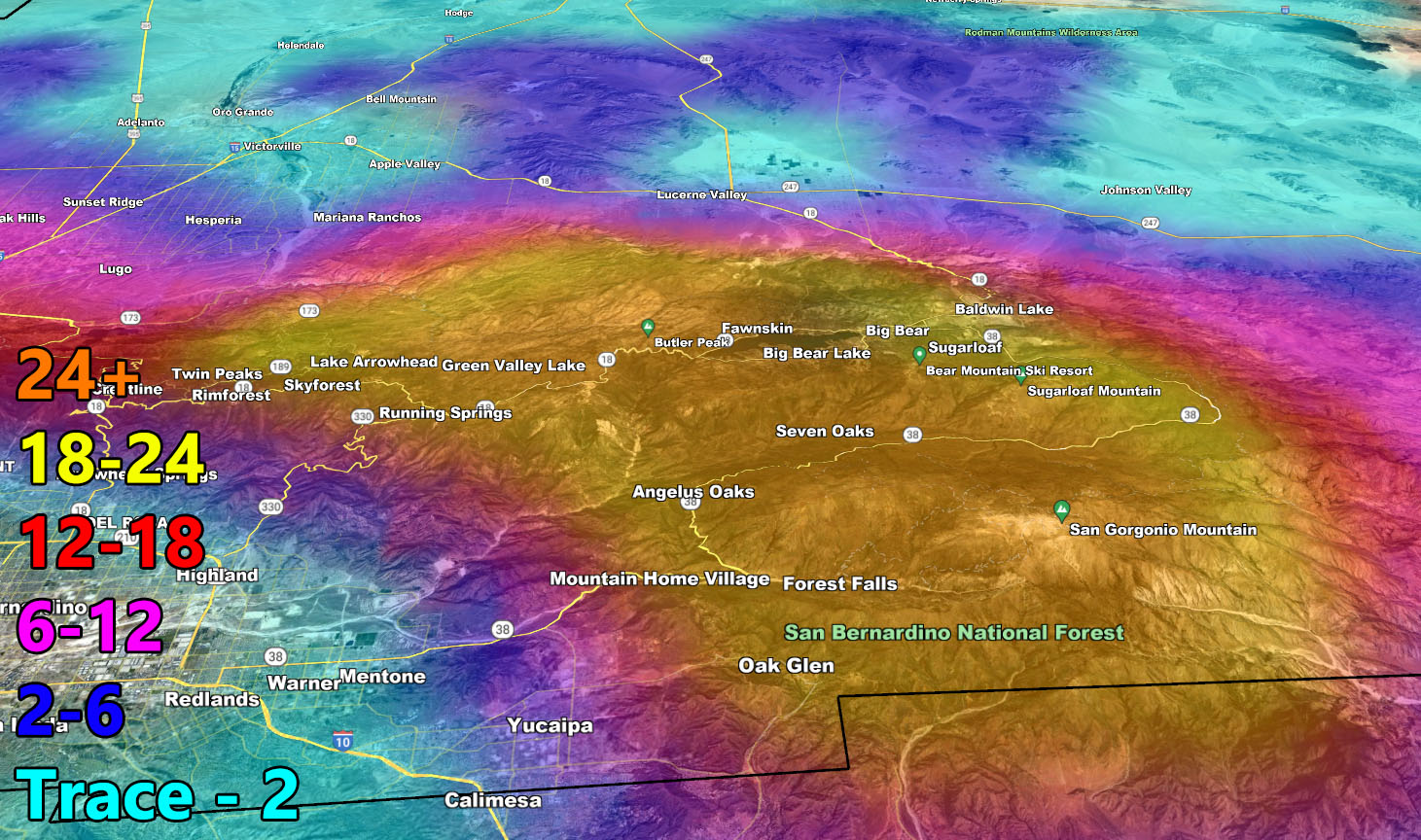
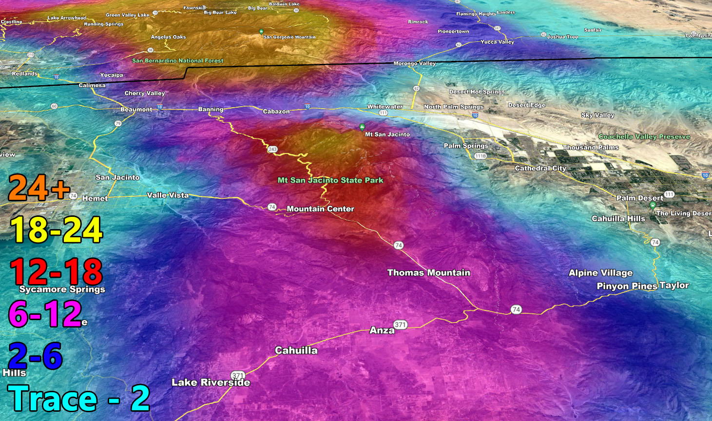
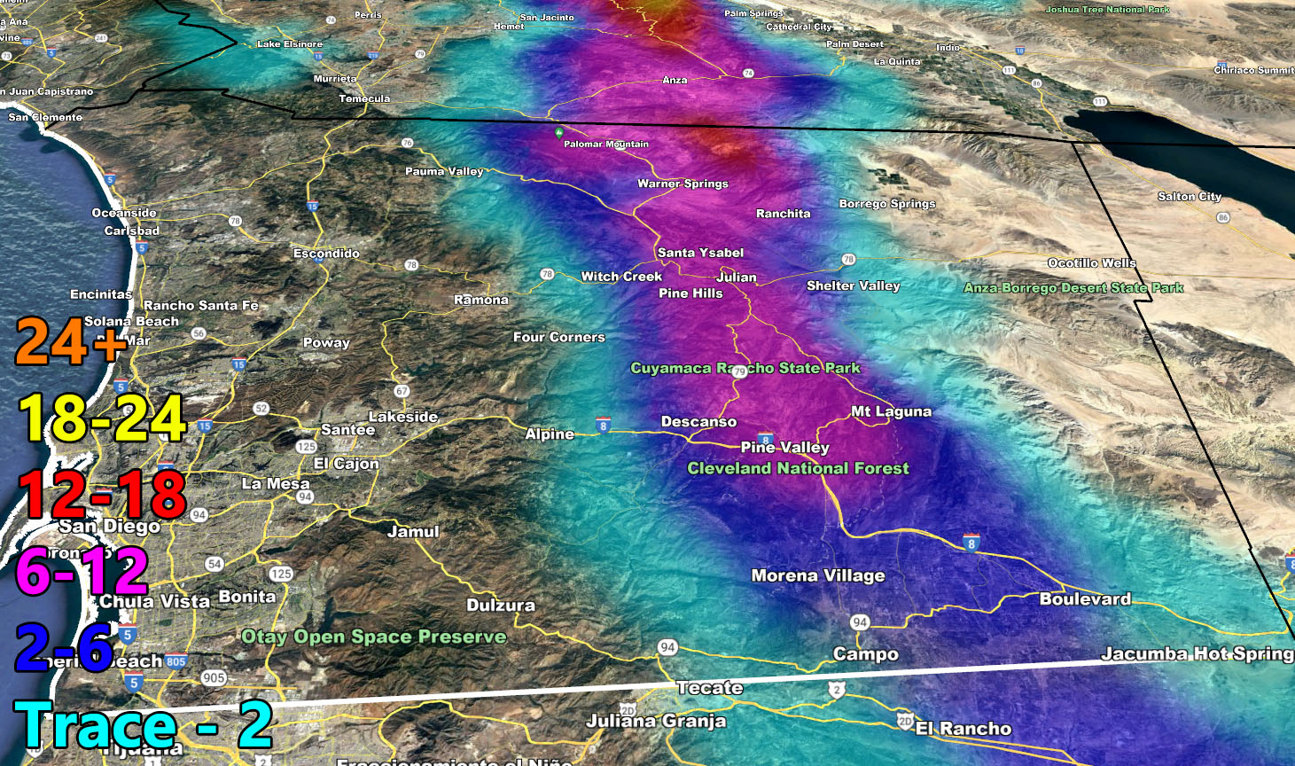
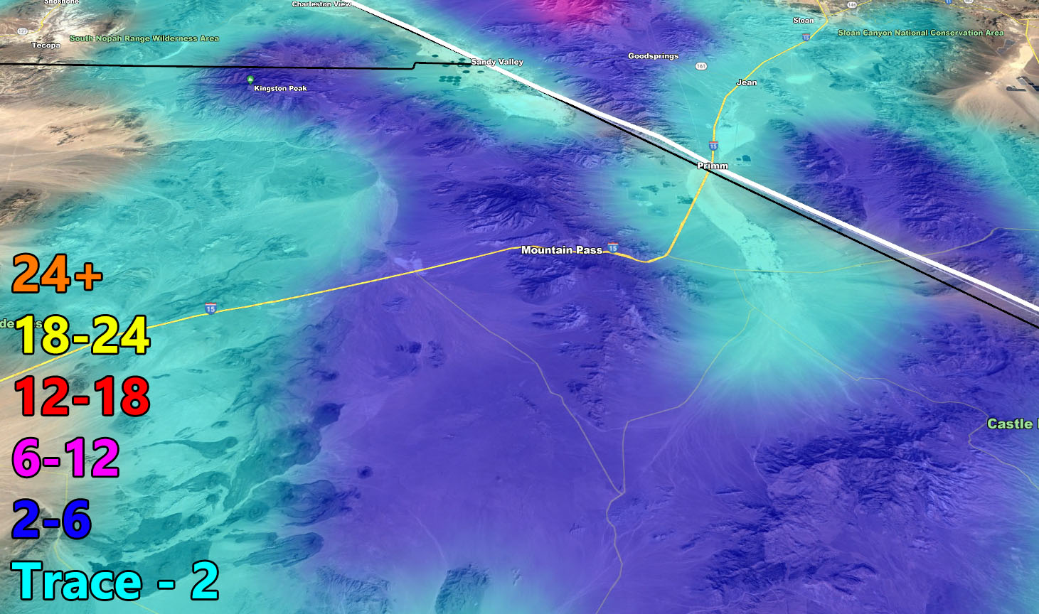
There is not much to talk about other than the now famous pretty models here at Southern California Weather Force. Please use the information below this writing and also make sure you see when it is valid for. Models now show a zoom-in to the mountain locations for your convenience.
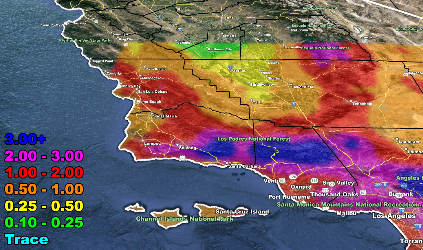
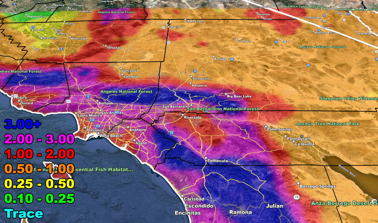
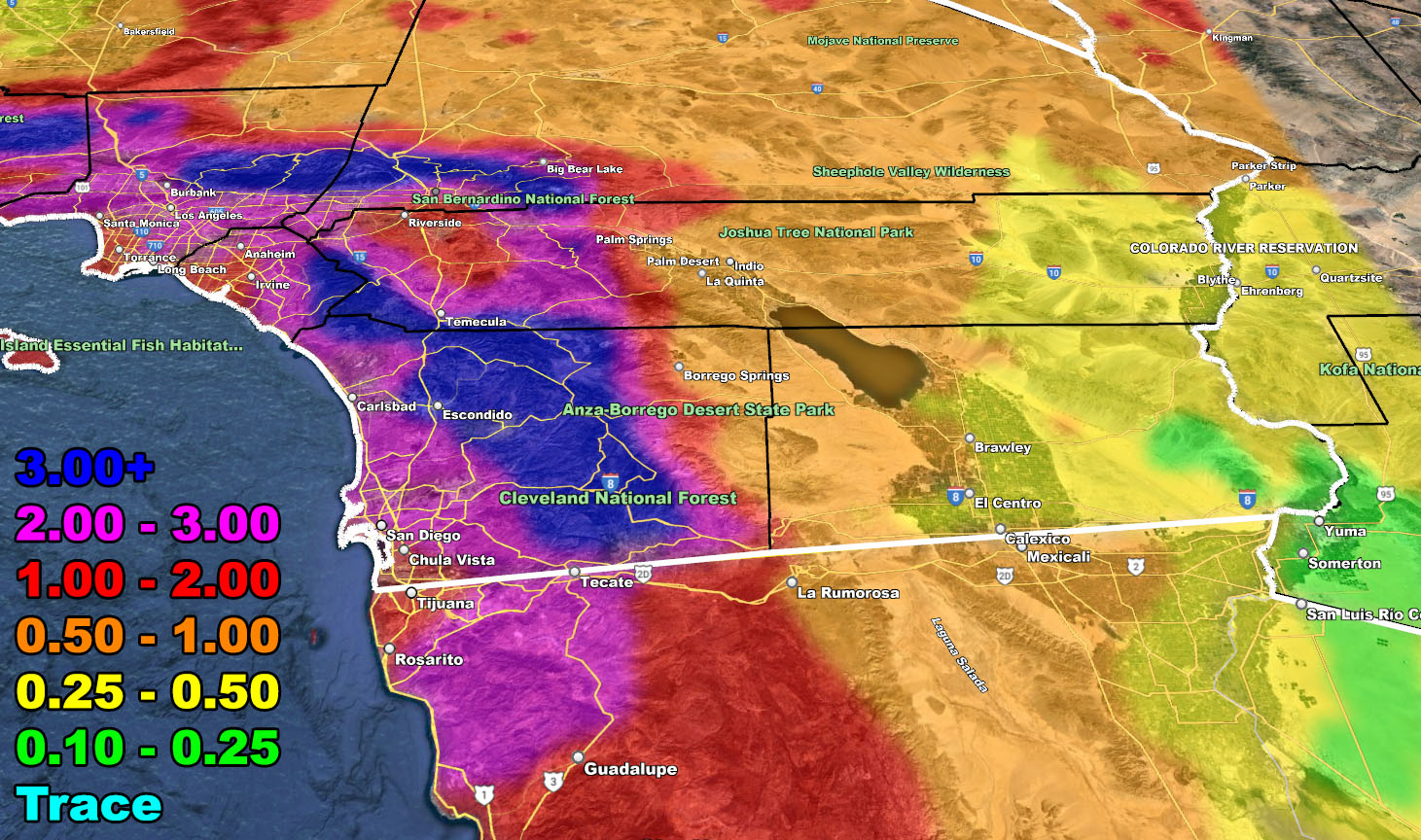
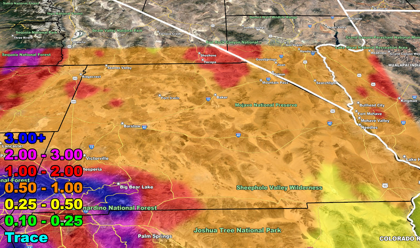
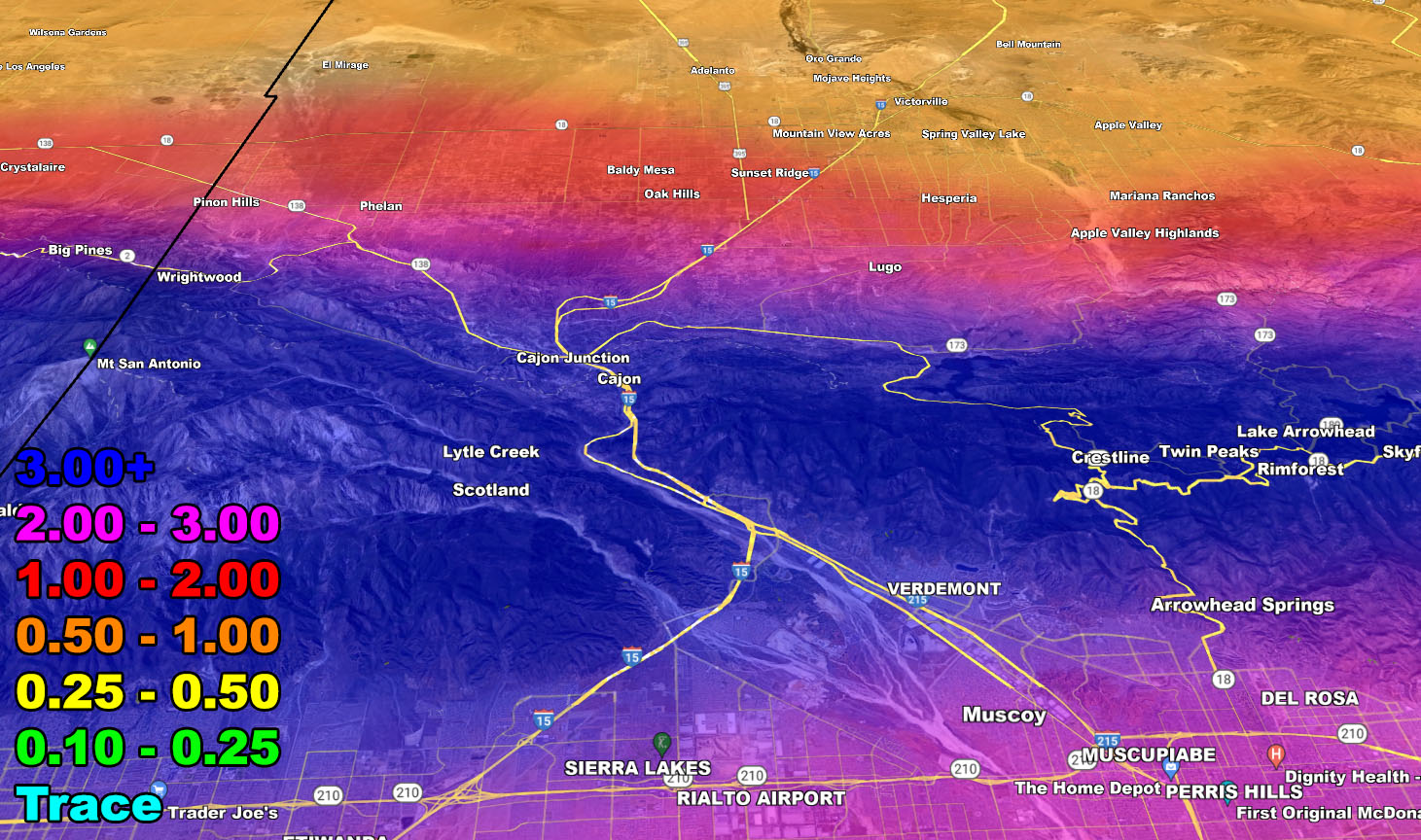
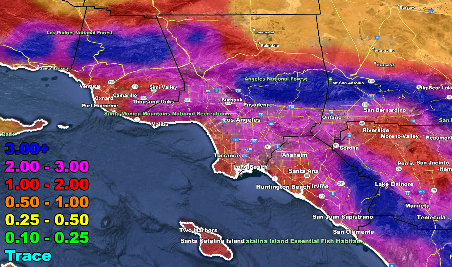
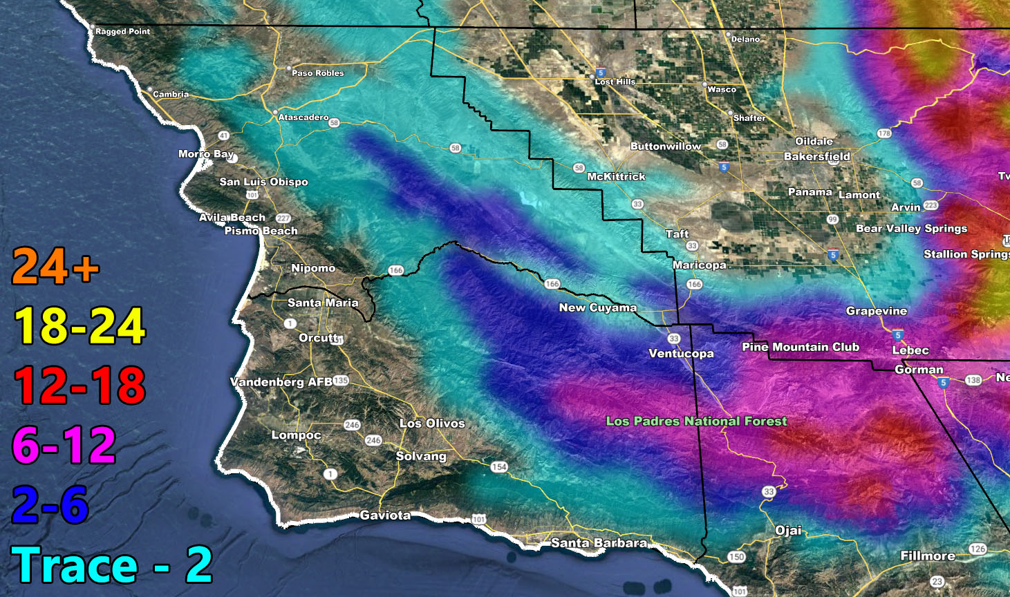
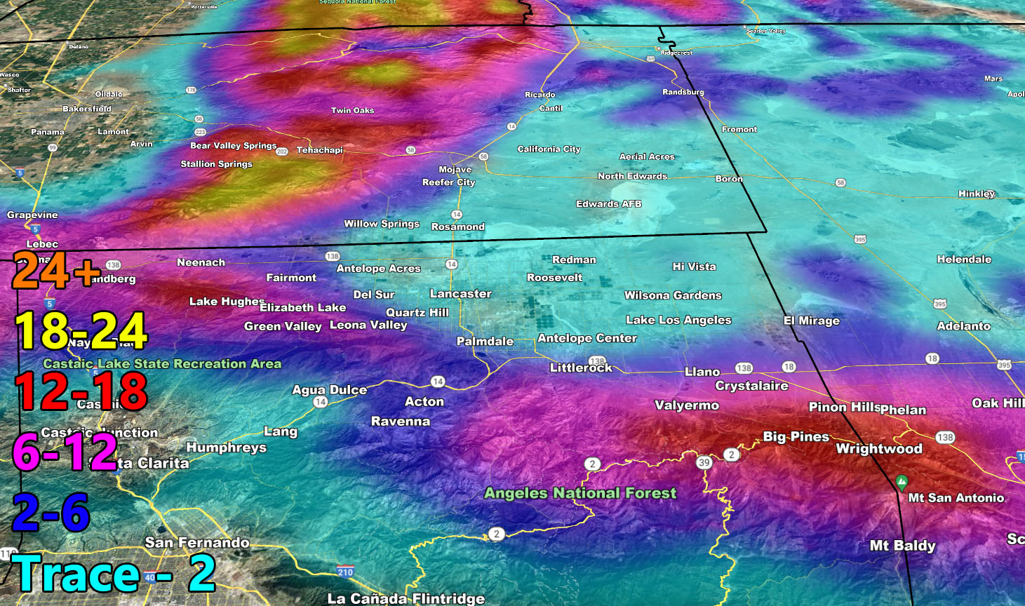
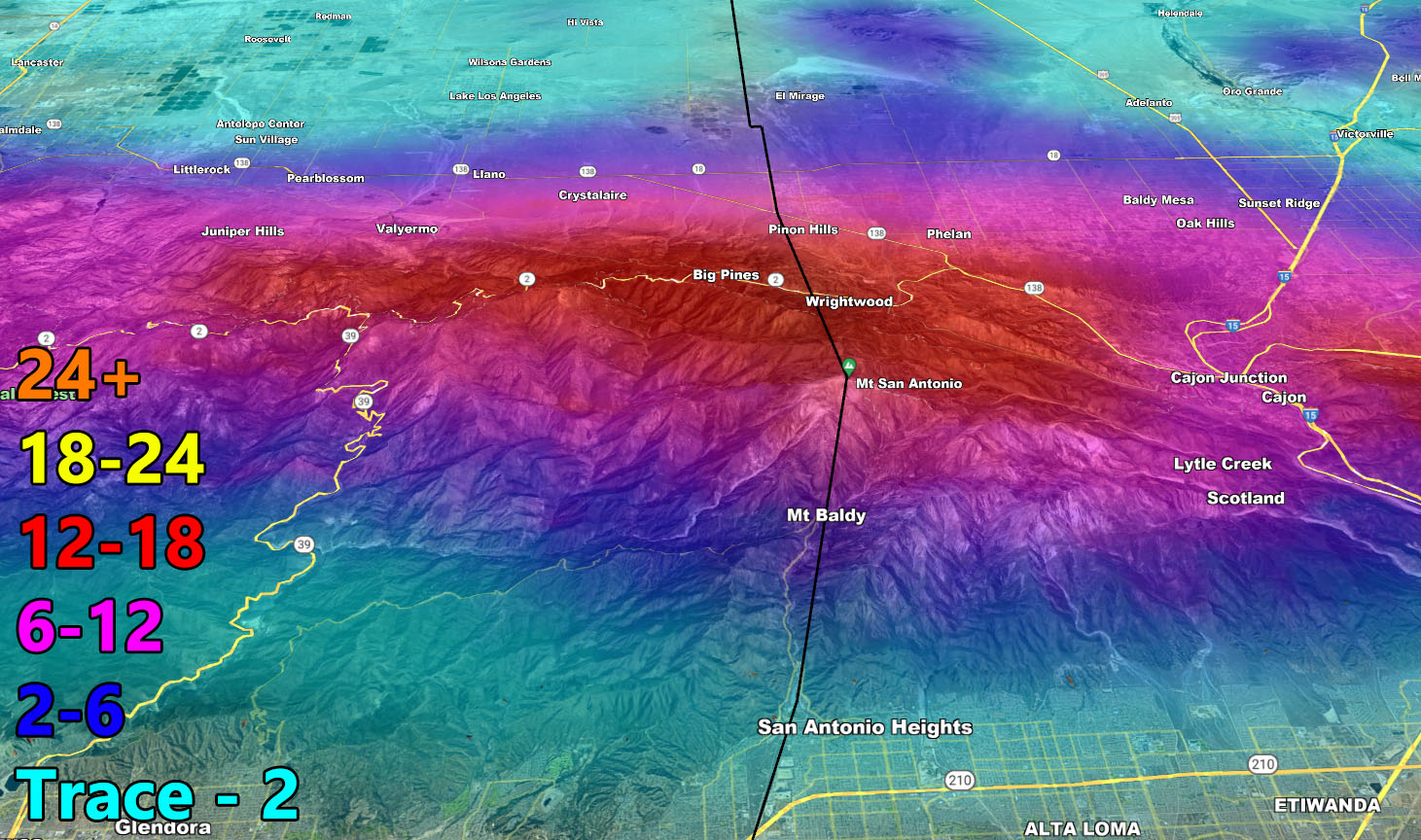
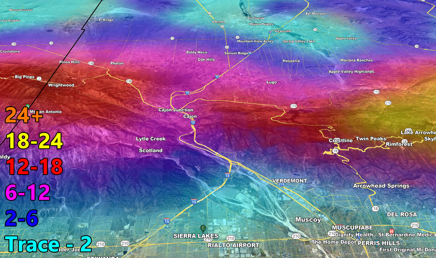
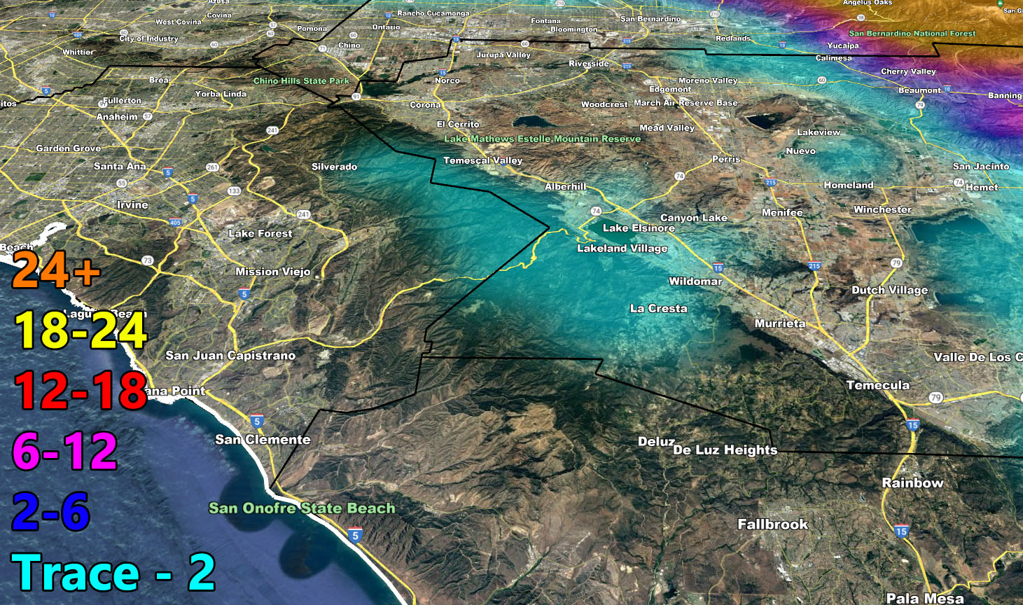
Rain Model – TUESDAY EVENING THROUGH THE WEEKEND, PEAK THURSDAY EVENING INTO FRIDAY AFTERNOON
SUPPORTING MEMBERS: Click Here To See The GPS Version Of This Model In Your Member Section Tab.
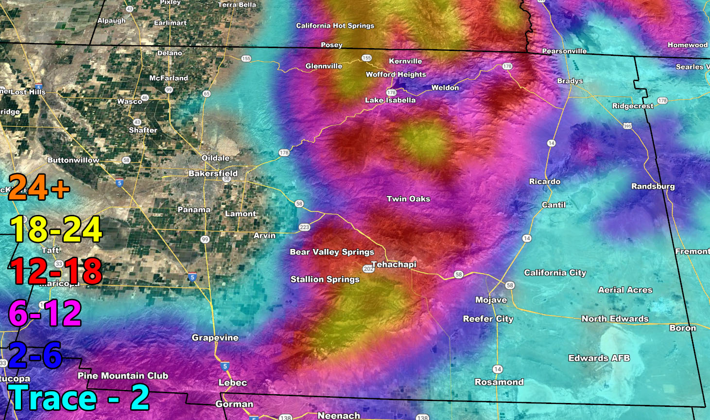
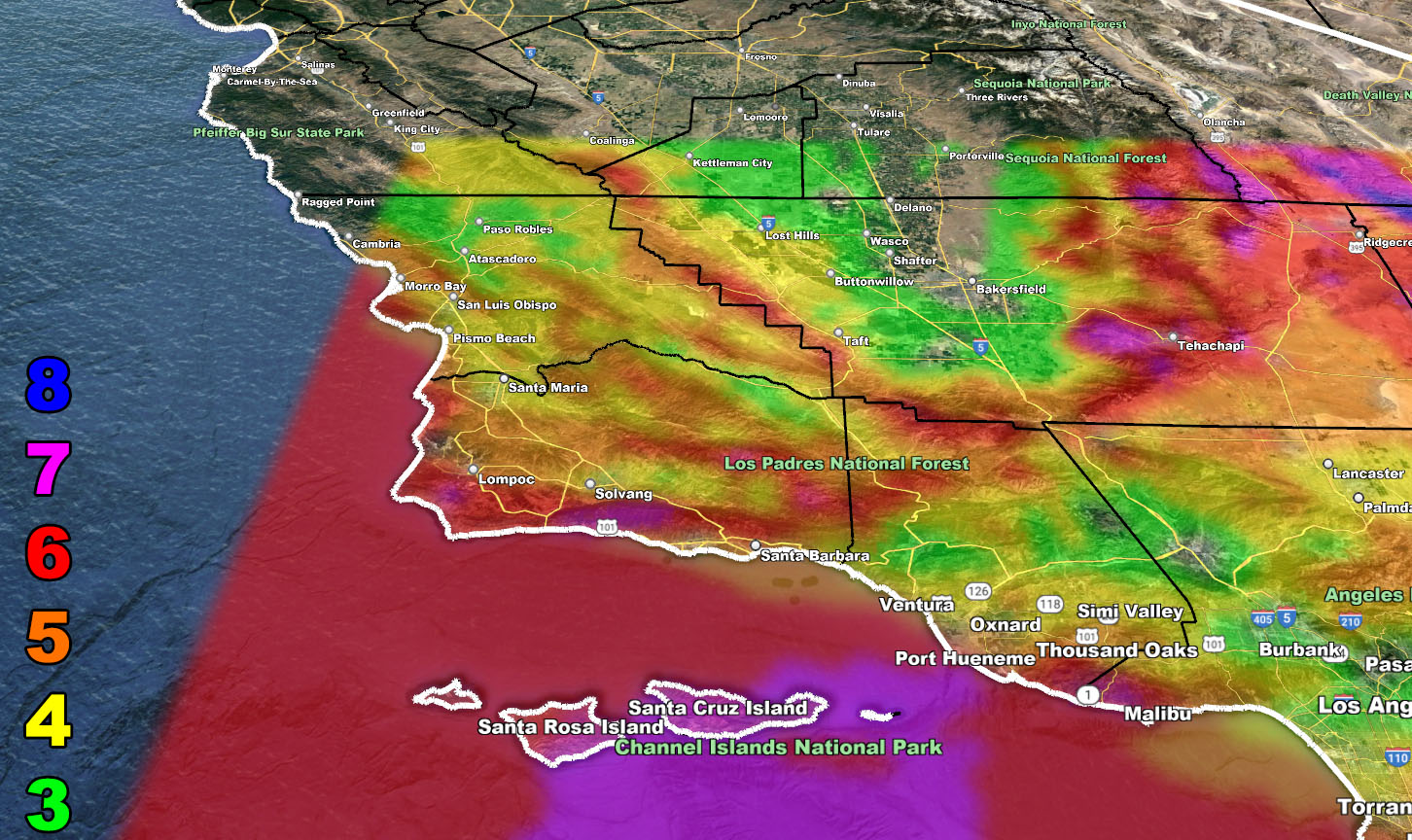
Snow Model – TUESDAY EVENING THROUGH THE WEEKEND, PEAK THURSDAY EVENING INTO FRIDAY AFTERNOON
SUPPORTING MEMBERS: Click Here To See The GPS Version Of This Model In Your Member Section Tab.
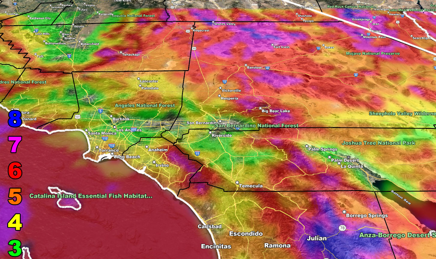
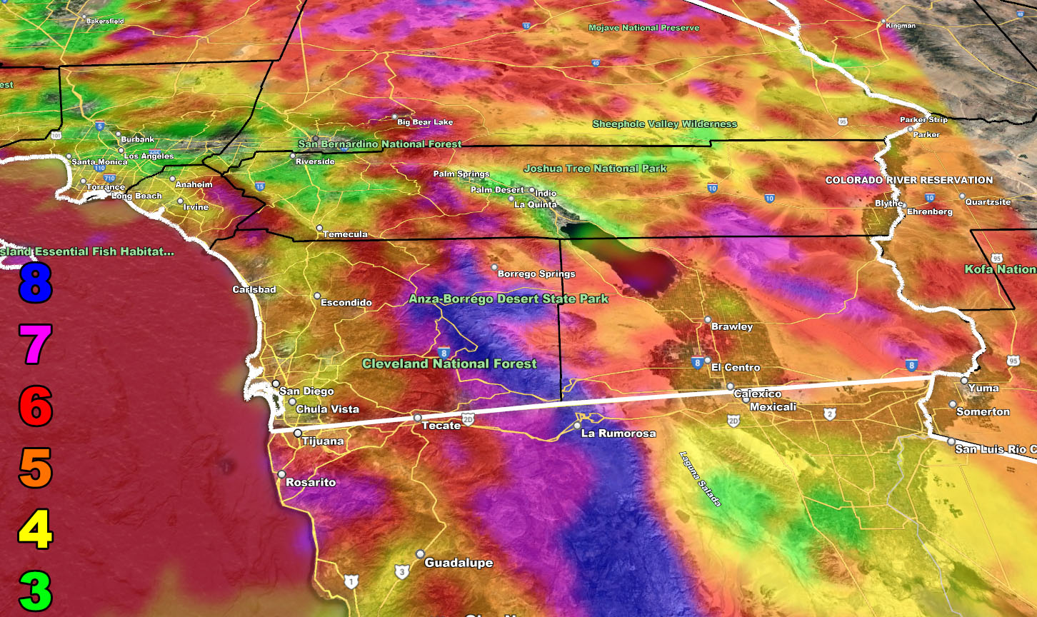
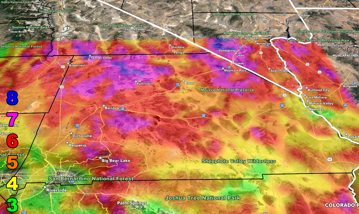
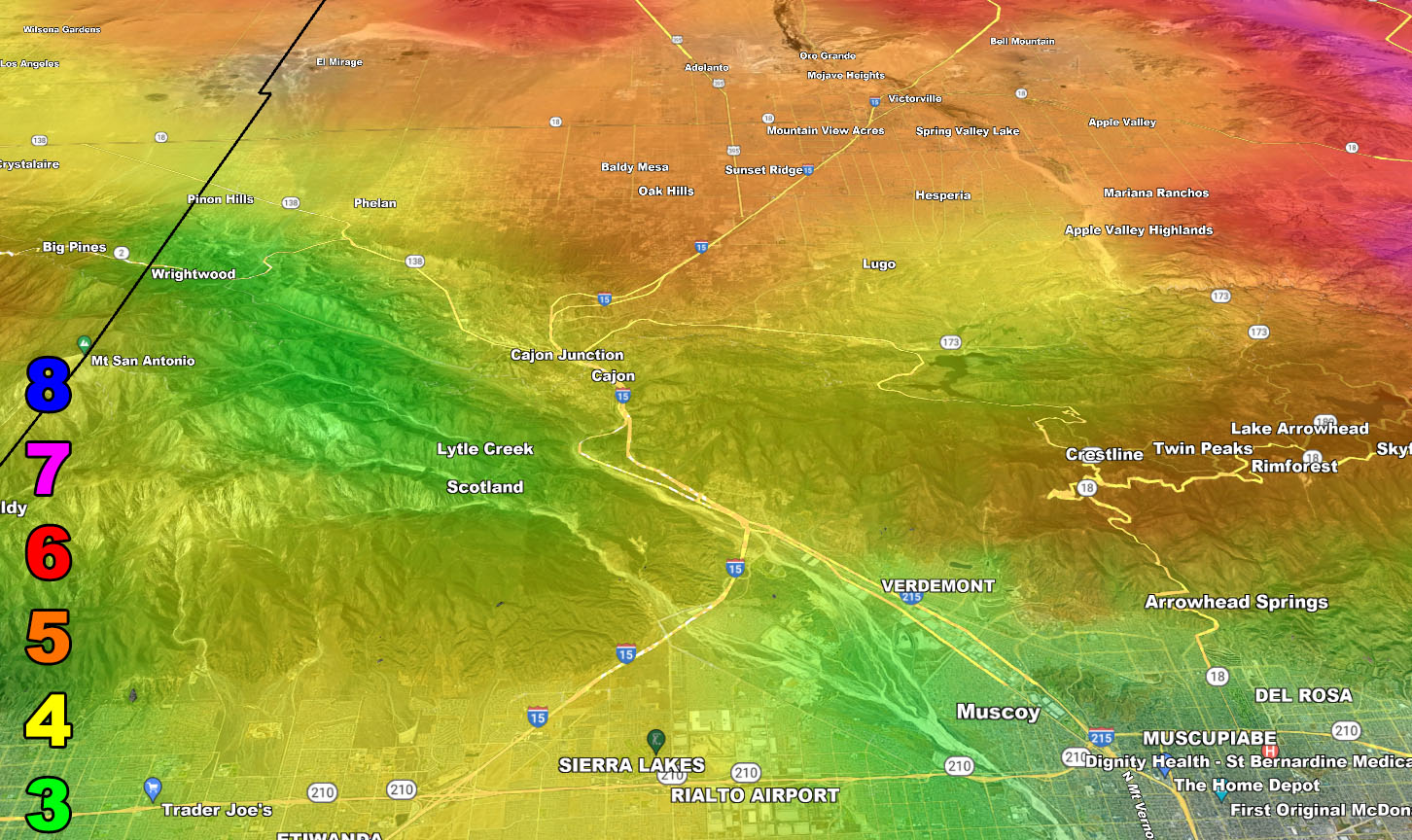
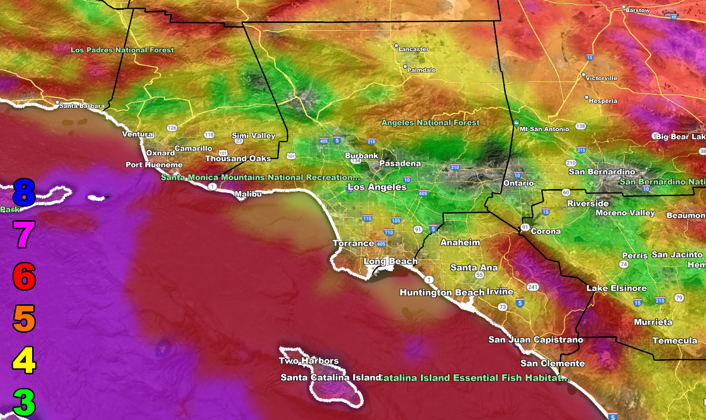
Wind Model – TUESDAY EVENING THROUGH WEDNESDAY 2-22-2023
SUPPORTING MEMBERS: Click Here To See The GPS Version Of This Model In Your Member Section Tab.
Raiden Storm Wind Gust Intensity Scale –
8. Extensive widespread damage.
7. Trees are broken or uprooted, building damage is considerable. – High Profile Vehicle Roll-Over CERTAIN.
6. SOME Trees are broken or uprooted, building damage is possible. – High Profile Vehicle Roll-Over Likely, Do NOT recommend Traveling in this zone. This zone also is the starting zone where trees and powerlines will fall and damage cars and even kill people near or in them!
5. Slight damage occurs to buildings, shingles are blown off of roofs. HIGH WIND WARNING CRITERIA – High Profile Vehicle Roll-Over Possible if weight is not corrected.
4. Twigs and small branches are broken from trees, walking is difficult.
3. Large trees sway, becoming difficult to walk. POWER SHUTDOWN THRESHOLD DURING FIRE WEATHER / WIND ADVISORY CRITERIA
WANT THESE DELIVERED WITH ALL THOSE PERKS INCLUDING BEING ON THE MICRO-CLIMATE ALERT SYSTEM AND MODELS DURING EVENTS BECAUSE NOT EVERY ALERT IS POSTED ON SOCIAL MEDIA FROM THIS WEATHER OFFICE – JOIN TODAY BY CLICKING HERE – Southern California Weather Force Subscriber System – Southern California Weather Force
Join The Main Southern California Weather Force Facebook Group (50 percent delivery time) – You can join the main SCWF page as well through that group.
Click Here To Join The Page Today