
The January 2023 forecast for above average rainfall did indeed come true and now it is time to look at the February 2023 forecast. A number of high amplitude upper high-pressure ridges will be happening this month, which will own to both temperature and precipitation period swings so read on for details …
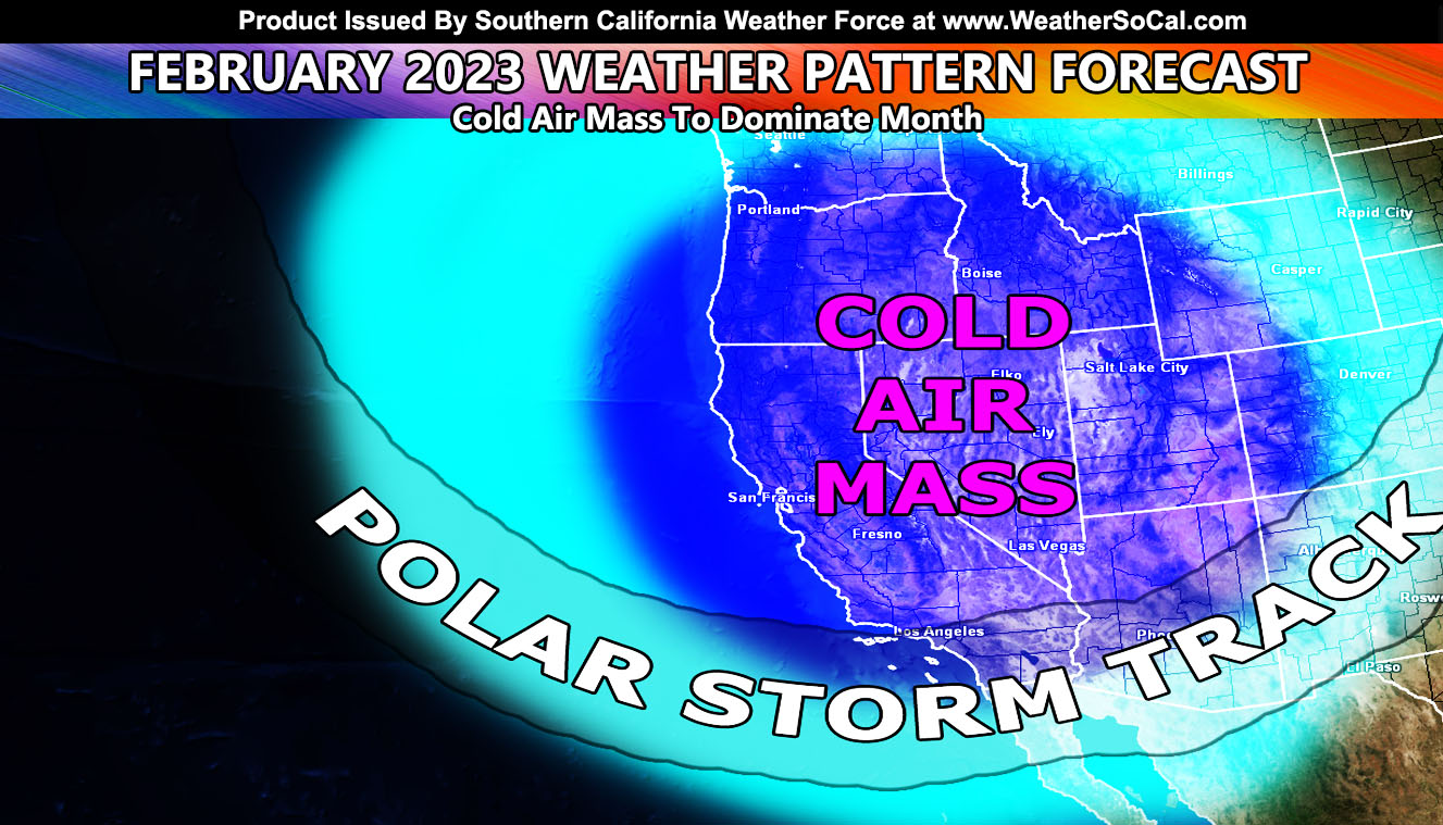
With our current system having departed, the air-mass for the next few days it will leave behind will have well below normal temperatures, but also owning to drier conditions for the extended period. There is the chance of the return of storms by mid-month, with stronger systems after the 20th, extending to the end of the month. The last half is the focus period on my numbers.
With the ridges in place, these storms, especially the ones during the last half/part of the month will have very cold air with it. This will mean that low elevation snowfall will be in the cards.
As such, February 2023 will be average to just below average in rainfall as the official Southern California Weather Force projection. The average Los Angeles precipitation in February is 3.64″ so that means that even with a slightly below average month, the month will have enough rain to go through my margin I set of 14-18″ of rainfall for this season last Fall. We are currently at 14.13″ of rainfall in Los Angeles for the season where the average is 14.25″. This means we will certainly be above average after this month.
This comes months after the forecast here at Southern California Weather Force stated that the 2022-2023 season would not be a normal La Nina (Click Here To Read That), and the margin of forecast precipitation in Los Angeles would be 14-18″ of rain, middle part being 16″. Can we exceed it? Trends are looking that the margin will be met, where NOAA went warm and dry due to a La Nina and here at Southern California Weather Force I went opposite. La Nina and El Nino do not dictate what happens here. There are more factors in place many in the field do not understand yet, which is where I come in.
A Raiden Storm Pattern is a pattern in the long range that was predicted before any other source or app available today, named after the discoverer as a comet is named after their discover. Weather forecasting is a gray area, and no prediction is ever respected or covered by others in the field, therefore it had to be done to create the Raiden Storm Pattern term.
Join the Facebook Page for Further Updates If You Have Not Yet!
SOUTHERN CALIFORNIA WEATHER FORCE MAIN:
Southern California Weather Force Twitter – CLICK HERE
WANT THESE DELIVERED WITH ALL THOSE PERKS INCLUDING BEING ON THE MICRO-CLIMATE ALERT SYSTEM AND MODELS DURING EVENTS BECAUSE NOT EVERY ALERT IS POSTED ON SOCIAL MEDIA FROM THIS WEATHER OFFICE – JOIN TODAY BY CLICKING HERE – Southern California Weather Force Subscriber System – Southern California Weather Force