
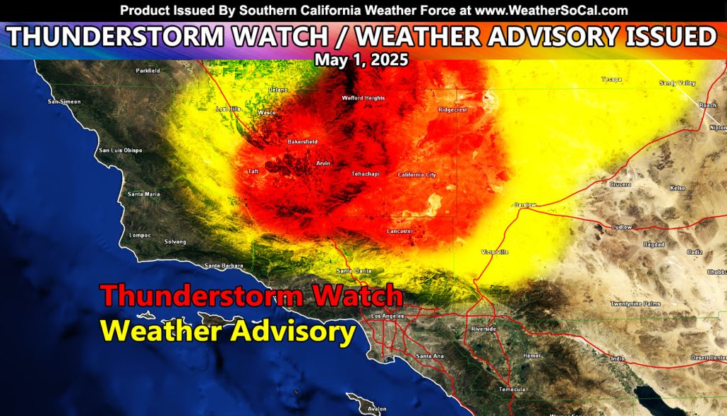
Southern California Weather Force has issued two alerts, a Thunderstorm Watch and Weather Advisory effective through the rest of today, Thursday, May1st, 2025
An upper level low moving through the bight of Southern California will position the following zones under the alerts, due to strong upper-level lift and instability combined. Brief heavy rain, hail, funnels are all possible today as the convergence zones light up.
It is to be noted that the areas of the most activity will be from Pine Mountain Club, Tehachapi, and Kern Desert, including direct to Edwards Air Force Base.
Convergence zones for the metro High Desert will include the ring of the El Mirage Convergence Zone, which includes Victorville, but does not include areas at the top of the Cajon Pass. That area will have hit and miss today.
Also note that while the SCV is in the shade, only left overs from Highway 14 would be possible and your chances of these are nowhere near the desert zones in the red-shade.
Thunderstorm Watch issued zones – Kern County, Antelope Valley, Gorman/Pine Mountain Club …
Weather Advisory Zones – Victor Valley / SCV
Raiden Storm
Master General Meteorologist