
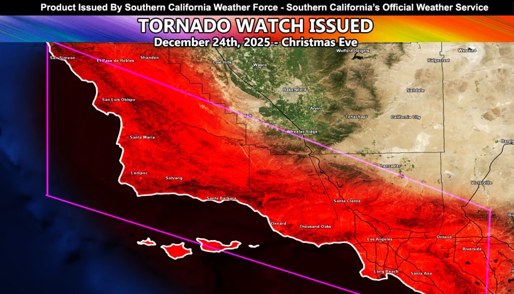
Southern California Weather Force has issued a Tornado Watch effective overnight tonight through Christmas Eve for the following zones;
San Luis Obispo, Santa Barbara, Ventura, Los Angeles, Orange County, and the Inland Empire …
Discussion: As stated in previous updates (Reference A Below), tornadic dynamics would be likely with this type of system, not seen since around March 1982. For this time of year the atmosphere is unusually unstable, meaning the southerly flow is bringing warmer low level temperatures and a lot of low level winds, aka wind shear would be the key here.
A powerful front will move through on Christmas Eve. Given the low-level flow and dynamics, this front looks to be able to produce waterspouts and even tornadoes away from the coast.
CHRISTMAS DAY: This Tornado Watch may need to be extended on Christmas Day because colder air aloft will work in and more instability will be present. This would be the day to watch as well with the second storm system bring strong in terms of thunderstorms than the Christmas Eve one. I’ll reissue the watch when needed, but you have your heads up in the same area zones as this watch is for.
Reference A link to the rain/wind maps and tornado wording – https://www.facebook.com/scweatherforce/posts/pfbid02Sx4CkHbjnBayweiPvtr3Geb3BuJ4Tweurbghn3JEPzxmcbvSLywkRGkx319vHRSDl
Raiden Storm
Master General Meteorologist