
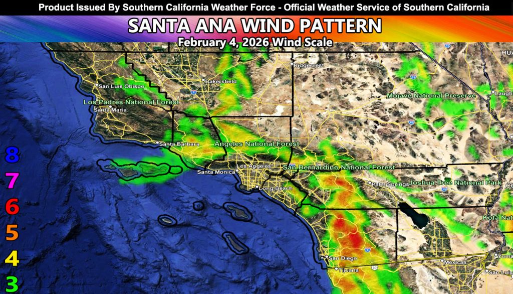
Southern California Weather Force has issued a Santa Ana Wind Advisory effective now for mainly Wednesday, February 4, 2026, along with the highly famous zoom-in maps for certain micro-climates.
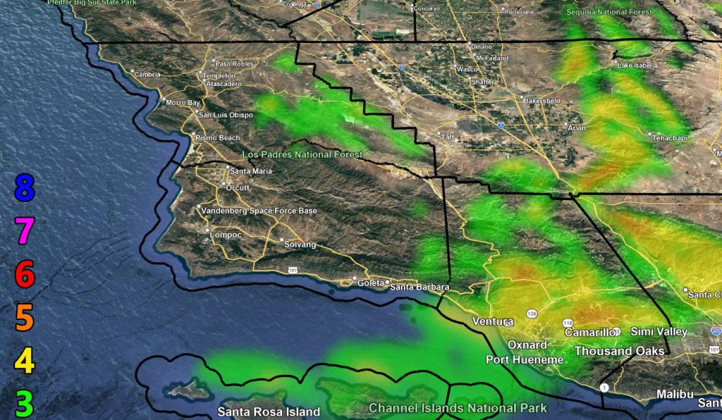
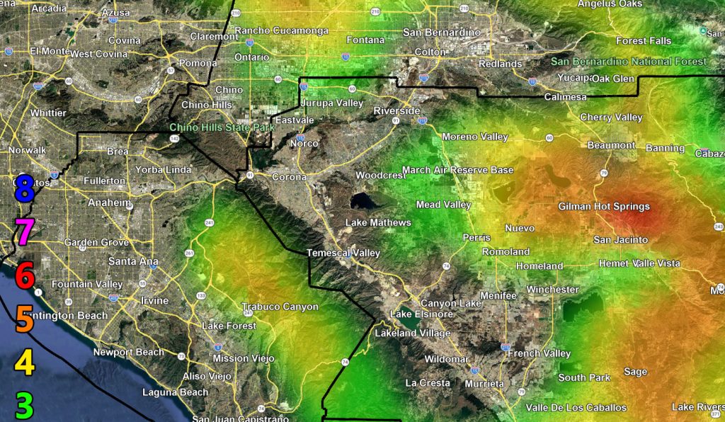
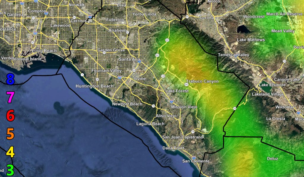
Discussion: An interesting flow for this time of year will enter the area on your Wednesday. This flow will introduce an easterly wind component. You can see from the Southern California Weather Force Raiden Storm Wind Model that the higher amounts will not be in the normal areas. Such as you can see here in Corona you have no value above a 3, while Hemet, San Jacinto get the higher gusts.
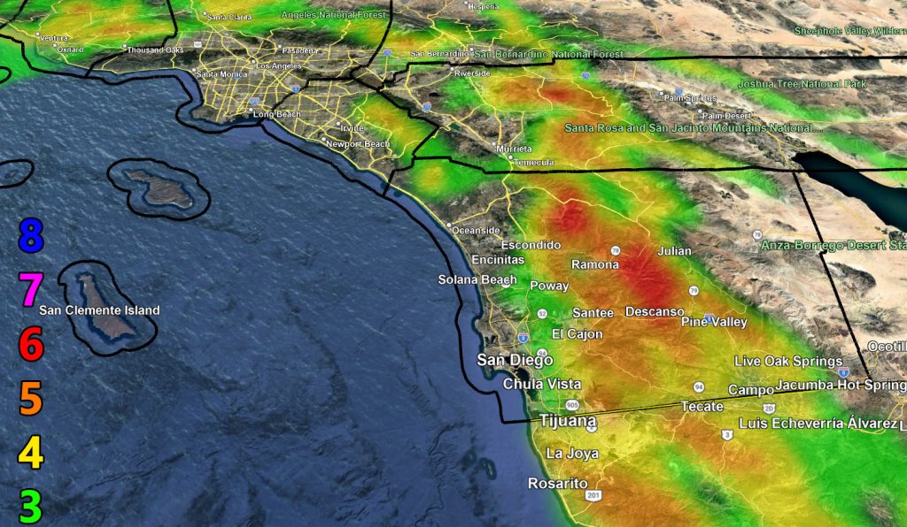
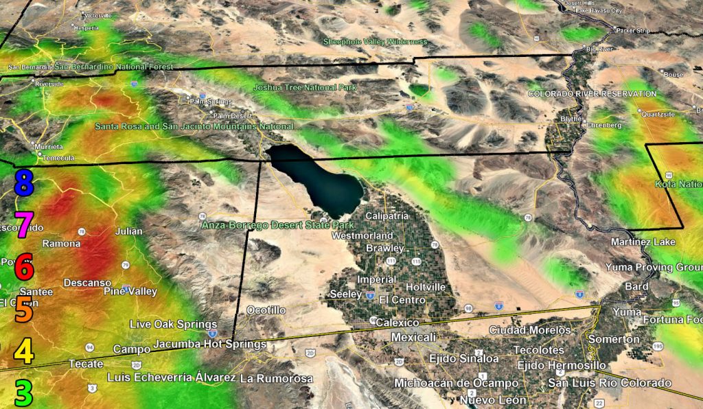
On Top of that, the highest winds will be the San Diego County Mountains and Foothills zones, especially areas like Ramona. Wind Advisories do exist there now, but I would go solid High Wind Warning in the level 5 and higher zones.
LONG RANGE: It is possible we will enter a period storms, cold at times as well, within the established known Raiden Storm Pattern. That article is here – https://www.southerncaliforniaweatherforce.com/2026/02/03/offshore-flow-this-week-will-be-followed-by-a-colder-storm-pattern-from-the-10th-and-into-middle-month/
If On Facebook it is here – https://www.facebook.com/scweatherforce/posts/pfbid0mSJgxUJpxbTYvzkxLJp8Gajbq7bofNbNW6MUjEPPoXDPHJZA1swkkr2USnM328MWl
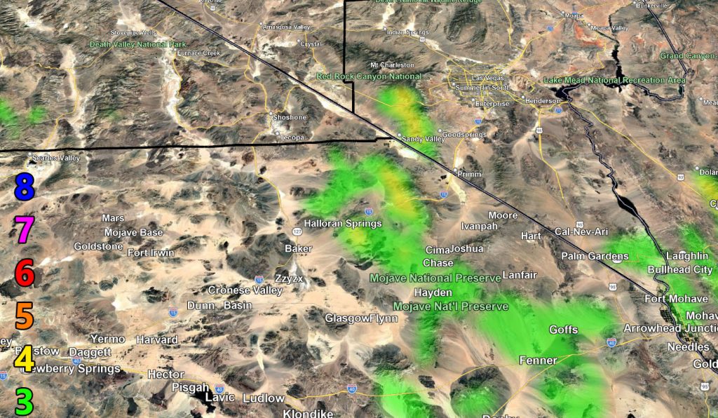
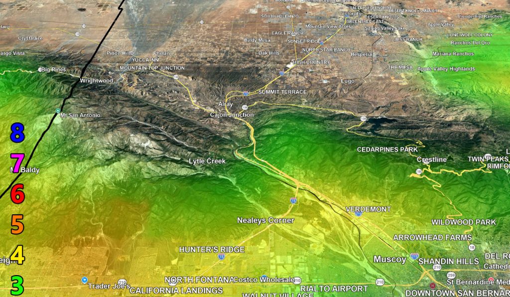
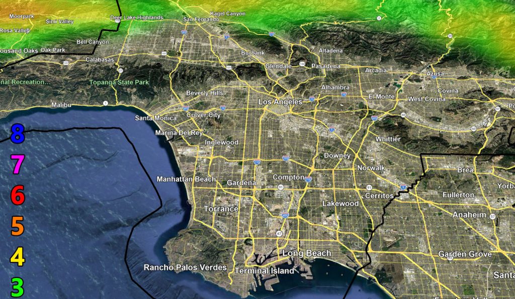
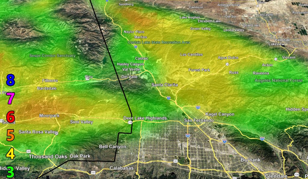
Use the zoom-in maps below for the alert period.
Raiden Storm Wind Gust Intensity Scale –
8. Extensive widespread damage.
7. Trees are broken or uprooted, building damage is considerable. – High Profile Vehicle Roll-Over CERTAIN.
6. SOME Trees are broken or uprooted, building damage is possible. – High Profile Vehicle Roll-Over Likely, Do NOT recommend Traveling in this zone. This zone also is the starting zone where trees and powerlines will fall and damage cars and even kill people near or in them!
5. Slight damage occurs to buildings; shingles are blown off of roofs. HIGH WIND WARNING CRITERIA – High Profile Vehicle Roll-Over Possible if weight is not corrected.
4. Twigs and small branches are broken from trees, walking is difficult.
3. Large trees sway, becoming difficult to walk. POWER SHUTDOWN THRESHOLD DURING FIRE WEATHER / WIND ADVISORY CRITERIA
Raiden Storm
Master General Meteorologist