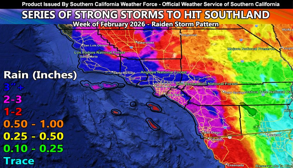
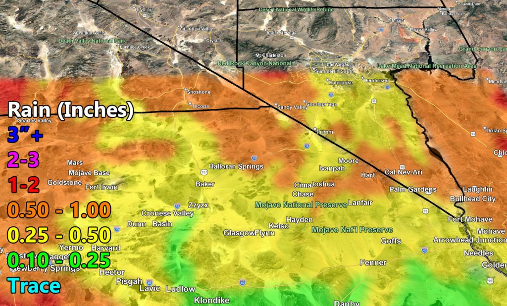
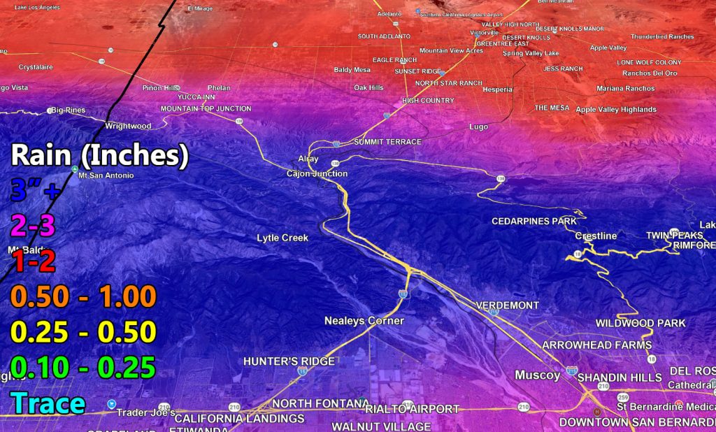
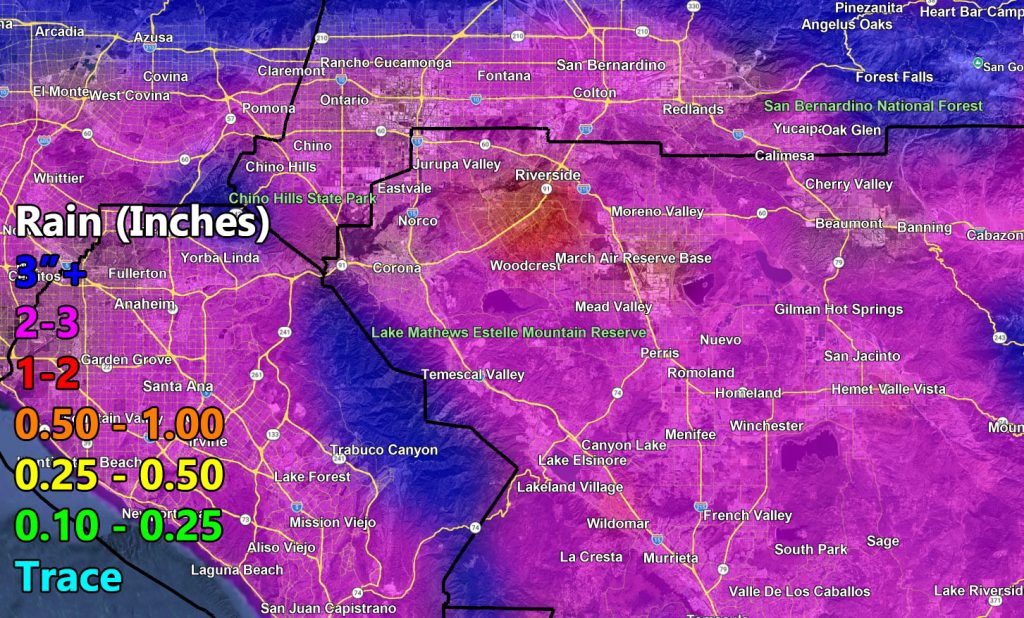
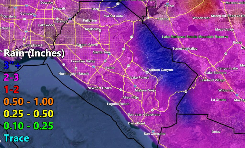
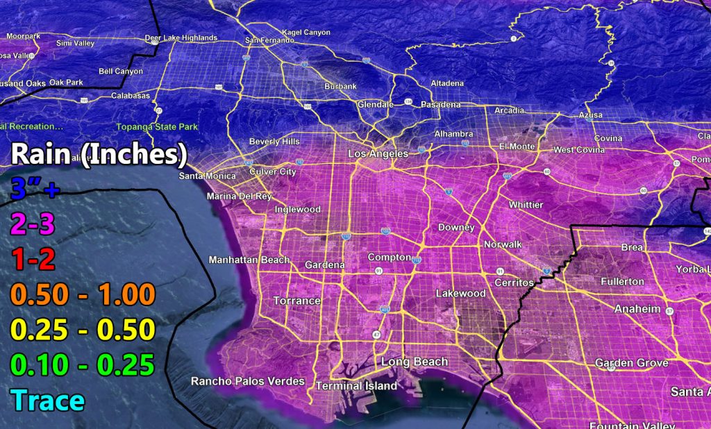
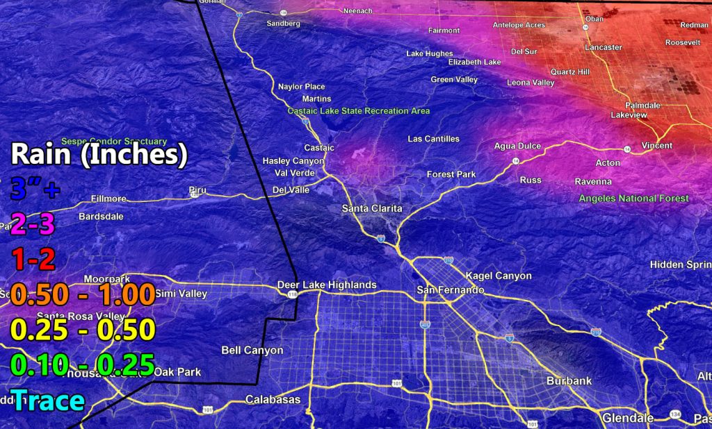
Southern California Weather Force has issued the preliminary rain and snow zoom-in maps for the week of February 16th, 2026 as the series of storms, also known as a Raiden Storm Pattern, moves in.
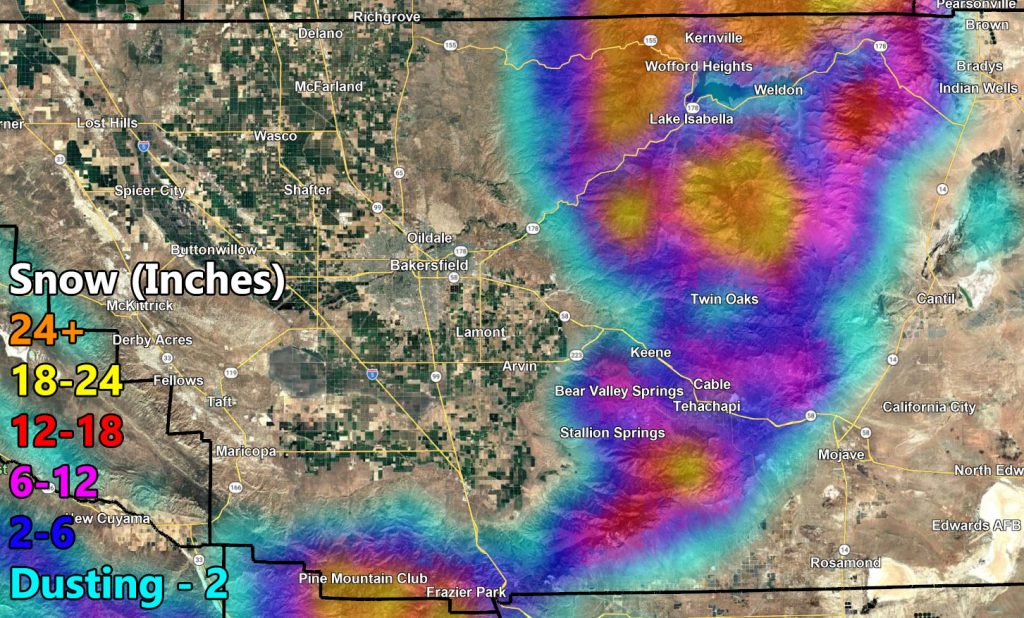
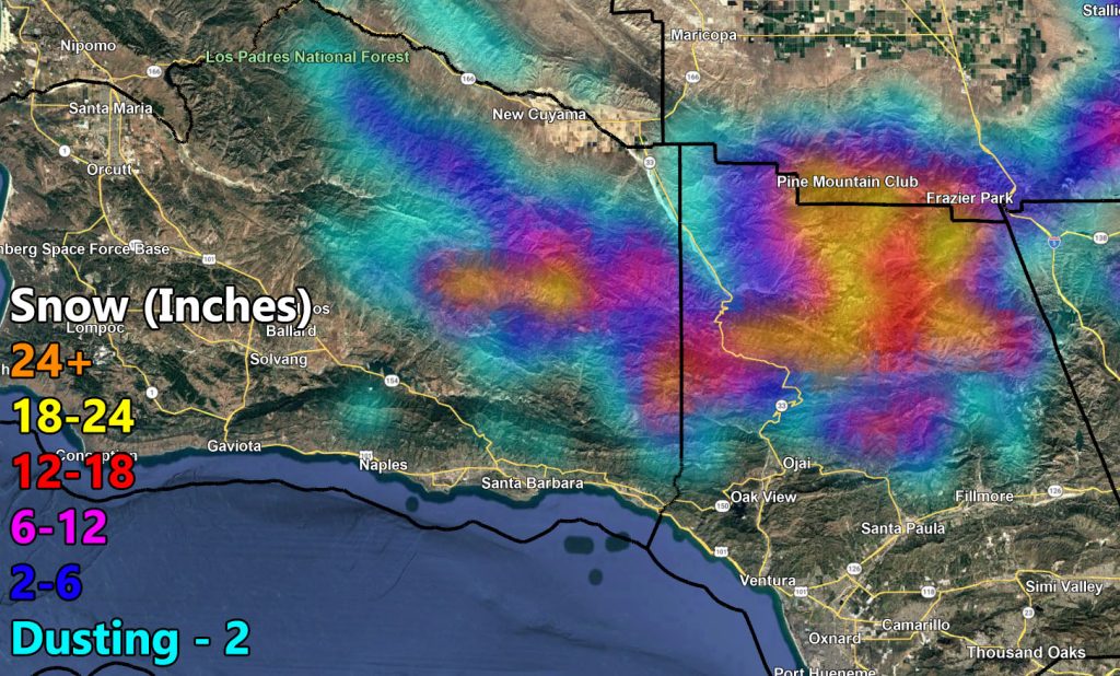
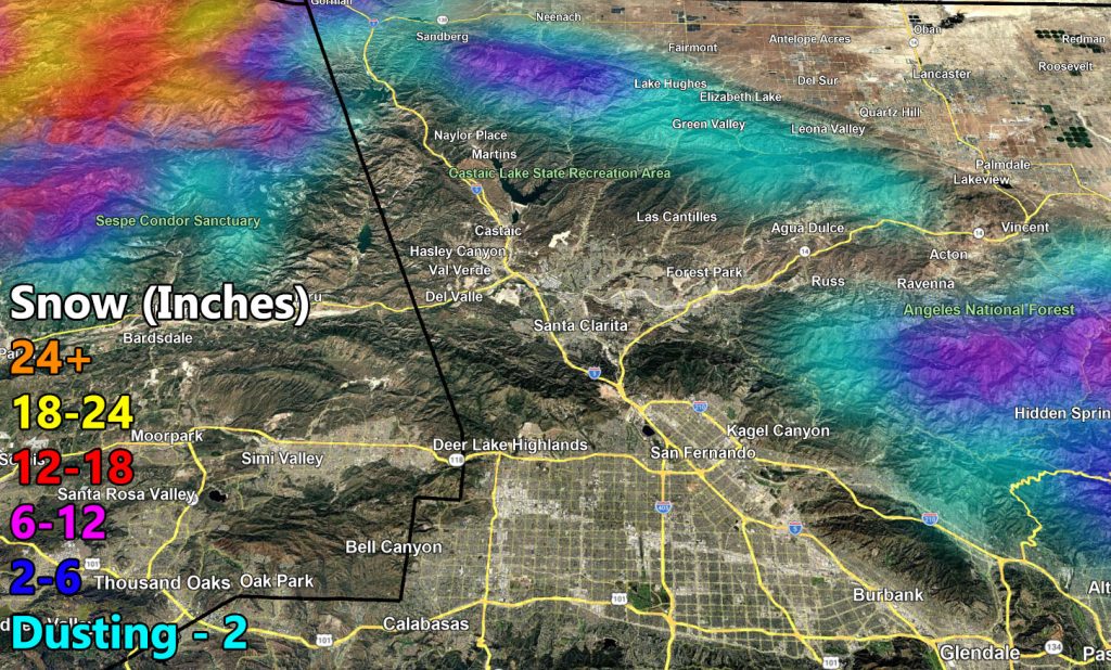
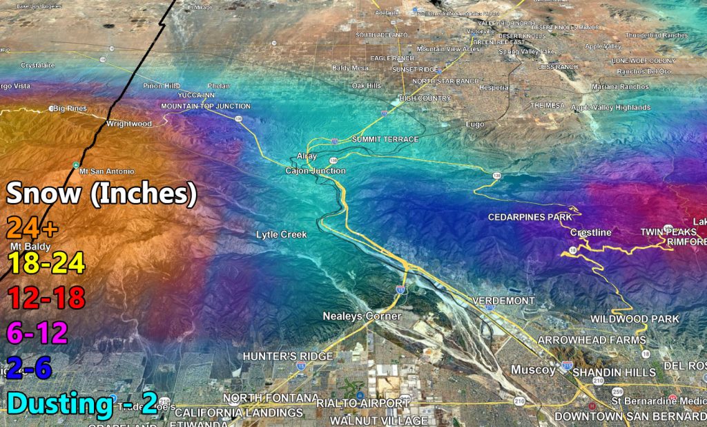
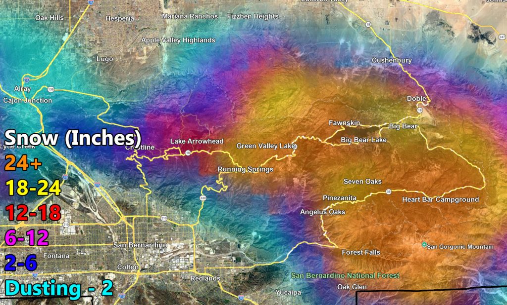
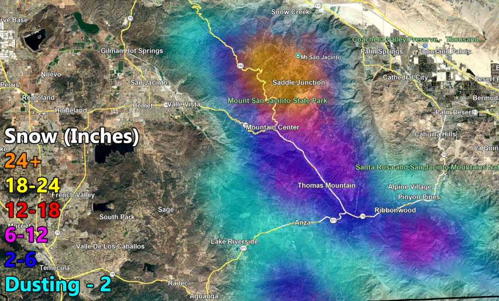
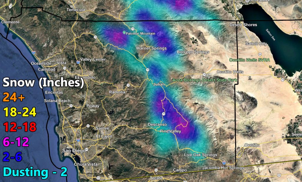
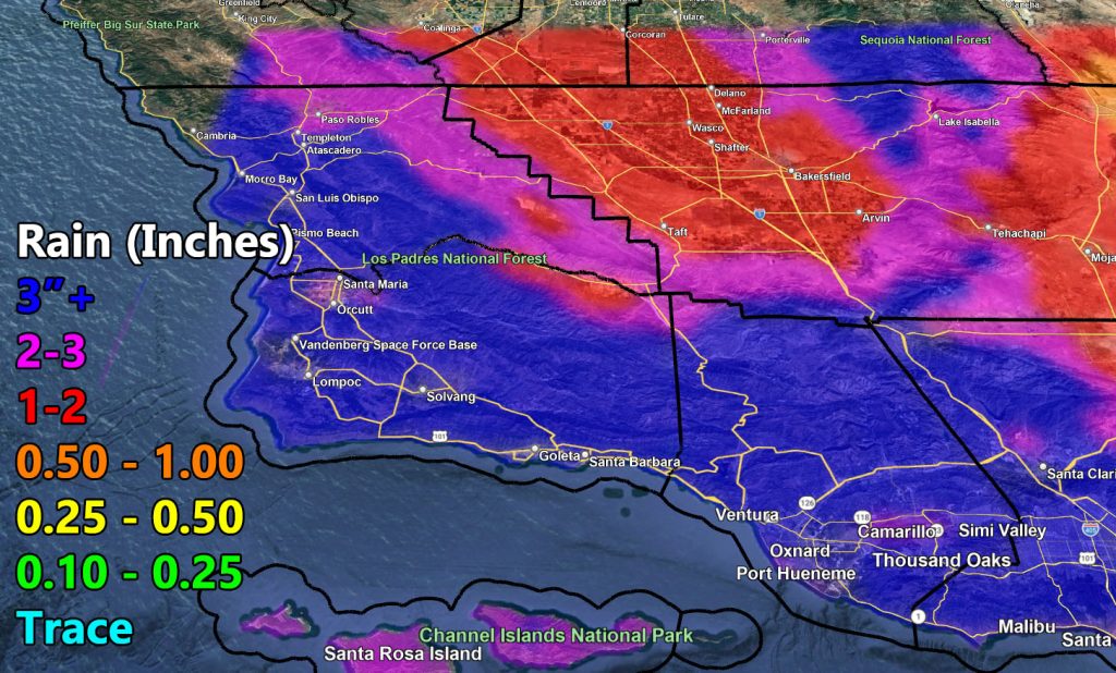
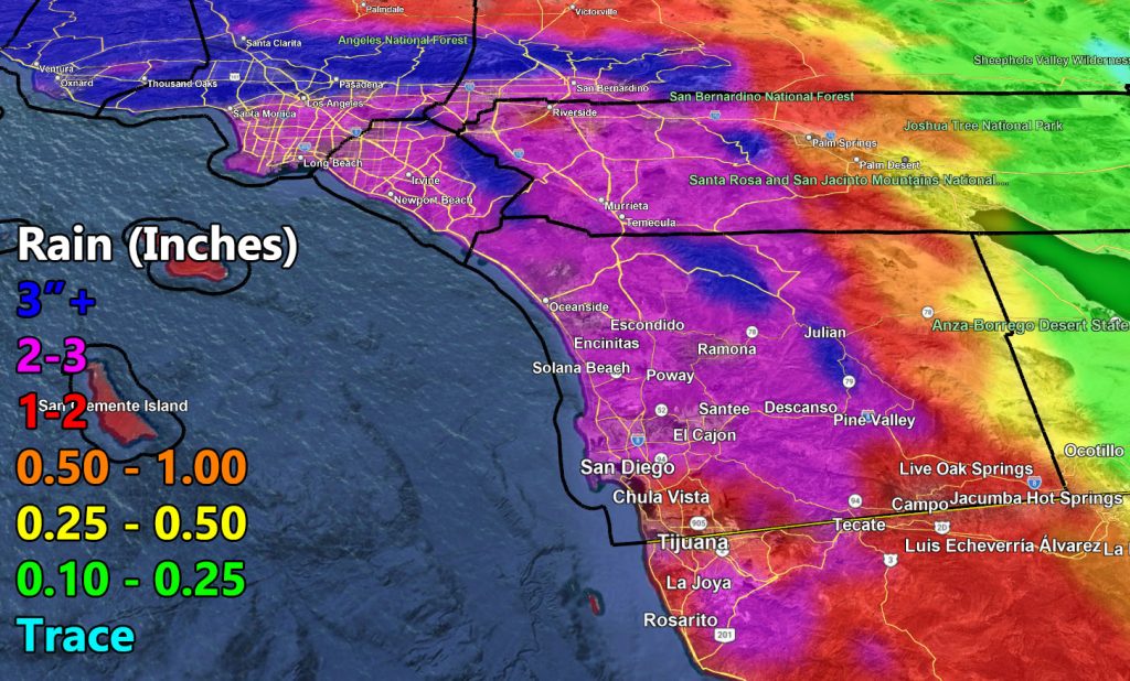
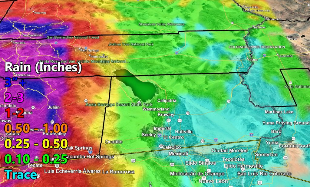
A break in the activity with rain hitting parts of Arizona on your Friday will be in, but Southern California is going to see the series of storms, which should bring the rainfall totals up over the average for the season, along with heavy mountain snow with a snow level of 4,000 FT, which means snow will fall on both the Gorman and Cajon Pass. The Gorman Pass will either close or have CHP escorts.
The zoom in maps shows resort level snow amounts being over the 2-3FT mark. This lines up well with the January 25th update here at Southern California Weather Force for colder systems to start arriving. While the High Desert will not be within the snow-level, areas like Phelan could see some snowfall with this due to the rain-shadow effect and drier low-levels bringing the snow level down.
Elsewhere, expect heavy rainfall. Thunderstorm potential will be looked into as we near it. For now, have the rain and snow zoom-in maps, which will again be for the week of February 16th, and starts on that date with the most precipitation falling then and through Wednesday. Additional rain/snow will be within this forecast through the rest of the week as well.
Stay tuned to Southern California Weather Force for the official forecasts on this event.
Raiden Storm
Master General Meteorologist
Rain
Snow