
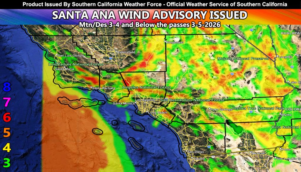
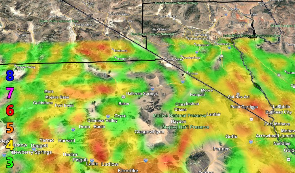
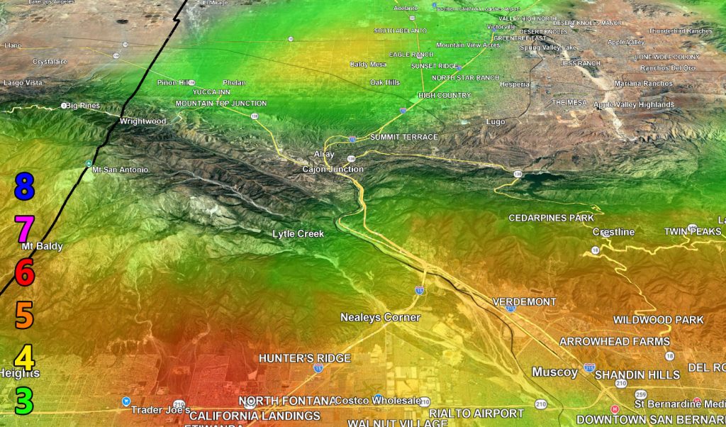
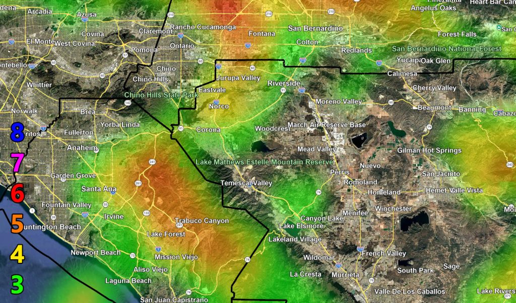
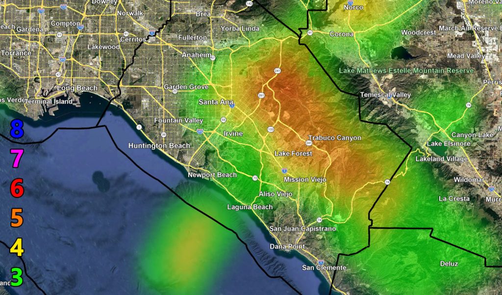
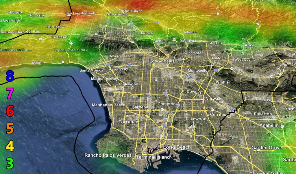
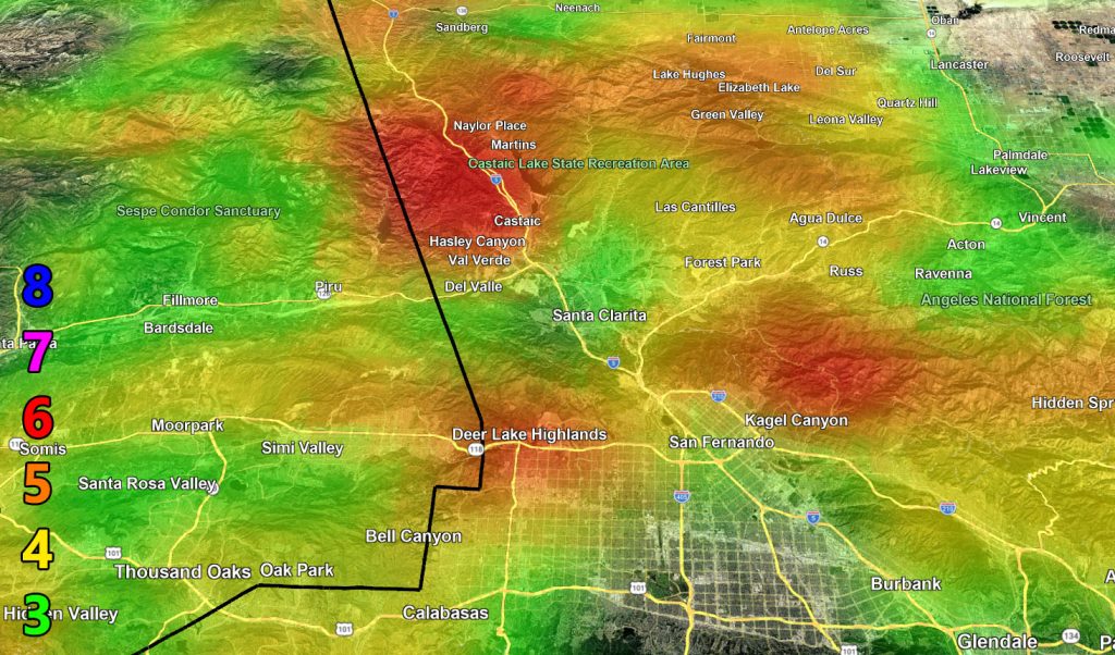
Southern California Weather Force has issued a Santa Ana Wind Advisory effective Wednesday into Thursday for the nominal prone zones.
Discussion: As a storm today passes to the north, drier air will be in place, especially on Thursday. This will generate offshore gradients for moderate Santa Ana Winds. The mountains and deserts will be first on Wednesday with northwest winds, including the Santa Clarita Valley. These will switch north and the northeast on Thursday for primarily below passes and canyons. In essence, this is a split pattern depending on location and day.
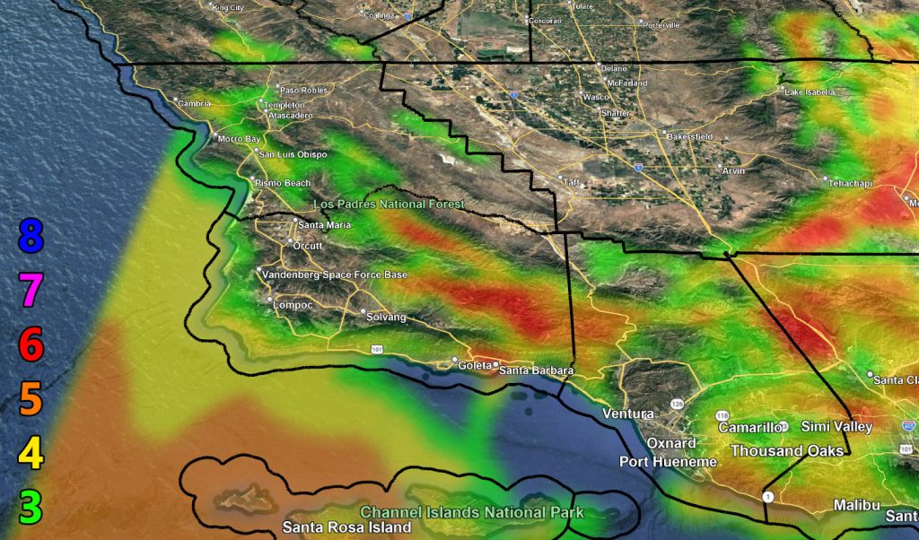
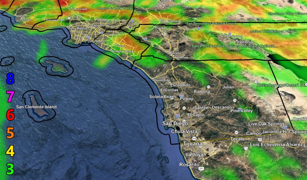
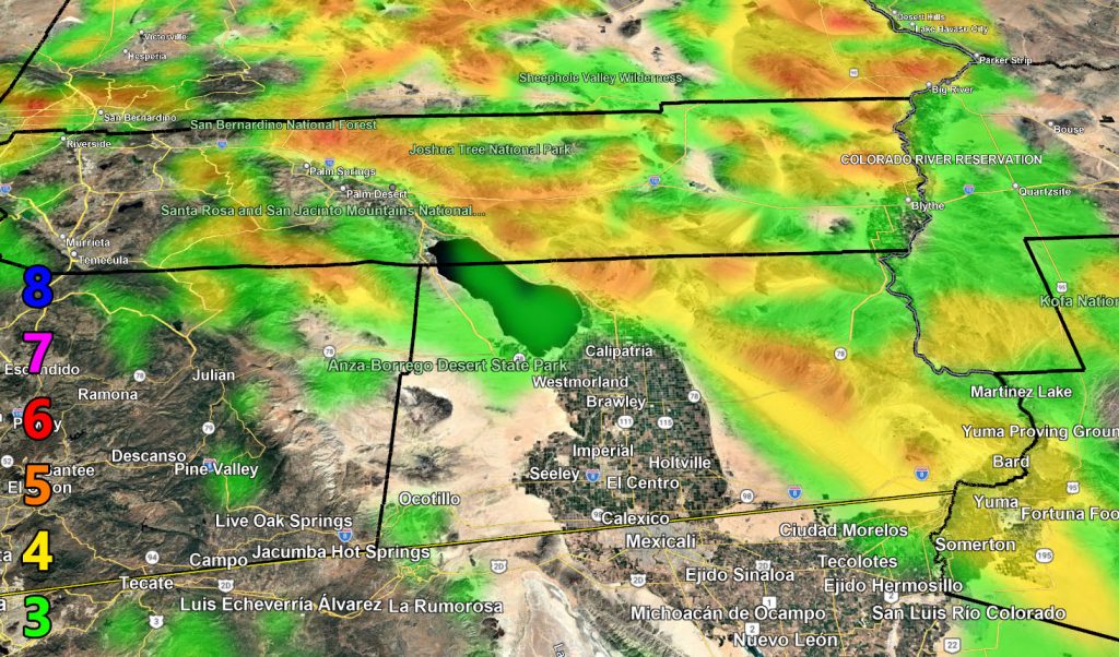
Use the zoom-in maps below for the alert period.
Raiden Storm Wind Gust Intensity Scale –
8. Extensive widespread damage.
7. Trees are broken or uprooted, building damage is considerable. – High Profile Vehicle Roll-Over CERTAIN.
6. SOME Trees are broken or uprooted, building damage is possible. – High Profile Vehicle Roll-Over Likely, Do NOT recommend Traveling in this zone. This zone also is the starting zone where trees and powerlines will fall and damage cars and even kill people near or in them!
5. Slight damage occurs to buildings; shingles are blown off of roofs. HIGH WIND WARNING CRITERIA – High Profile Vehicle Roll-Over Possible if weight is not corrected.
4. Twigs and small branches are broken from trees, walking is difficult.
3. Large trees sway, becoming difficult to walk. POWER SHUTDOWN THRESHOLD DURING FIRE WEATHER / WIND ADVISORY CRITERIA
Raiden Storm
Master General Meteorologist