
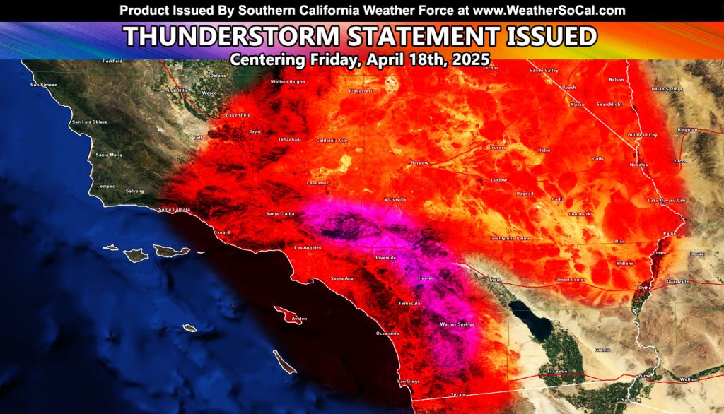
Southern California Weather Force has issued a Thunderstorm Statement effective the end of this next week, as a cold storm system moves out of the north into the area as an inside slider
Snow levels will be rather mid with this one, owning to around 5,000 FT, but it does look like a Back Door cold front will sweep into the area around Friday, April 18th.
Due to the high Sun angle of April, we will have the following. Hail, heavy rain at times, and even funnel clouds that could turn into isolated tornadoes.
Given my trajectory of this storm system, it looks like that even the coast might actually be affected by this one. So this thunderstorm statement is going to go from the coast, valleys, mountains and even yes, the High Desert.
Stay tuned to further updates here at Southern California Weather Force …
Raiden Storm
Master General Meteorologist