
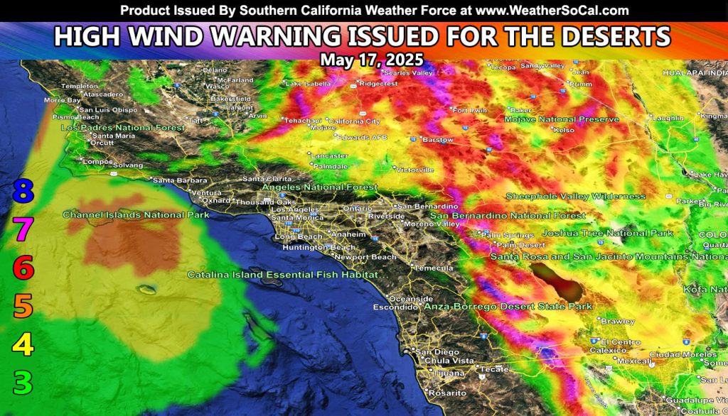
Southern California Weather Force has issued a High Wind Warning effective Saturday, May 17, 2025.
A strong inside slider will move north of the warning zones, bringing in a strong west-northwest wind, starting later morning and lasting till a few hours after sunset on your Saturday. Wind gusts will be expected to be anywhere from 35 mph to as high as 70 mph.
Roads to watch out for during this period due to crosswinds with high profile vehicles will be the following;
I-15 from the Cajon Pass to Las Vegas
Highway 395
Highway 14 near Mojave
Highway 127 to Death Valley
Highway 86 west and along the Salton Sea
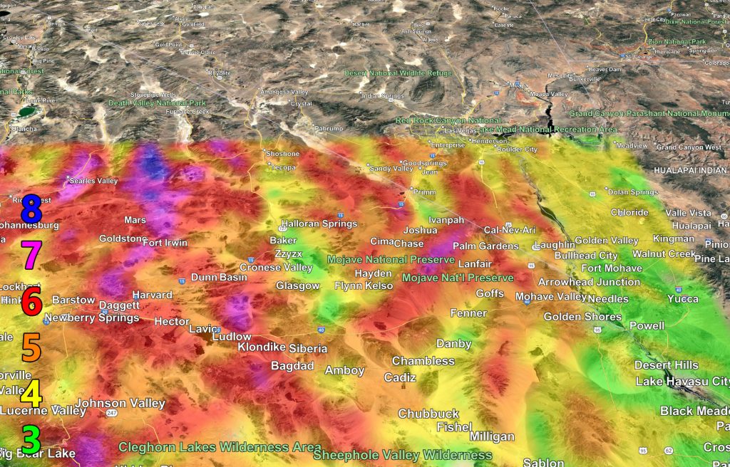
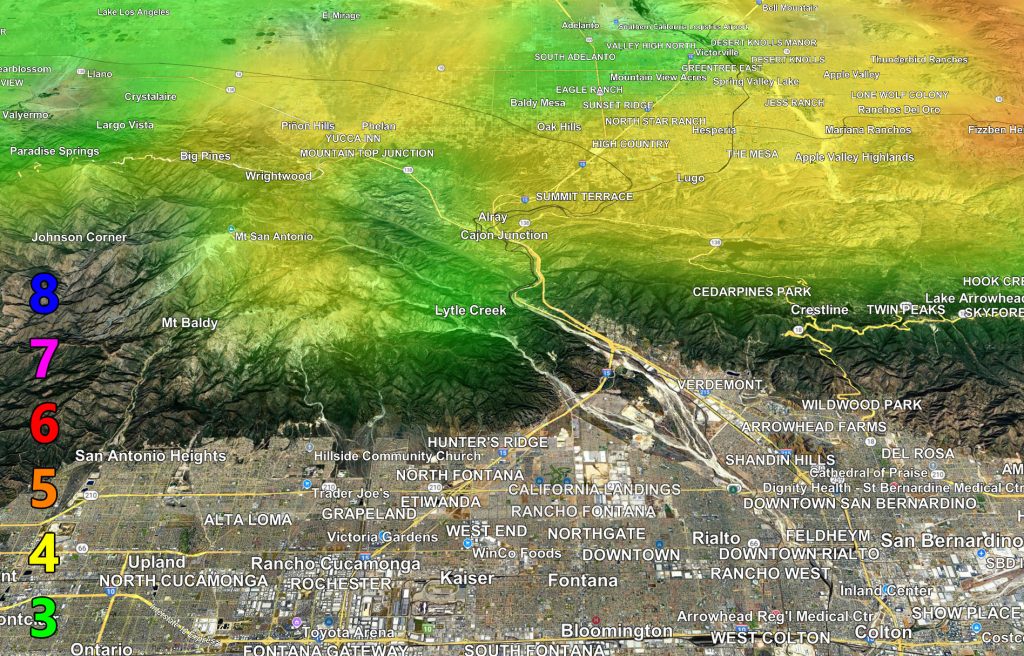
Wind (to zoom, right click and hit open image of some sort, or a device use your thumbs to zoom in)
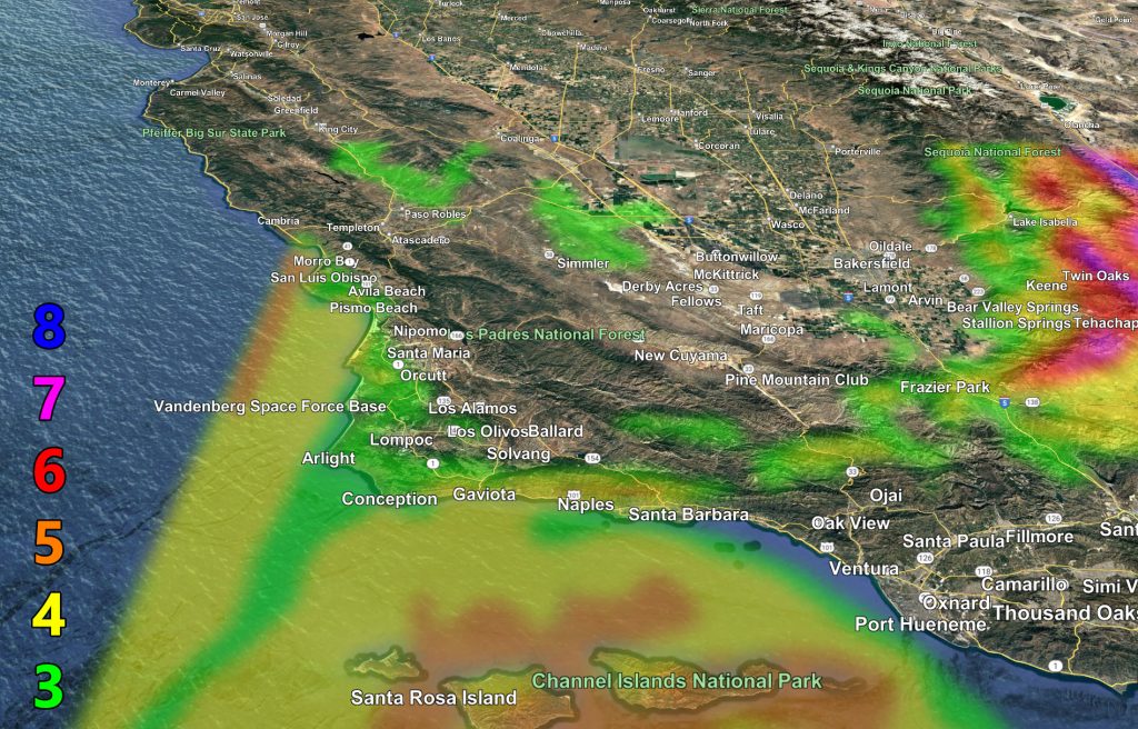
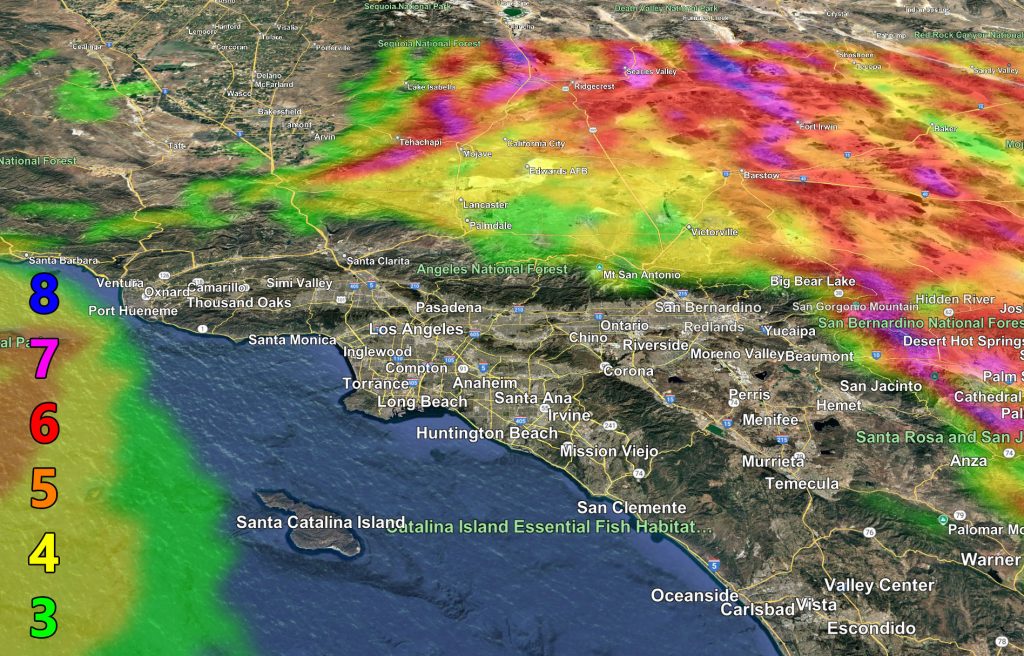
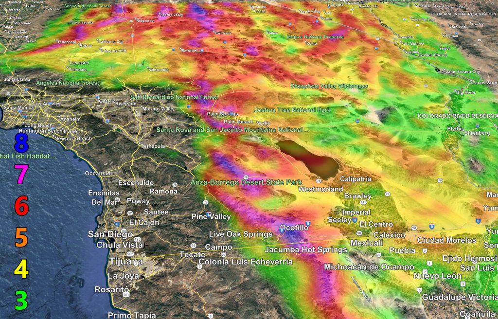
Raiden Storm Wind Gust Intensity Scale –
8. Extensive widespread damage.
7. Trees are broken or uprooted, building damage is considerable. – High Profile Vehicle Roll-Over CERTAIN.
6. SOME Trees are broken or uprooted, building damage is possible. – High Profile Vehicle Roll-Over Likely, Do NOT recommend Traveling in this zone. This zone also is the starting zone where trees and powerlines will fall and damage cars and even kill people near or in them!
5. Slight damage occurs to buildings; shingles are blown off of roofs. HIGH WIND WARNING CRITERIA – High Profile Vehicle Roll-Over Possible if weight is not corrected.
4. Twigs and small branches are broken from trees, walking is difficult.
3. Large trees sway, becoming difficult to walk. POWER SHUTDOWN THRESHOLD DURING FIRE WEATHER / WIND ADVISORY CRITERIA
Raiden Storm
Master General Meteorologist