
A second cutoff system is moving down the California Coast at this time. This system will position southwest of the forecast area by Tuesday morning, and move eastward with time over the day on Tuesday, and into the night. This system is otherwise known as a Raiden Storm Diamond system.
A Raiden Storm Diamond is a diamond-shaped zone southwest of Southern California. When the center of a low pressure system moves into it, one can expect shower and thunderstorm activity in the forecast area, widespread at that, the work of Master General Meteorologist Raiden Storm Publications.
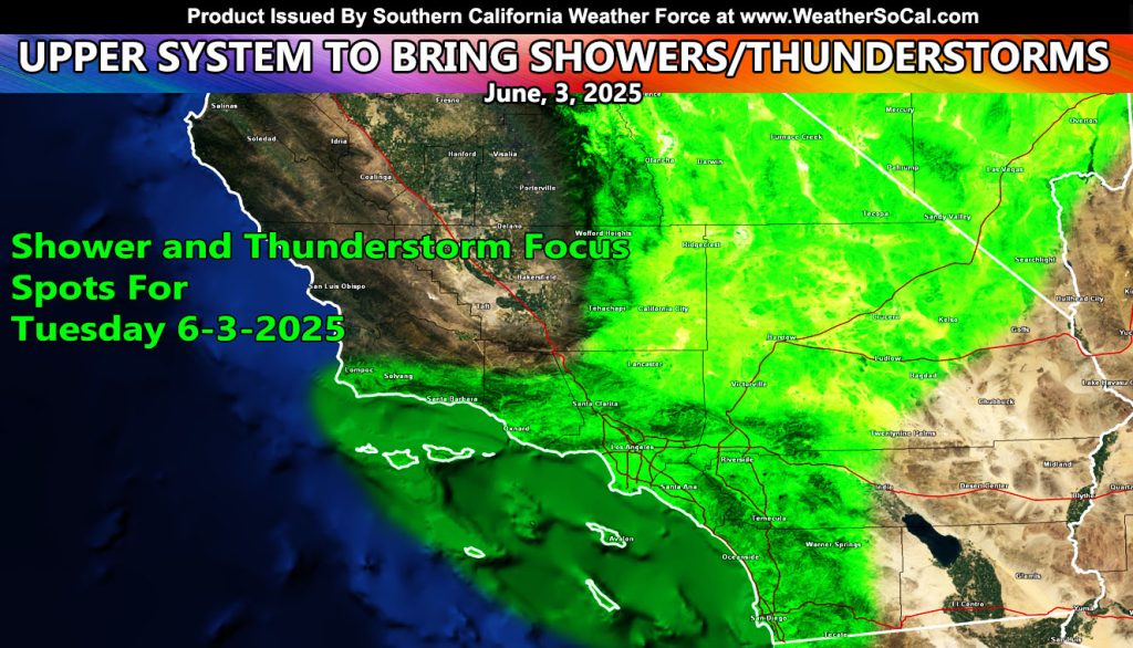
This system will have better instability dynamics for thunderstorms, especially the High Desert zones. One of the main storm chase focus spots for this will need to be Lucerne Valley to Barstow’s forecast zone, with the most concentrated storm activity expected.
Activity will start across Ventura and Santa Barbara County late Tuesday morning as the system moves into the Raiden Storm Diamond. As the system moves deeper into the diamond, shower and thunderstorm activity will fill the High Desert regions, eventually moving into the metros of the Inland Empire and Orange County zones near the evening hours, finally giving San Diego County the fun after sunset, with all zones having off and on shower and thunderstorm activity through the entire night, until Wednesday morning.
Stay tuned for updates
Raiden Storm
Master General Meteorologist