
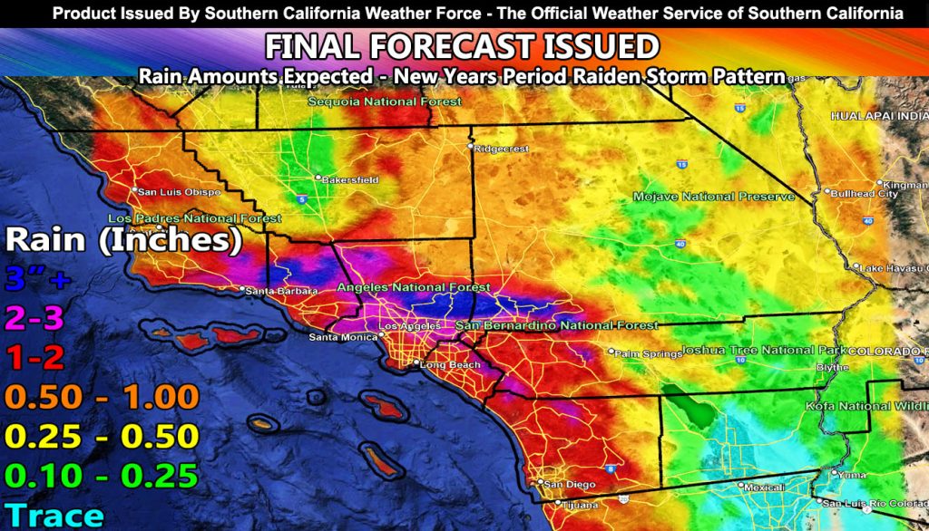
Southern California Weather Force has issued the Final forecast for the next Raiden Storm Pattern surrounding New Years Eve and higher for New Years Day for rain and wind damage to happen, along with the chance of severe thunderstorms and tornadoes, along with 10-15 foot waves.
A powerful storm system that would be rated the highest category I have will enter the area later on Wednesday and go through New Years Eve and Day. Strong low-level flow will promote orographic lifting for flooding for the metro areas, along with strong southerly winds. Given this, parking near a tree would also be dangerous as the winds will topple trees, especially in the metro zones of Santa Barbara, Ventura, Los Angeles, Orange County, San Diego, and the Inland Empire.
Another reason for my Category Six rating is not only because of the winds and rain, but because we could see the risk of thunderstorms with it, severe, with a chance of tornadic activity. This will be monitored, and as stated previously, additional updates for that will be given right here at Southern California Weather Force so stay tuned … The most probable period for these severe storms will be New Years Day, in Los Angeles, Orange County, and the Inland Empire, where the strongest low level shear and upper level divergence (lift) is.
This is a Raiden Storm Pattern, meaning it was predicted by me before any other source … and another will follow a week after that one, which is also a Raiden Storm Pattern …
Link to prediction was from the last one – https://www.southerncaliforniaweatherforce.com/2025/12/22/scwf-flood-emergency-issued-official-storm-forecast-for-christmas-eve-until-saturday/
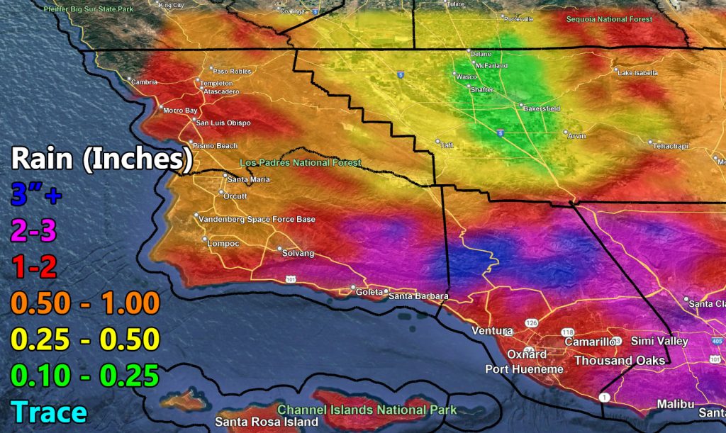
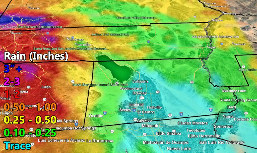
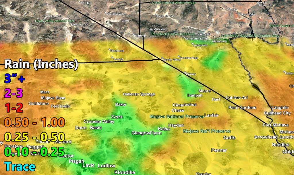
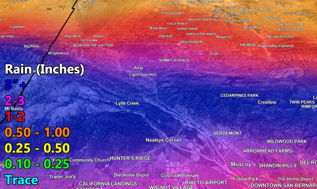
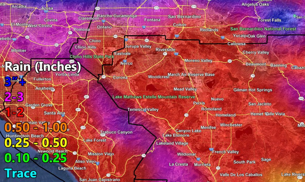
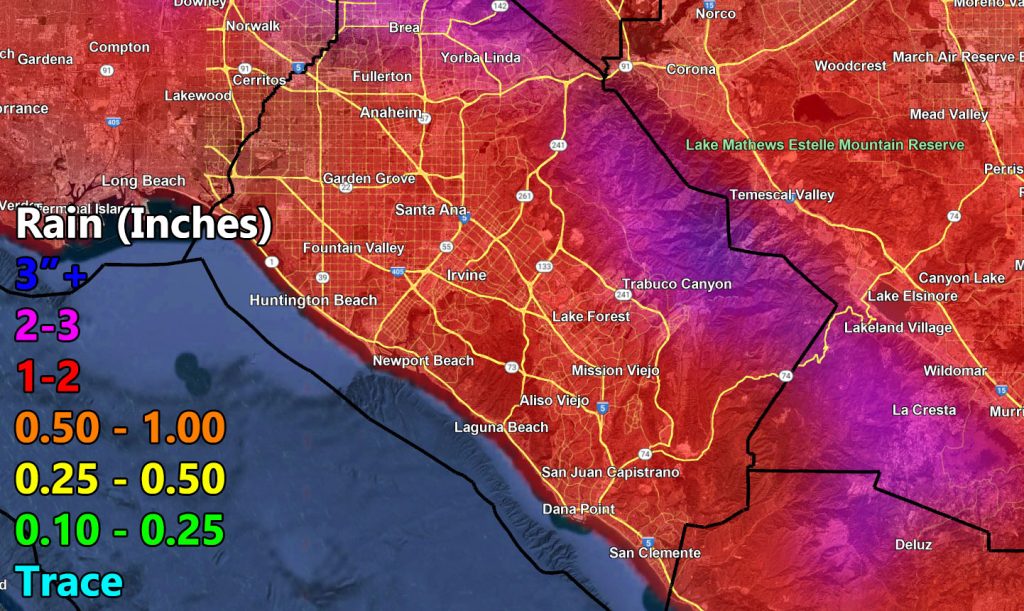
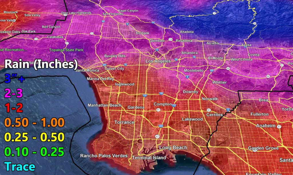
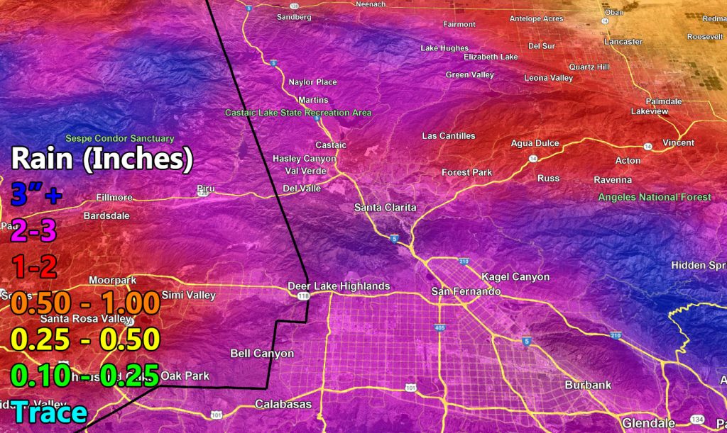
Use the zoom-in maps below for the alert period.

Raiden Storm
Master General Meteorologist