
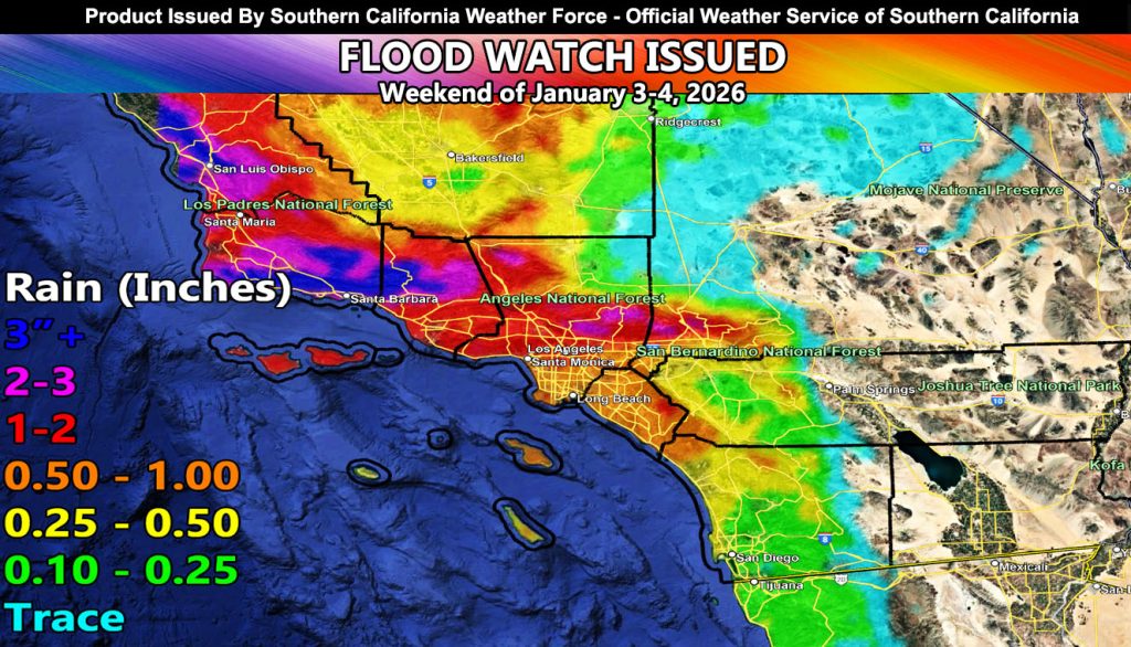
Southern California Weather Force has issued a Flood Watch effective January 3rd through the 4th for the following zones;
Zones Affected: San Luis Obispo, Santa Barbara, Ventura, Los Angeles, Orange County, and the Northern Inland Empire from the Rancho, Cajon Pass, Fontana, and Yucaipa areas …
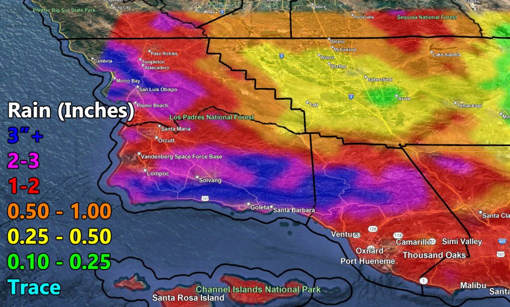
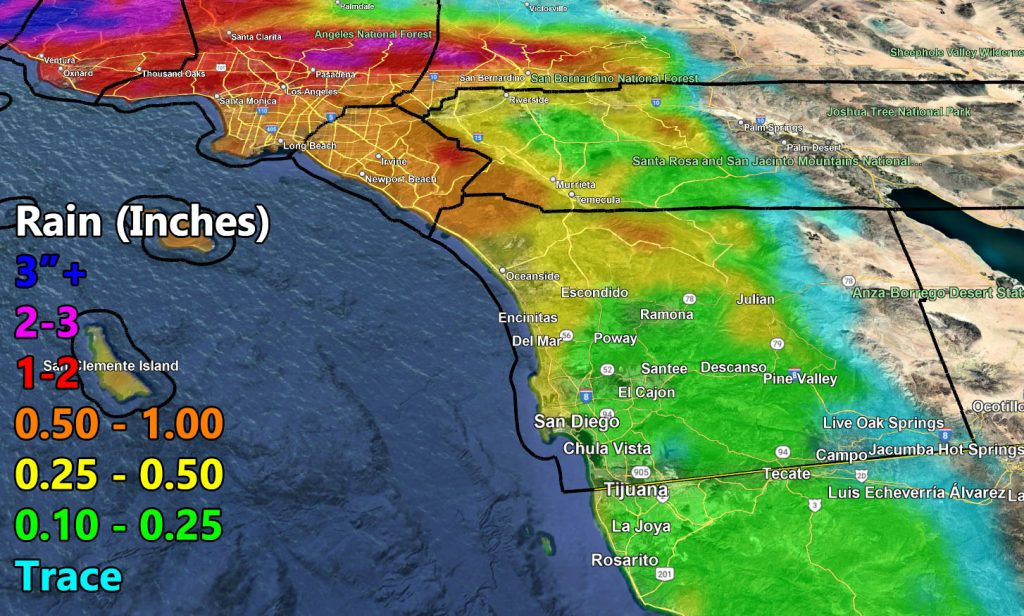
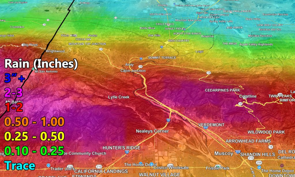
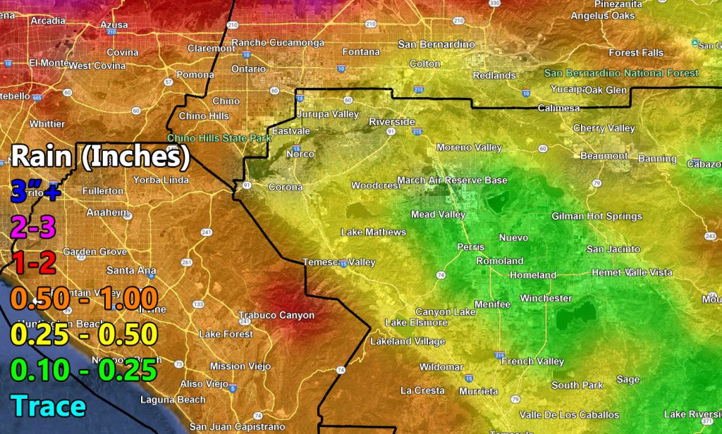
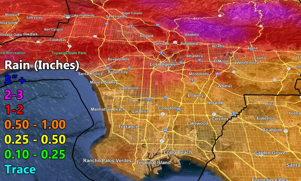
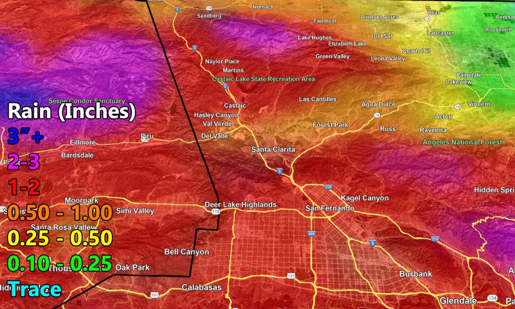
Discussion: Another storm system within the Raiden Storm Pattern will impact the region starting later today, but increase as Saturday moves on. Expecting two impulses to move through, one on Saturday and one on Sunday. These systems are traditional to what Southern California usually get, so expecting the worst to hit the southern end of the mountains due to southerly flow in the mid-levels, so areas like San Luis Obispo, Santa Barbara, Ventura, and Los Angeles County, as per the SCWF rainfall models issued here.
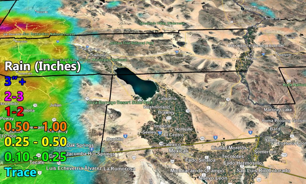
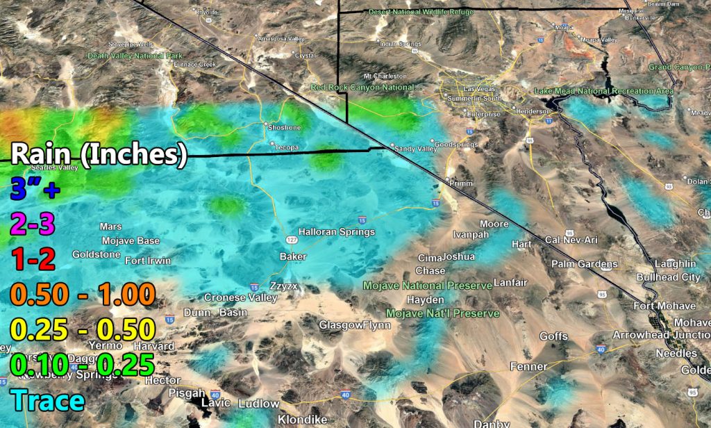
Inland Empire zones will have a small rain-shadow effect from the Santa Ana Mountains, meaning less rain and no flood concerns, as will San Diego. Rainfall will washout as it moves eastward, leaving most, if not all of the low desert dry with this one.
A 120 mph upper level jet within the lifting zone can produce a chance of thunderstorms with this event.
This system will have higher snow-levels, so travel in the passes and Big Bear will be met with just rainfall. Lower snow-levels are expected around January 6th give or take a day on each side as colder systems target the region.
Use the SCWF Rainfall Maps below. You can zoom in on devices with your keyboard, or if on a phone then you use two thumbs as the resolution on the is high.

Raiden Storm
Master General Meteorologist