
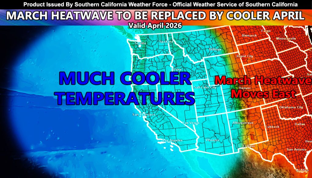
The March heatwave that has caused record setting temperatures across the Southern California will move east by the end of the month. Yes, we still will be above average in temperatures through then so hang in there.
Projections here at Southern California Weather Force’s Long Range abilities shows that a breakdown in the March Ridge will shift east, with a snap of a finger and as clockwork as March 31st comes and goes. By April 1st, temperatures in the metros and high desert zones will be in the 70s, with 80s in the lower desert communities. This will be a major relief.
An area of low pressure parking off the coast will usher in the cooler onshore flow, and with it, the chance of some systems moving in to say there would be that chance of rain as well, so here we go with ‘April Showers’.
I’ll continue to monitor the coming pattern, but till then, stay safe in the heat, and talk to you soon.
Raiden Storm
Master General Meteorologist