
While a weaker system is hitting the area through tonight and Sunday morning, a strong system is set to impact the region on Monday, bringing rain, mountain snow, and severe thunderstorms with damaging winds. Major Pacific Storm Gary has officially been given a category four out of our one through six scale. Read on for details.
A couple alerts have already gone out ahead of the storm for the members and these alerts range from severe storms to winter weather products, which will be issued in full on Sunday for mountain residents.
A weaker front is moving through the area tonight into Sunday morning, currently located as of 6pm to the west of Vandenberg Air Force Base and moving eastward with time. Areas in the SLO/SBA/VT/LA zones will see more from it than the OC/IE/SD Zones, with SD seeing a quick hitting front on Sunday morning. Snow level with this is high and snow levels won’t go below 6-7k until Sunday afternoon after the front passes so with the main swath of this first weaker front … expecting higher snow levels and mostly rain in resort areas.
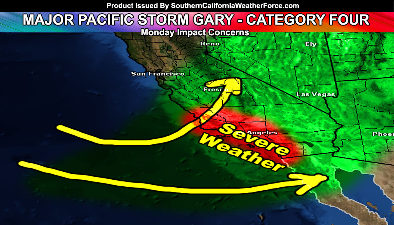
The stronger system hits on Monday, that of Major Pacific Storm Gary. Gary was chosen from the original “G” name Goliath because Goliath had to be a Category five or six in order to maintain that kind of name. Gary was the second pick in the list if it was below a category five.
Major Pacific Storm Gary’s core dynamics for most metro areas will have wind gusts of 50+ mph, a heavy rainfall producing front, and severe thunderstorm dynamics. Given this, Gary is a category four system.
He will impact the SLO/VBG zones early Monday morning before sunrise, traveling all the way into Los Angeles just 4-6 hours later. This is considered a fast-moving potent front and with the upper level divergence, deeper ice layer, strong mid-level lifting, instability, and deep-layer moisture with it … it will certainly bring most metro areas the risk of thunderstorms. Because of the wind damage dynamics + thunder … it is likely that severe thunderstorm products will be needed with it, hence the already in place Severe Weather Statement on the main site.
The snow level will be an average 5,000 FT with the middle of the front, dropping below that within that and the ending of it … with any left-over showers as well. Given the strong winds, lower snow elevation, high snowfall rates within the front, and chance of thundersnow … our Winter Storm Watch has been issued for mountain residents, all the way down to the passes.
Mountain/Desert winds will also accompany the system through Monday …
Gusty north flow winds develop Monday night into Tuesday for all areas of the forecast zone …