
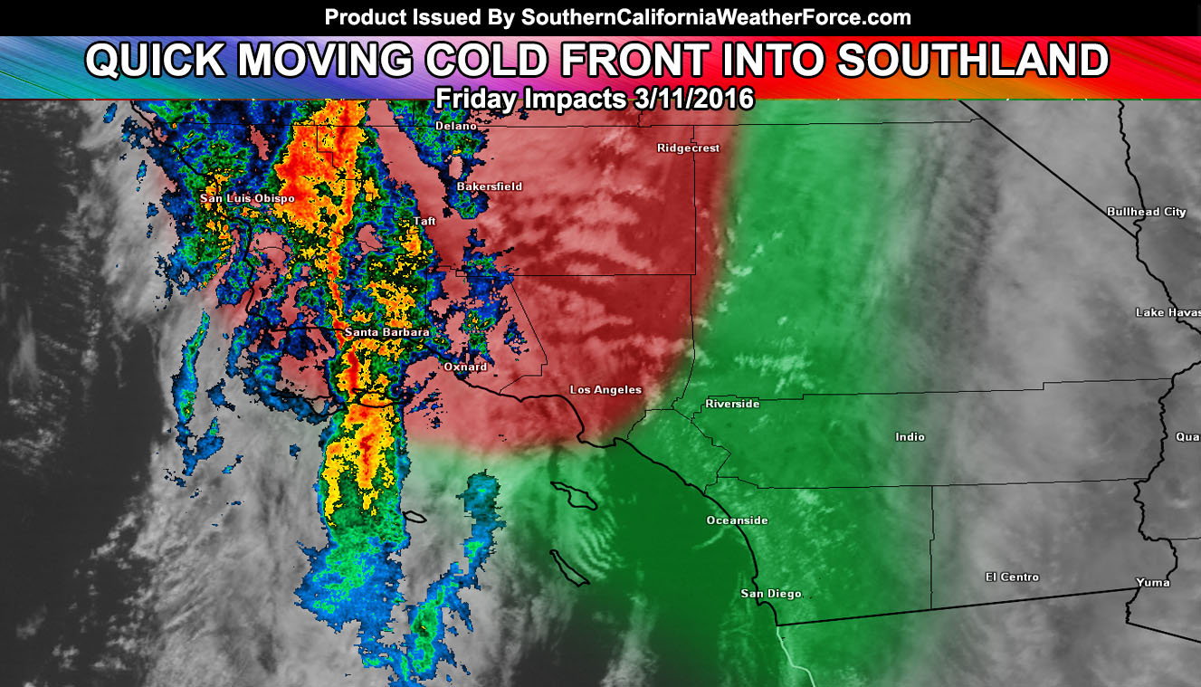
A quick moving front will move through Southern California today, bringing another round of rain, some isolated thunderstorms in spots, gusty winds, and mountain snow. Read on for details.
In Santa Barbara at the moment a front is moving through with some gusty wind potential and moderate to heavy rainfall. A weather advisory was issued for the SLO/SBA/KERN/LA County areas last night for this system and this is for the risk of heavy rainfall at times and/or isolated thunderstorm potential.
As a swinger type system where the trough axis swings into Southern California from southwest to northeast, the system will split dynamics with thunderstorm dynamics being from Los Angeles County north and westward, leaving areas south of there out of the main core of them … so if you’re in the Inland Empire, Orange, and San Diego County area you can expect a fast-moving front … and for some it may not even seem like much.
The cutoff is the San Bernardino, Riverside, and San Diego Mountains where the front will washout and areas east of the High Desert Metro and Coachella Valley may have a tough to almost impossible chance of seeing measurable rainfall from the system … a normal type system into Southern California … bordering category two, the system will not be named.
Snow level will be high to start, dropping within the front to 5,000 FT so a few inches is possible at those levels … with snowfall ending in the LA/SBD/RIV mountains this evening and holding on with light snow for the Kern County Mountain areas.
Gusty winds are already impacting the area …expecting them to strengthening through today as the front approaches and gradients from a surface low over Las Vegas tighten …
Next 7-10 days may have another system … till then stay tuned to Southern California Weather Force.com