
[vc_row][vc_column][vc_column_text]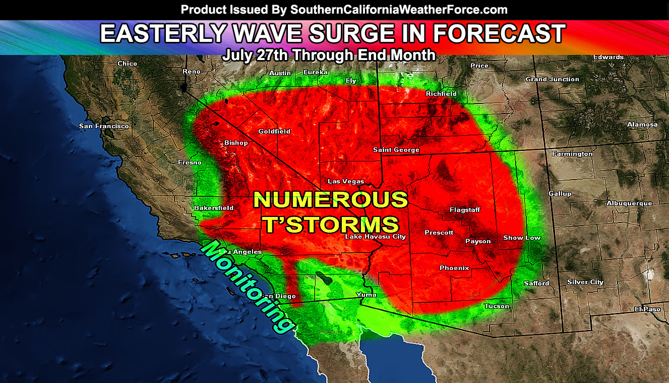
Easterly waves within the monsoonal flow (first of the season) are targeting Southern California for the risk of showers and thunderstorms into the region, extending even to some valley and coastal regions this next week. Find out more and where the monitoring and confidence areas are as of now by reading on …
The monsoon ridge; or heat dome, will move into position to allow for the monsoonal moisture door to open, bringing in a due east-southeast to even easterly flow into Southern California. This flow will start in the Imperial County Deserts as early as later Sunday through Monday .. .but be fairly shallow at best. The deeper moisture will arrive by the middle of the week, and especially between the dates of July 28th and July 31st for the rest of the forecast area.
Although it is a bit far out to get into details, careful monitoring of the pattern over the last week has revealed that what will be Hurricane Frank will contribute to denting the ridge on the southern end, knocking the ridge of high pressure into the Great Basin and provide for a very fast moving flow out of Arizona during this event.
What that means with both the ridge and the influence of Hurricane Frank well south of the area … kinks within the ridge’s southern periphery will cause mini areas of vorticy that will rotate into our region, and each of these will bring the real chance of increased shower and thunderstorm threats.
Our current models are showing a storm level wind below 15mph through the middle part of the week and strengthening as the weekend approaches toward the 29th and 30th. This means storms should be confined to the mountain and desert areas to start … but edge more westward in development each day until finally they reach the Central Inland Empire surrounding Riverside toward the end of the month.
The simple answer to most of your questions at this point on the Facebook Page will be that yes we have the risk of shower/thunderstorm activity as far as the coast of Orange and San Diego County … but our models do favor the mountain and desert regions with this event … with some valley zones of the Inland Empire and San Diego County seeing the activity as well.
Models here at SCWF yesterday showed nothing for the Inland Empire areas and today they do. This means that if our models in the medium range are anything like our temperature models … the shift will be to the west and stronger so the ‘monitoring’ part of the forecast area that includes Downtown San Diego … OC … Los Angeles .. and Ventura County … as of now will be what will be monitored and upgraded on if needed.
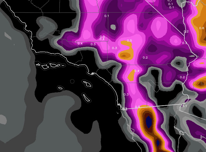
Our model showing the precipitation zones … with it extending west into the Inland Empire … will monitor it … This model is usually for MEMBERS ONLY for Fall, Winter, and Spring … Summer is a downtime period so you get to view it freely.
[/vc_column_text][/vc_column][/vc_row][vc_row][vc_column][vc_facebook type=”button_count”][/vc_column][/vc_row]