
[vc_row][vc_column][vc_column_text]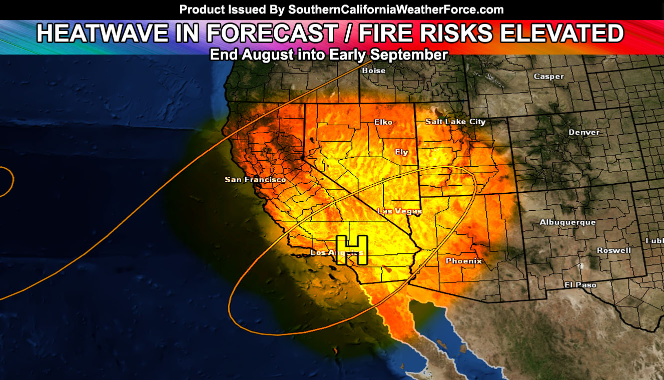
Well the first half of the month was hot, now it is normal, but we’re heading back into the heatwave and elevated fire risk levels for the end of the month, finishing off the forecast for hotter than average temperatures for the month of August. It will be my birthday with heatwave levels and sorry, this isn’t the birthday present I wanted so read on for those details.
A trough of low pressure this week is shoving monsoonal moisture to the east of the area and keeping nominal temperatures across the entire forecast area … quite comfortable for this time of year. That will end though as a ridge of high pressure builds back into the area by the end of the month with temperatures soaring back over 100+ degrees for the inland areas. The type of flow this is will be watched because if the flow continues the way it is, we may easily see some of these higher temperature inch their way to the coastal areas as well.
The September 2016 forecast will be out by 9/1 when the heatwave will be ongoing.
In addition, the Southern California Weather Force 2016-2017 Pacific Storm Names will be voted on by you the viewer right on our Facebook Page. When that thread shows up you can comment a name and the rest of the people can vote on them. That will be very soon … sometime in Early September.[/vc_column_text][/vc_column][/vc_row][vc_row][vc_column][vc_facebook type=”button_count”][/vc_column][/vc_row]