
[vc_row][vc_column][vc_column_text]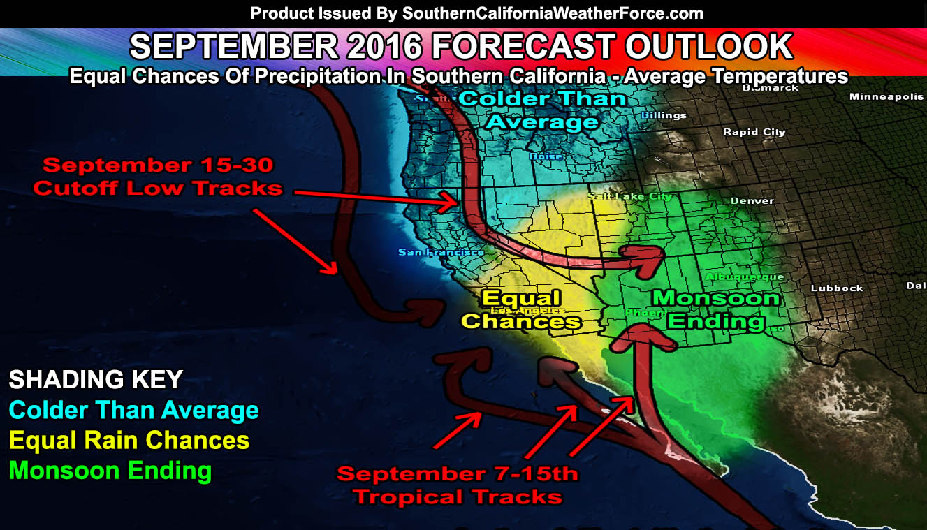
The September 2016 forecast has now been released and it will talk about the different patterns we can expect to see this month. Also, since 1999 this project in different names has been naming Pacific Storms and now you the reader can get a chance to get a name in there so read on for the details.
The contest will be on our Facebook Page thread so go on over there and vote. How you vote is you can either put a name down or you can like the comment with the name. Rules are the names have to be actual real names, nothing like Pacific Storm Gangster or anything like that.
The September 2016 forecast looks to have average temperatures and average precipitation. Given this is the time that tropical storms or hurricanes get closer to Southern California we have to introduce those average precipitation chances in. September is also cutoff low season just as October is and we’ve seen some fairly strong thunderstorm events during cutoff low season.
The beginning of the month will be colder than average. The monsoonal moisture will push far east, even out of Arizona. We can expect windy conditions in the mountain/desert zones Friday into Saturday with a trough passing by and this will last until September 7th when the ridge axis builds back in and temperatures inland climb again.
After around September 7th we will see a ridge try to push back into the area and this would pull the next Tropical Storm or Hurricane going along Baja, California either to Arizona, Eastern Southern California, and Santa Barbara. This cone of uncertainty for the remnants of the system is very wide at the moment.
The storm system’s moisture and associated dynamics between September 8th and 15th could bring the risk of storm activity in our forecast area. If it hits the Eastern forecast zones then areas east of Los Angeles will get the event … if west of the forecast area then all of the forecast area stands a chance at this. It has to come close to one of scenarios though … I just don’t see this staying way offshore and not affecting the United States.
Average to Above Average temperatures will prevail for the last part of September. Due to the jet stream becoming more erratic up north … the % chance of cutoff lows reaching down here increases.
The hottest period will be the end of the month …[/vc_column_text][/vc_column][/vc_row][vc_row][vc_column][vc_facebook type=”button_count”][/vc_column][/vc_row]