
The Tropical Storm has formed and it’ll reach Hurricane Status by tomorrow morning, impacting Cabo San Lucas, Mexico as a Category One system before heading into Arizona by Wednesday as the storm deflects away from Southern California … and temperatures are heading back up as a result for a brief time. Read on for the details …
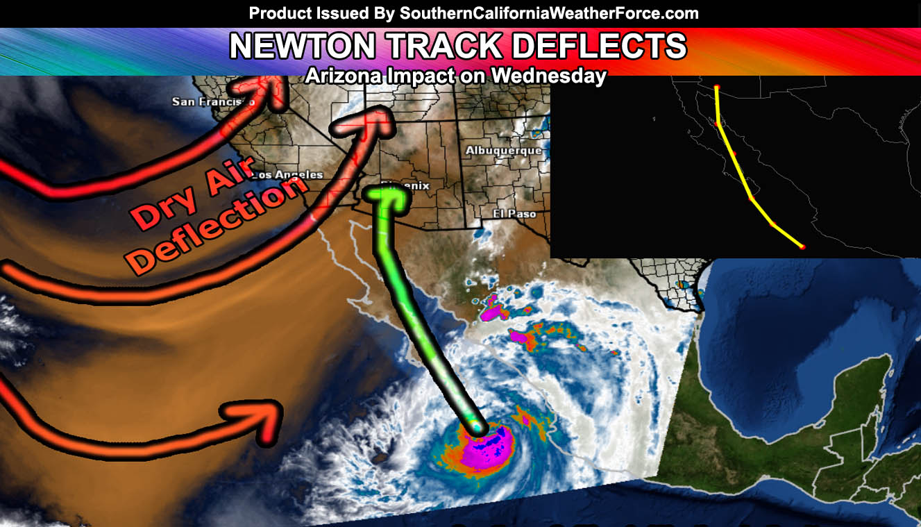
The system is currently southeast of Cabo San Lucas, Mexico and moving northwest toward the coast. Newton will impact the city on Tuesday morning and keep on up through the Baja Peninsula before hitting Arizona on Wednesday.
The tracking of this could not be possible until the storm had a strong center of circulation and while this was suppose to be the target for us between September 9th and 15th … it will only impact Arizona. Long range tropical systems .. even predicting their development is tough and while the statements of the past were not official forecasts from this site … the system was predicted to hit the Southwestern United States somewhere .,.. just wherever was uncertain until the storm fully formed.
Given this, a hand plot method I use for tracking tropical systems and did so for Dolores last year in July has enabled me to be confident that Newton will enter Arizona’s border south to southwest of Phoenix and continue into the state. Flooding will be likely in areas Phoenix eastward and precautions should be made for anyone in those areas mid/late this week.
Because there is a trough-axis directly over Southern California … any deep-layer moisture associated with the storm will veer into Arizona … with continued dry weather across the region as Arizona gets hit. Those of you in the member section have seen the precipitation risks shove east over the last three days and this trend will seem to continue for Newton.