
[vc_row][vc_column][vc_column_text]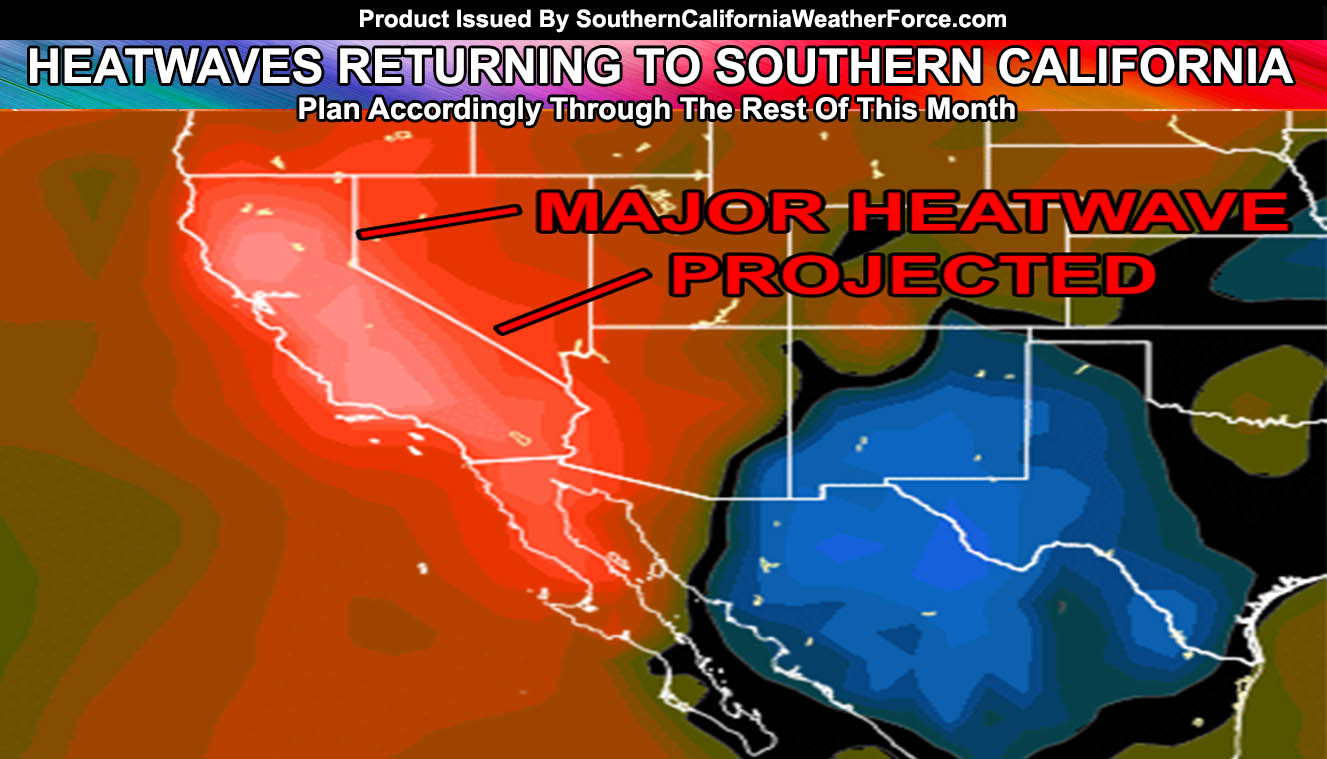
After a taste of Fall, mild offshore flow will set into the area by this weekend and last through some of this next week with triple digits returning to the inland areas along with a mild Santa Ana Wind pattern for elevated fire risks by the 20th or 21st with a MAJOR Heatwave expected toward the end of the month! Read more for details.
Drizzle/light rain hit some of the VT/LA/OC/IE areas this morning and this will rapidly move out over the day with returning low clouds for most of this week … minus the rain dynamics.
A storm system moving to the east of the area seems plausible at the moment over the weekend and this would bring in a weak offshore flow and thus sinking air through the basins from it would result in a drastic swing in temperatures toward heatwave levels after Saturday and lasting for several days.
Looks like if it can move a bit southwest of the area and not shove off into Arizona we will be introducing the risk of strong southerly flow from this cutoff and draw in moisture from what will be a developing sustained tropical system early this next week. Precip. probs are being monitored.
NEW: SCWF Weather Alert Facebook Groups By Region – JOIN ONE TODAY!
Don’t get use to the Fall cool air either right now even after this heatwave … as my September 2016 forecast stated we would see a major heatwave by the end of the month and it will be very hot into the beginning of October …
Stay tuned to SouthernCaliforniaWeatherForce.com[/vc_column_text][/vc_column][/vc_row][vc_row][vc_column][vc_facebook type=”button_count”][/vc_column][/vc_row]