
Santa Ana Winds and Heat Give Way To Storms In Monsoon Flow Tuesday and Wednesday … Read on for details …
The upper level low that was causing the Santa Ana Winds and heat in the basin this past few days will retrograde and actually bring monsoonal moisture into the mountain and desert regions on Tuesday and Wednesday … how far west ? … read on .. .
Main Article begins now …
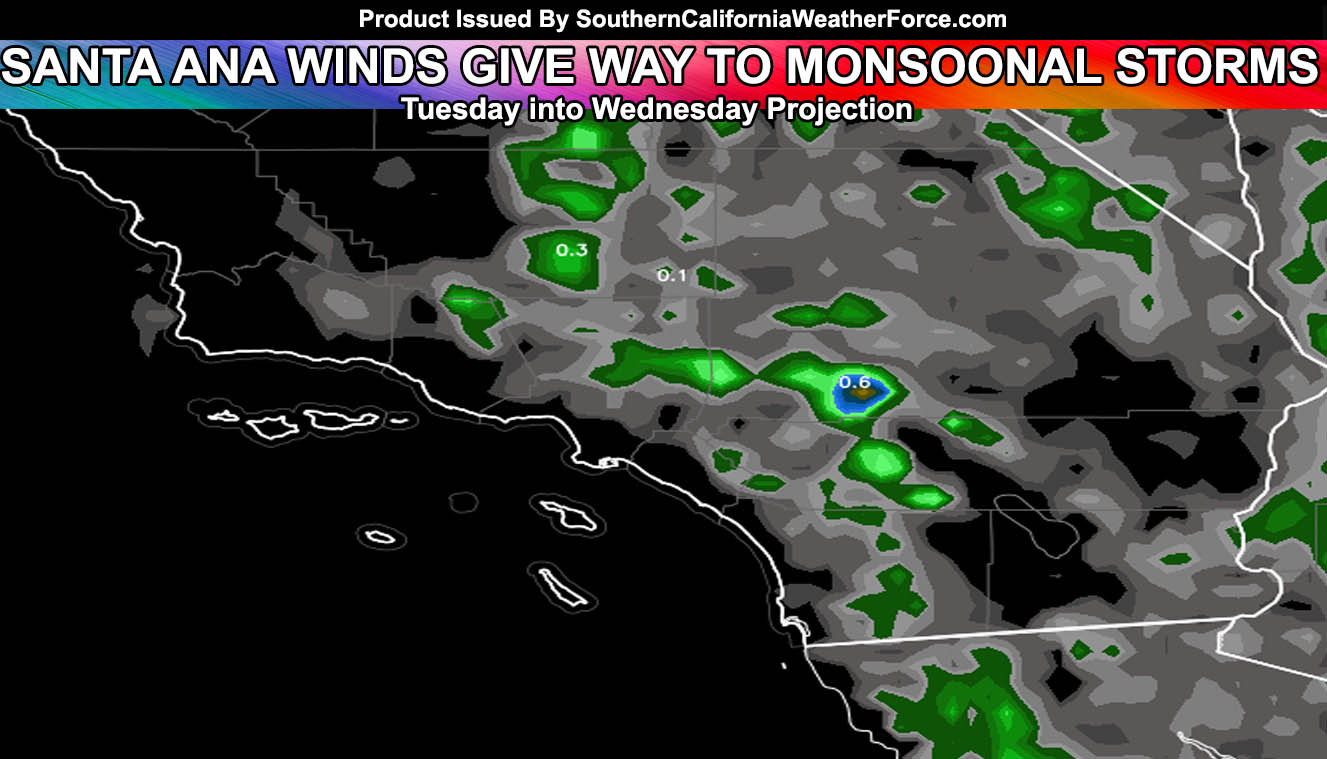
The upper level low that was causing the Santa Ana Winds and heat in the basin this past few days will retrograde and actually bring monsoonal moisture into the mountain and desert regions on Tuesday and Wednesday…
An upper level low over Mexico will retrograde back northwest and deliver monsoonal moisture into the forecast area as early as overnight tonight in the SD/RIV/SBD mountain areas and adjacent inland empire eastern forecast zones next to those mountains … There is A RISK that this vort could hit the SD Valley/Coastal areas overnight into Tuesday morning but again a risk .. .this could bring shower OR tstorm activity there but no promises since no other source has it … I’m going to try to put that in.
But the real activity will begin on Tuesday as upper level lifting moves into the area from the east. This will make the mid-level moisture push to the west and affect the inland areas west of the mountains .. especially the inland empire…
Between Tuesday and Wednesday it will be possible for outflow to hit SOME OF THE LA Northern Valley surrounding Glendora … including the Kern County Mountains … southeast to the VT County Mountains …
I AM NOT EXPECTING STORMS in COASTAL LA/ VT / SBA / SLO or the metro Kern Valley areas … This will act like a typical strong monsoonal flow for all areas NEAR THE MOUNTAINS … and IE areas …
That is it …