
Santa Ana Winds and Heat Return This Week Followed By A Major Pattern Change With Colder Temperatures so read on for details.
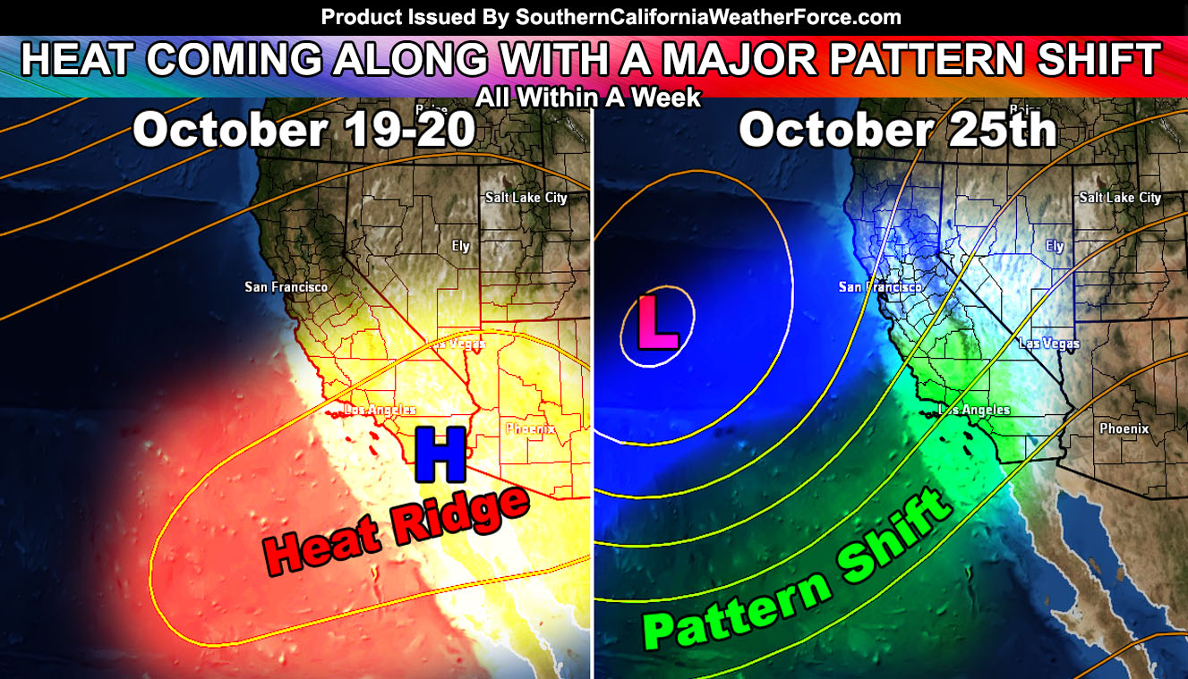
A ridge of high pressure will build into the region by the middle of this next week and push the temperatures up to heatwave levels for this time of year, which is generally anything over 7 degrees above average. Gradients Wednesday and Thursday support the return of the Santa Ana Winds. Although not a damaging Santa Ana Wind Event, gusty winds below passes and canyons will certainly return. The dry and hot air along with those windy conditions supports a fire risk.
After this next weekend the pattern is going to change to an interesting one. This type of southwest flow in the mid-levels will be supported by a trough due west of here. Elevated moisture and instability could make it interesting for the risk of shower/thunderstorm activity to return before the month is over. Next week is going to be interesting with a hugely amplified pattern, something not often seen in October.
Temperatures will also start to drop then and I expect a colder than average Halloween, typically in-line to what we usually see then.
Taking a look into November .. the amplified pattern will bring colder temperatures then as well. Fall is coming … just get through this last heatwave and we should be good to go.