[vc_row][vc_column][vc_column_text]
Pacific Storm Amelia is moving through the forecast area this morning and it’ll move out later today … Read on for details.
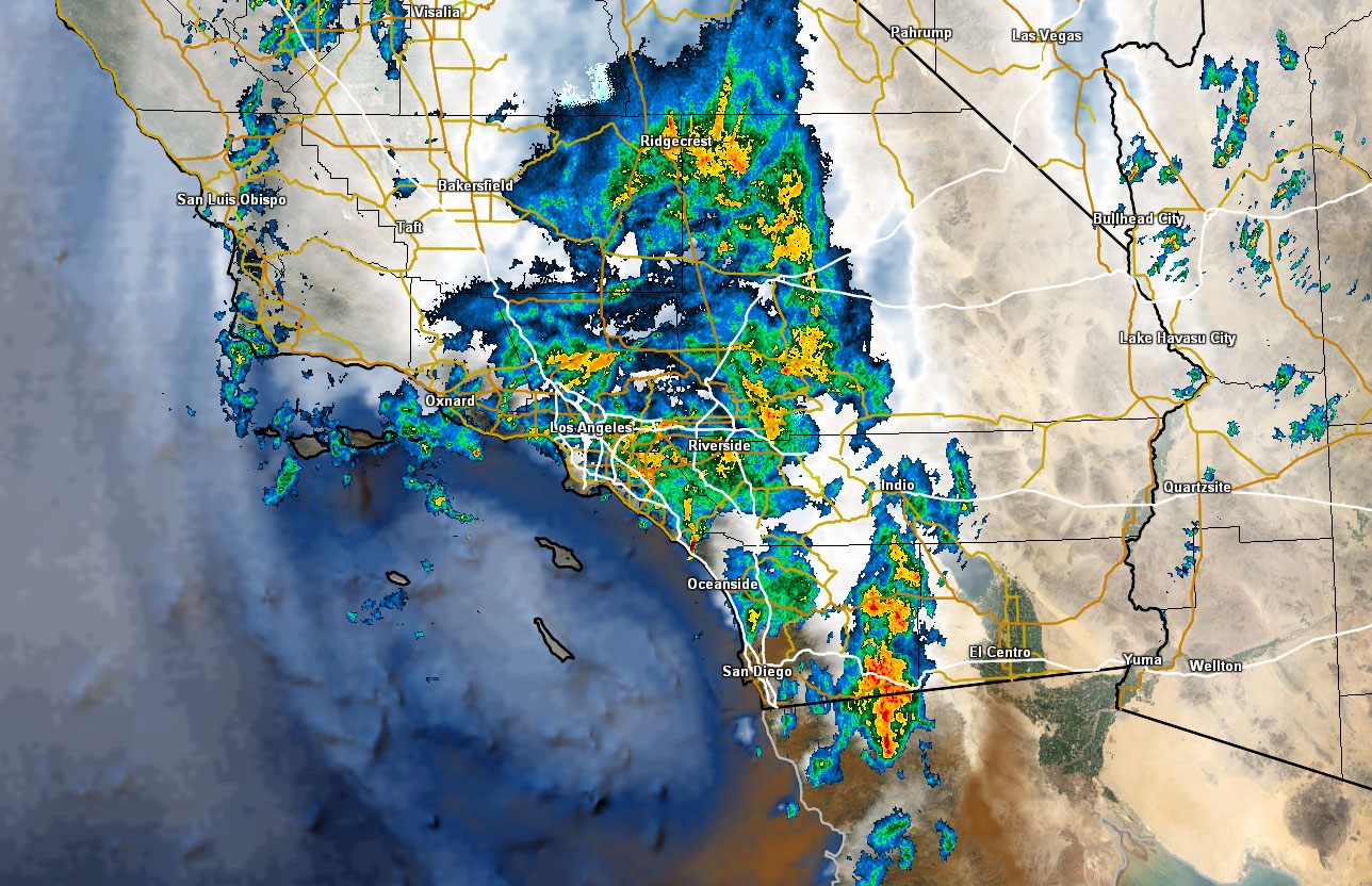
The warm sector of the storm moved through on Sunday morning/afternoon west of Ventura and finally into the Los Angeles, Orange, San Diego, and Inland Empire zones overnight and continues to move eastward this morning through the deserts.
A dryslot with the system is preventing stronger thunderstorm development and this is mainly a warm conveyor belt type system. However, it is the rain we desperately need here in Southern California but as you can see with the SCWF Flood Advisory … too much at one time isn’t always a good thing.
Scattered showers and isolated thunderstorms are possible through the rest of the morning for the LA/OC/IE/SD zones … and light snow is possible in our LA/SBD Mountain areas as the snow level finally comes down to 6,000 Feet … where during the main front … as previously forecast … it was at the Big Bear Lake level between sticking and wet snow, which would be a temp of 32F and a dewpoint of 32F .. not as exactly the best for dry sticking snow and good amounts but you’ll take it …
Shower activity will continue near the foothills of the San Bernardino, Riverside, and San Diego Mountains most of today with residual moisture backed up against them …
Our next shot of rain is either the end of the month or into December … but confidence is on the low side … What I do know is that at the end of the month the blocking becomes very strong and much colder temperatures are coming our way region-wide …
[/vc_column_text][/vc_column][/vc_row][vc_row][vc_column][vc_facebook type=”button_count”][/vc_column][/vc_row]
