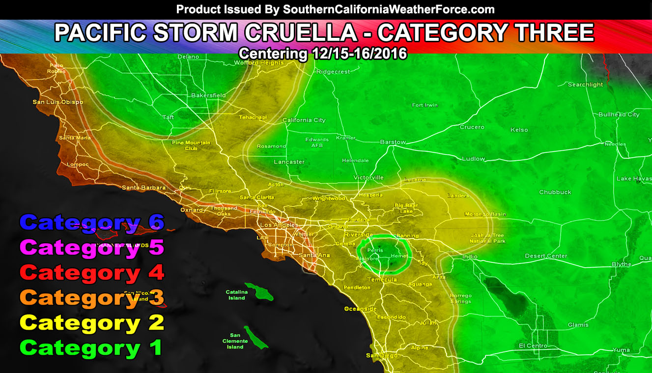
Pacific Storm Cruella is now official and will impact as a Category Three out of Six this evening, intensifying overnight, and leaving on Friday. She will bring at the heart of her an Extreme Rate of Rainfall, 40 mph wind gusts along the front for the coast/metros, Hurricane Force Winds in parts of the Desert, Higher Snow Levels, and flooding in many spots. Very important that you go to the article and understand what category you are in because a C3 does not mean you will see those conditions so get familiar with it .. I don’t want to hear you think the forecast was wrong and live in Barstow …
This will be the final forecast as the previous forecast has been right on target so this will iron the details out.
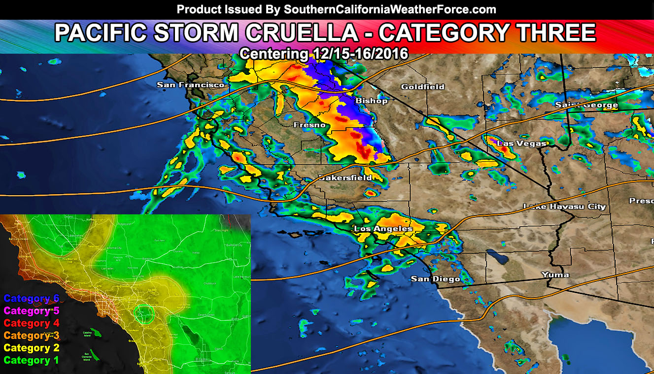
A tropical atmospheric laden storm system will hit the area today and tonight. The flood advisory is for heavy rain that will lead to flood in the hills for mudslides … and road flooding in the flatter land areas. Heaviest rain will arrive this evening for the SLO/SBA/VT county areas, spreading overnight into the LA/OC/IE/SD forecast zones.
A number of things to consider with this will be the heavy rainfall sure … but also within the coast/basin/valley zones will be the risk of strong winds … which could bring some trees down .. especially near the coast where the winds have an unobstructed terrain they are coming from. Rain will start in areas well before the main front today .. .but the main action is this evening and overnight … into sunrise Friday morning …
Could easily see 1-2″ of rainfall in most of the advisory zone with the tropical type atmosphere … and over 3+” in the mountains below the snow level, which will remain very high through the heaviest precipitation on the front … briefly hitting 8,000 FT before sunrise on Friday morning.
Some interesting notes will be the system having a small rain-shadow effect for parts of the Inland Empire surrounding Perris. Due to the Santa Ana Mountains … less rain will be seen in that city than areas like Corona, Ontario, and San Bernardino, which are not greatly affected by the taller Santiago Peak.
Rainfall will also lack in all desert areas … including the Victorville/Hesperia zones
A very powerful mid-level jet will move through the area .. .and as the front passes the sinking air behind it will slam down and create wind gusts that could surpass hurricane force on the eastern slopes of the San Bernardino, Riverside, San Diego Mountains. Morongo Basin to Lucerne Valley is also in this …
Wind like this are above the traditional advisory/warning levels I’d normally issue so take it seriously. Less concern for west of Big Bear Lake with a lot of concern in eastern sections into Big Bear City. The highest wind gusts will be along Highway 62 in the city of Joshua Tree.
Issued a High Wind Warning for all desert areas …
Thunderstorms are extremely iffy right now because we do have a lack of instability and higher freezing levels … which means we aren’t having much of a column for a greater thunderstorm threat and if it happens it would be isolated at best. The category three is more for the extremely heavy rainfall rates + gusty winds.
Strong winds on Friday will make for high waves and damage possible on the west and southwest facing beaches … with some areas seeing waves as high as 10FT … especially San Diego County …
ANOTHER IMPULSE: There is a chance that another impulse will swing down on Friday night … and nudge the forecast area. That would bring some offshore winds to the area … however what I am watching is the chance of some lighter snowfall for the San Bernardino Mountains around Big Bear.
Full Members can see the flood risk, rainfall maps, and more during events … Click Here To Enter the Member Section
Make sure you like your micro-climate group! That is where the alerts and magic happens … – https://www.southerncaliforniaweatherforce.com/scwf-weather-alert-facebook-groups-by-region/
The image below is what category will be assigned and felt in what areas of the forecast area out of an intensity of 1-6 which measures rain, wind, and thunder … clearly the most dynamics coming together in the Category Three areas.