
[vc_row][vc_column][vc_column_text]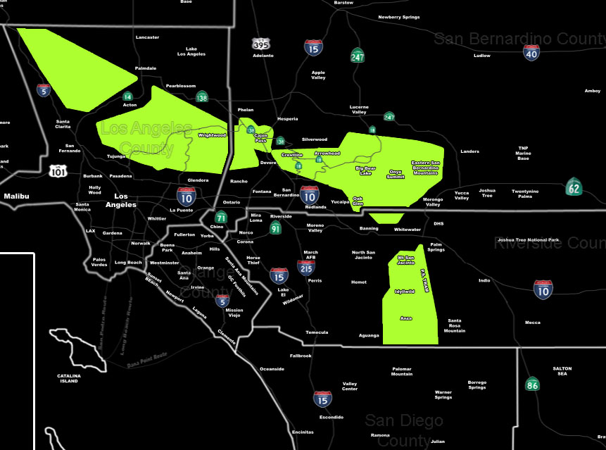 [/vc_column_text][vc_column_text]Issued Zones: Los Angeles, San Bernardino, Riverside Mountains above 4,000 FT …
Site: SouthernCaliforniaWeatherForce.com has issued a Blizzard Watch effective now for Friday evening into Saturday morning …
Date: 12/22/16 at 12:10pm PT
Forecast: A backdoor cold front will impact the area merging with moisture out of the west.
This lifting source on Friday evening through Friday night will make it possible for a snow level down through 4,000 FT and thus higher elevations at the resort level will see a complete mess with well over 12-18″ of snowfall in the San Bernardino and Los Angeles County Mountain areas … and 6-12″ for the Riverside Mountains above the snow level …
Very potent system this is and with the wind gusts expected to be tropical storm force or higher … whiteout conditions will hit and thus a full blizzard is expected …
Should this continue .. I will put out the highest alert for winter weather … the Blizzard Warning … Stay tuned … Do not travel in these areas …
10 mile rule: These alerts issued on this site means that within your zone and 10 miles from you will see the event forecast for. You may or may not see the event but it means you are in the zone or 10 miles from where someone will.
Forecaster: KM[/vc_column_text][/vc_column][/vc_row][vc_row][vc_column][vc_column_text]
If this doesn\’t say “you like this” below then click the LIKE button if you thought this was good information! This helps spread the word by just ONE LIKE … Do it every time if you enjoy these … Thanks for helping!
[/vc_column_text][vc_facebook type=”button_count”][/vc_column][/vc_row][vc_row][vc_column][/vc_column][/vc_row]