
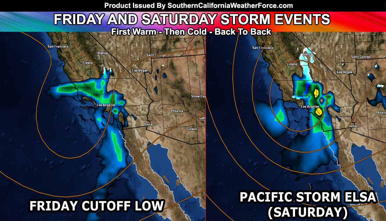
A cutoff low now beginning to move north-northeast toward the forecast area will bring rain to the region on Friday with a stronger storm out of Alaska for Saturday. Various areas will see different effects so read on for the early details.
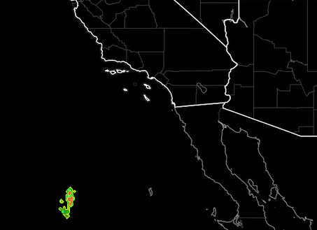
At the current time, lightning detection on the eastern periphery of the low west of Baja, Mexico is showing strikes. This would mean the system does have the upper dynamics and instability for thunderstorms down there. As it moves toward the Southern California area for Friday, expecting that increase in shower and even thunderstorm activity. Since it is a cutoff, the rainfall amounts this far out cannot be accurately predicted, nor can the location.
However, there is confidence that on Friday the graphic released in the last article looks about right with a deformation band across the VT/LA areas and a conveyor belt of moisture across areas south and east of Los Angeles. Given this, monitoring will continue and proper alerts will be issued once narrowed down. The cutoff is not within the main flow of the jet stream so it is not as easy to predict.
The stronger storm on Saturday is a hybrid cutoff / jet stream storm so it is a bit easier to predict. Timing looks correct on Saturday. The type of system looks to go down the California coast and then move inland just before San Luis Obispo. The pattern would keep Vandenberg and San Luis Obispo mainly on the ‘drier’ side of the low .. with wetter conditions for Kern, Los Angeles, Orange, Inland Empire, San Diego, surrounding mountains, the high and low deserts. This is about what I am going with now. I issued a Winter Storm Watch above 4,000 FT …
The system looks cold so snow-levels for the most part above the 4,000 FT mark, which could impact the mountain passes at that elevation.
Going to go with a start in the Kern County/Ventura County Mountain zones by later Saturday morning, moving through the LA areas by afternoon, and into the SBD/RIV Mountains later afternoon/early evening.
The upper divergence does pose a risk of thunder-snow …
Snowfall amounts are not ready yet because it is a hybrid cold system/inside slider but this watch is for heavy snowfall conditions in the watch area … upgrading to warnings/advisories as the storm gets closer. Travel is not recommended …
As for the rest of the forecast area. Do believe from The I-5 Corridor from Gorman, Kern, and the Santa Clarita Valley that strong upper divergence on Saturday would warrant the risk of thunderstorms, including the High Desert, Inland Empire areas. It’ll all depend on how far west the upper level low goes. But … with this type of pattern .. I’ve seen thunderstorms be plentiful in it since it is a dynamic Alaskan storm / hybrid.
The system would be Pacific Storm Elsa when named … Category will vary because of the lack of wind dynamics in some spots … could be seeing a category two or three. Remember, category is for how much damage it could cause with a combination of three things … rain/snow intensity, wind, and thunderstorm/type.
How I do the category system?
Click Here To See How It Works
MEDIUM/LONG RANGE: After this we’ll have a strong offshore flow wind event on Thursday … followed by a storm pattern that could be significant surrounding January 9th. The member section already has the long range information.
Not on our Facebook Page? Join thousands for updates.
Click Here To Join
Everyone else is going to have to click the link and go to your micro-climate section and await the alerts that come. Some are out now … and others will be issued.
Click Here To Go To Your Micro-Climate Section –
Full Members can see the snow level, snow amount, flood risk, rainfall maps, by tomorrow morning before Dante hits … Don’t miss out! … Click Here To Enter the Member Section
See ALL the alerts I issue here – https://www.southerncaliforniaweatherforce.com/