
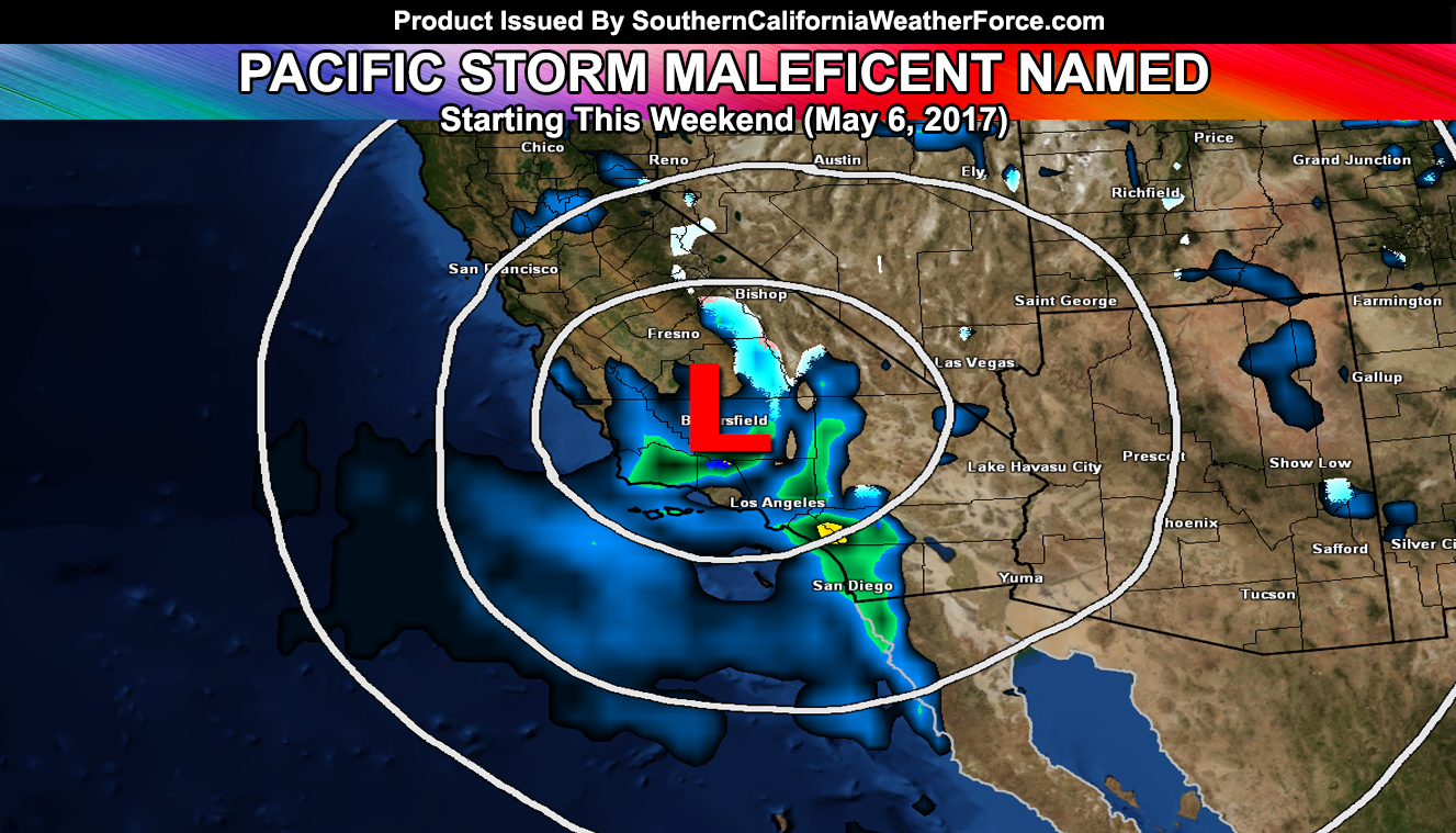
A strong cutoff low will dive into the region this weekend and produce a multitude of weather events that has earned the coming storm the next name on the list … ‘Maleficent’ … The storm will have mountain snow, thunderstorms, damaging winds in spots, waterspouts, blowing dust in the desert, and over 10-15 Foot waves. Category is to be determined… Read on for details.
Three alert products are active as of today here at Southern California Weather Force. The Marine Weather Warning consists of damaging waves. A strong cutoff low will approach the area this weekend. On Saturday, strong onshore flow gradients of over 30-50 mph in gusts will make for rough seas … with waves as high as 15 FT in some areas … with a median of 10-12 FT … some individual waves could slam at 18 FT high … Shower/thunderstorm activity will also be possible … depending on the track of the low …
My High Wind Watch is in effect for the mountain and desert regions. A strong cutoff low will zoom down into the region by Sunday .. however out ahead of it will be a strong surface low over Las Vegas, Nevada. This strong surface low will work with some mid/low level jet dynamics to bring a stronger than normal onshore flow..
Wind gusts over 50+ mph is certain and blowing sand or dust will make for terrible travel … including the risk of damage. The winds ease through on Sunday with the risk of shower/thunderstorm activity through at least Wednesday of this next week …
LIKE US ON FACEBOOK for updates! Click Here and join thousands …
The Southern California Weather Force Heat Advisory will end by the end of the week with the approaching cold system.
Tracking of the system has been consistent in bringing it directly over the forecast area on Sunday. This is when strong lifting associated with the system will give the risk of shower/thunderstorm activity just about anywhere. For now I’ll say anywhere.. however as the storm gets closer I’ll be able to narrow down areas that would see more than another … something of a novelty here at Southern California Weather Force.
Because of the speed at which the system drops, Maleficent will not get a chance to warm up in the mid/upper levels and thus this will produce snow levels as low as 5,000 FT later on Sunday.
The system meanders around for a bit for several days, each bringing in lifting dynamics for the risk of shower/thunderstorm activity to continue well into this next week.
Members, Click Here To Enter Your Member Section for precip maps …