
As we are enjoying this cool-down in all inland areas, so goes Newton’s Third Law as every action has an equal and opposite reaction and the heat is returning … this time with humidity and shots of shower/thunderstorm activity so read on for details.
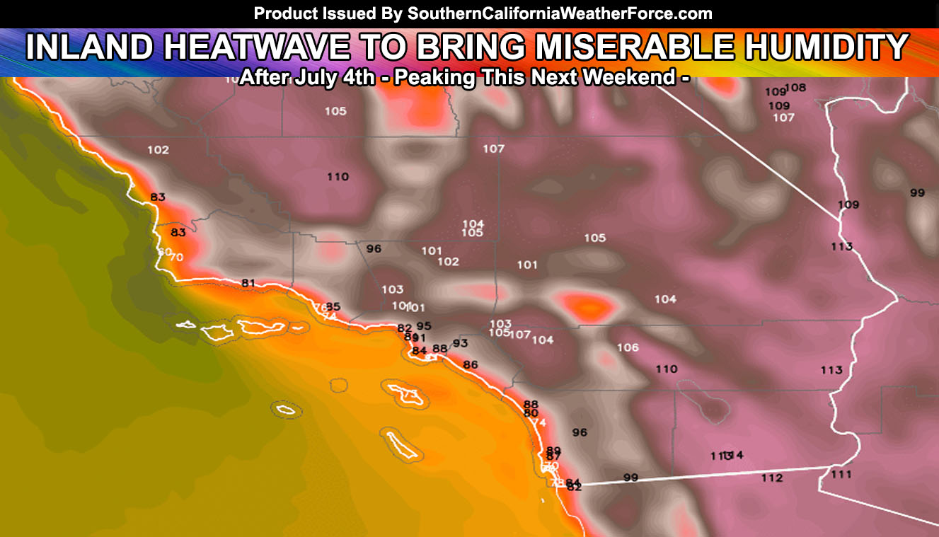
The ridge of high pressure will build over the four corners from July 4th onward … with each day becoming hotter from mid-week through the week with temperatures between 105-110F in the valley zones again and Downtown LA going to the 90s.
LIKE ME ON FACEBOOK for updates! Click Here and join thousands …
With this will not only be heat, but the humidity will be a factor this time, making it feel much more miserable than the last inland heatwave. This moisture will be due to the four corners ridge setting up and pushing monsoonal moisture over the area. As stated in the July 2017 forecast, this time-frame after July 4th through July 14th is the time where we will start to see the daily mountain and desert thunderstorms popping up.
Now will these have a chance at going into the nearby valleys or coastal areas is up in the air … however some indications are that it just might for some Inland Empires areas surrounding Hemet and Banning with a southeast flow out of Aguanga.
Click Here To Find Your Zone On Facebook For Updates Now and In The Future
Click Here To Find Me On TWITTER.
With any case, all monsoonal flow intrusions will be watched up until the arrival of them … but not detailed outlooks will be made until I get a better idea how far west the ridge axis will take the moisture and just how deep we are talking here. Looks deep enough for monsoon induced shower and thunderstorm activity with the highest risks over the mountain and desert areas … and mostly east of Ventura County.
Stay tuned to Southern California Weather Force for further details …