
Preliminary numbers suggests that the ridge placements across North America will move into position to bring a classic storm pattern to Southern California. The January 2018 forecast went as forecast with 1-3″ in the Los Angeles area in that forecast, which was another long range projection. The month will end with just below the normal in terms of precipitation. Read on for details.
The January 2018 forecast went as forecast with 1-3″ in the Los Angeles area in that forecast, which was another long range projection. The month will end with just below the normal in terms of precipitation.
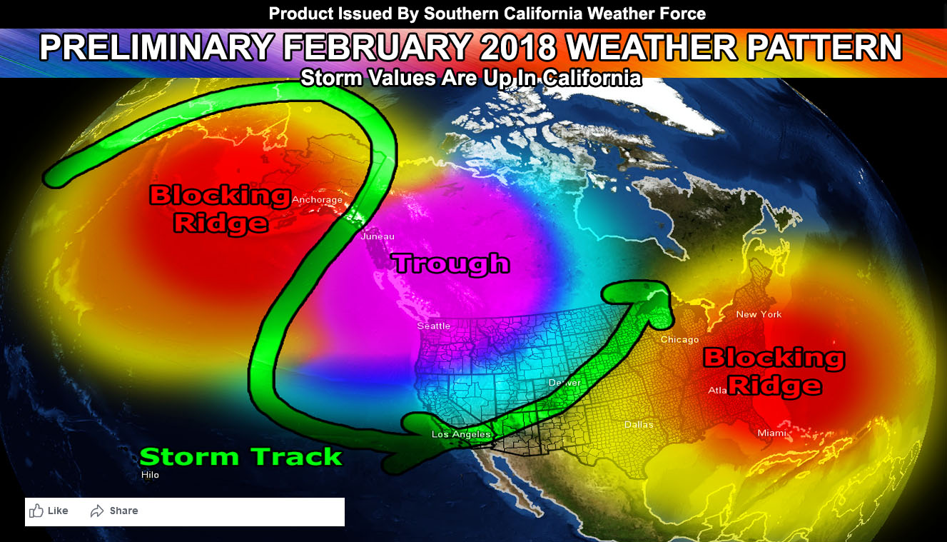
In this super long range projection I look into the position of the ridge right now. The ridge is in the Pacific west of Oregon, which is the primary reason we are getting northern slider systems. During February these ridges will move, and a ridge would form offshore the Eastern United States, which would in turn form a trough in Western Canada, and that trough pushes the ridge off Oregon up toward Alaska.
This push will ultimately bring storm systems around the Alaskan ridge and down the Eastern Pacific and into the West Coast. The placement further shows that these storms will be the cold variety and that the month of February is when we start to see better mountain snowfall producers… maybe even some high desert producers as well.
We have been slowly moving the ridge into place, but as I stated months ago … this is a mid to end season storm event pattern development for us as the jet stream becomes more erratic. So … My preliminary numbers at the moment look good for February to be active with this ridge placement being in Alaska and a trough in Western Canada.
If it does not say “Liked” LIKE The Page Below and join thousands of informed weather forecast viewers in our region for more of the updates!