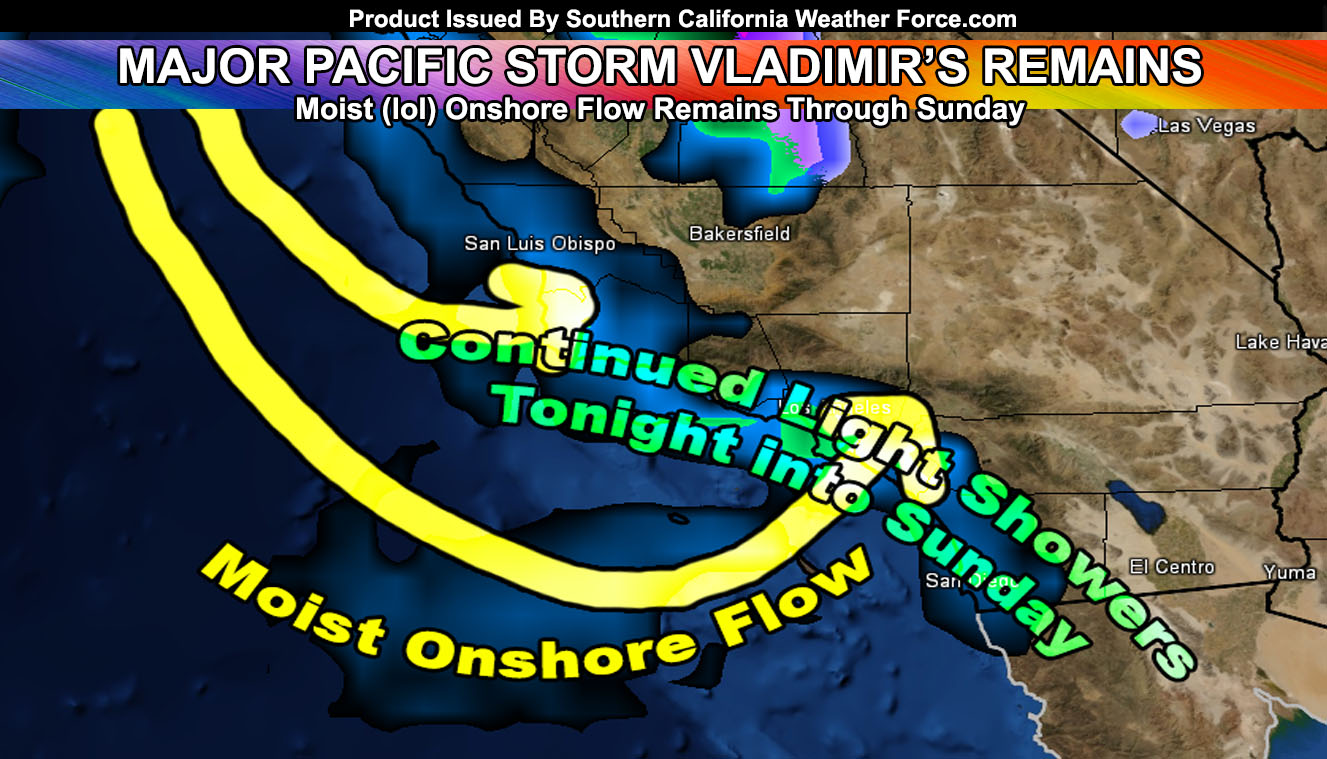
Major Pacific Storm VLADIMIR delivered the Category 5 event out of my 1-6 scale. Numerous debris flows from all burn areas were reported and many power-lines and trees were knocked down. Think I even had a comment that someone scored a kid’s pool and a trampoline. The main squall-line is moving on and it will allow the warnings to expire. Read on for the rest of the night into your Sunday and a look at Monday.
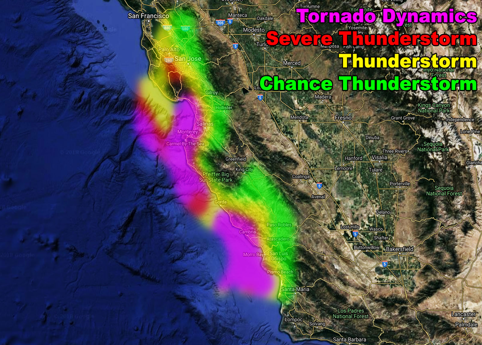
First, those of you in the San Luis Obispo County zones, mainly the western half, you are under my Tornado Watch. My thunderstorm/tornado model in the member section and viewable below this write-up clearly outlines the risk tonight. It also extends out of the forecast area and up to Southern bay area, including Monterey Bay so if you have anyone in those areas they’ll get a good show. A powerful surface low out in the Pacific is responsible for the damaging wind across the watch zone today. The initial front did not have thunderstorms as expected, however as the secondary cold front moves in this has all the ingredients for thunderstorms, upping the instability and upper divergence across the area for strong lifting. Based on the shear in the area we will have a secondary front capable of severe weather, including damaging winds and tornado risk. The best chance of tornadoes will be near the coast as they come off as strong waterspouts, but they could remain inland some as well. Most of the east end of this watch is for damaging winds and thunderstorms so you’d be a severe thunderstorm watch in Paso. The timing is mainly tonight with the more widespread thunderstorm dynamics.
I’ve gone ahead and issued a Flood Advisory for the burn areas of Santa Barbara and Ojai. The forecast is as followed tonight into Sunday morning; The main squall-line has passed the region and the Squall-line Warning will expire, however, a secondary low-level jet is expected to arrive overnight tonight and last for most of the night. This secondary low-level jet will bring gusty winds out of the south again and enhance the lifting once again in the advisory area. Flood Risk Model has this at a moderate for this advisory. An additional 1-2″ is possible overnight into Sunday morning.
For the rest of the area. Ventura/Southern Kern, Los Angeles, San Bernardino, and Riverside Mountains will get a bit of snow behind the front above say 5,000 FT but don’t expect much. My snow models are on the low end but I have my advisories out for the night.
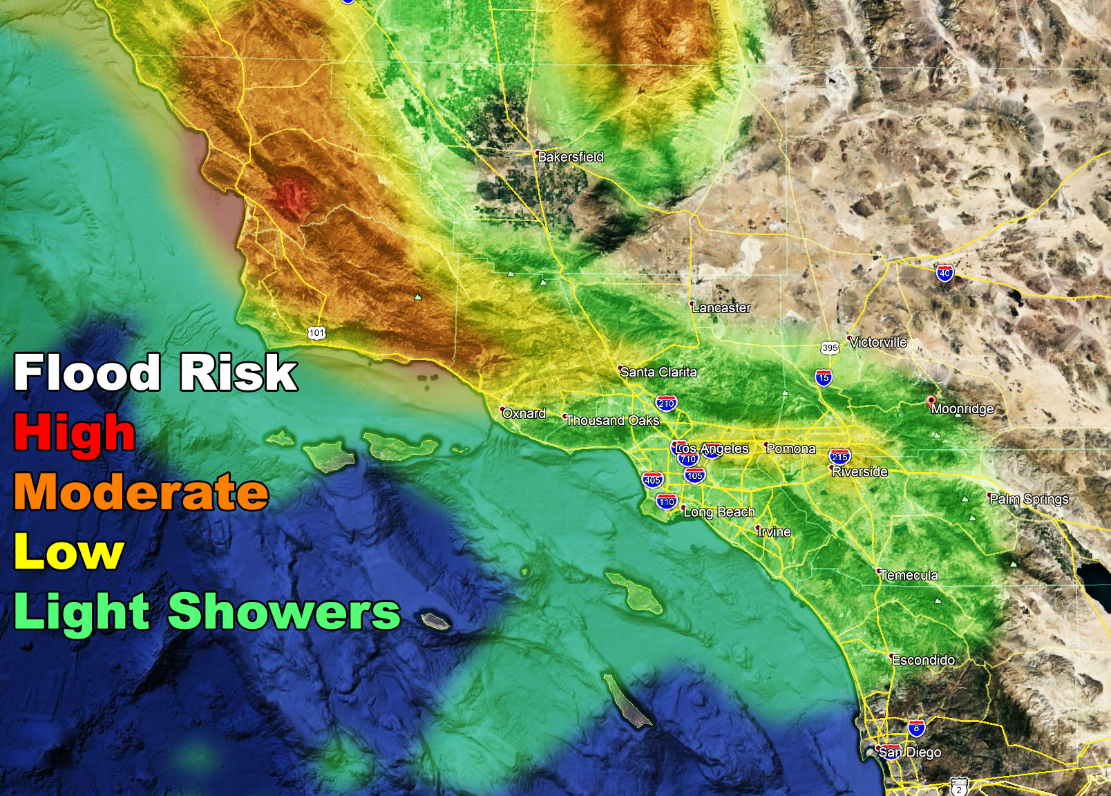
For the rest of the forecast area south and west of the mountains, the metros. We will be under a continued onshore flow tonight into Sunday. Flood Risk Model (Seen below in this article) shows a new value for ‘light showers’. This is what we have in the metros of Ventura, Los Angeles, Orange, The Inland Empire, and the Northern half of San Diego County. Think San Diego Downtown proper will have less activity through Sunday. Most show an extension into Catalina Island signaling the onshore flow and southwest to northeast light wind direction for upslope activity within the metros (green-shade below). There will be no main rain events in the high or low deserts on tonight or Sunday.
There is another impulse for San Luis Obispo / Vandenberg by early Monday morning, spreading over the day into the metros of VT/LA/OC/IE/SD once again. This is weaker in rainfall but may have some flood risks with it. The system also has a bit lower snow levels with it so this one on Monday, if named, will be Warren, and be slightly cooler for resort-level snowfall.
That is it. If you are new then welcome. Use the model images below for planning.