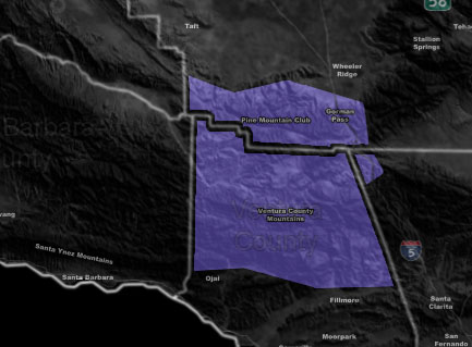
Issued Zones: Ventura Mountains … Kern Mountains PMC to Frazier and the Gorman Pass …
Site: Southern California Weather Force has issued a Winter Weather Advisory effective now through Tuesday night …
Date: 2/4/19 at 5:35am PT
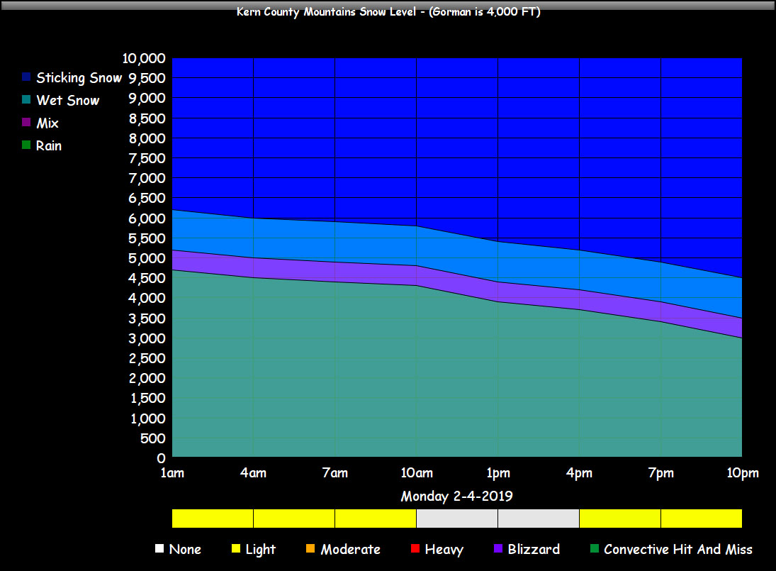
Forecast: A series of cold fronts will start today and move along through Tuesday night. These cold fronts will start the snow level at 6,000 FT today and lowering to 5,000 FT by the evening and to the Gorman Pass level overnight and stay there through Tuesday.
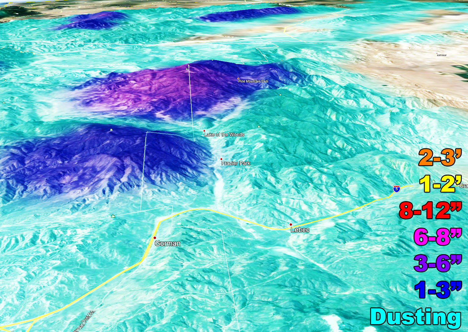
1-3 inches of snow is projected for the Pine Mountain Club zone with isolated 3-6 inch marks. 1-3 for Frazier looks far right now. The lack of snowfall is because of how fast each of the fronts move through after the first 6,000 FT level one moves through today. Rain-shadow also from the mountains will affect totals.
Each front will act like ripples on a pond. The snow will come and go with each one. Gusty winds will accompany the fronts at times, thus blowing snow is possible. Because of the ‘lower amounts’ I expect, a Winter Weather Advisory suits this area. The Gorman Summit by the time the event is over Tuesday night will receive just a dusting of snowfall.
The chart below will tell you what to expect with intensity of precipitation, timing, and snow level …
PREMIUM MEMBERS – Click here to check out what is updated today in the SCWF member area …
Join A Micro-Climate Group On Facebook For These Alerts – Click Here To Find Your Location Served By SCWF Today!
10 mile rule: These alerts issued on this site means that within your zone and 10 miles from you will see the event forecast for. You may or may not see the event but it means you are in the zone or 10 miles from where someone will.
Forecaster: KM

 Monday, June 30, 2025