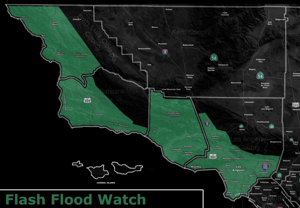
Issued Zones: Los Angeles, Ventura, Santa Barbara, and San Luis Obispo Coast/Metro Valley Basin Zones …
Site: Southern California Weather Force has issued a Flash Flood Watch effective now through Saturday at 8am …
Date: 3/1/19 at 3:30pm PT
Forecast: A fast moving yet potent front will move through the region overnight tonight. The heaviest rainfall will start just after the 9pm hour for San Luis Obispo to Vandenberg, after midnight for Santa Barbara/Kern, and after 2am into sunrise for the Ventura/Los Angeles County areas.
The SCWF Flood Risk Map has the region under a high risk for stream flooding due to everything happening in a short but potent time-frame. Residual showers are expected off and on through Saturday and Sunday, however after sunrise on Saturday the ‘heaviest’ flood producing cells would have moved out of the watch area.
Another system comes in during the middle of this next week. This system will be watched as it will be more potent than this system, reintroducing the flood risk products once again.
Most of the watch zone will see 0.50″ – 1.00″ of rainfall from this fast moving system.
EMAIL ALERTS: Get these to your e-mail by upgrading to a full member. It pays for itself in just ONE weather event: Click Here To Learn More
Additional Models: Visit the main site to see what was updated in terms of rain/snow/flood risk and more – Click Here
Join A Micro-Climate Group On Facebook For These Alerts – Click Here To Find Your Location Served By SCWF Today!
10 mile rule: These alerts issued on this site means that within your zone and 10 miles from you will see the event forecast for. You may or may not see the event but it means you are in the zone or 10 miles from where someone will.
Forecaster: KM
