
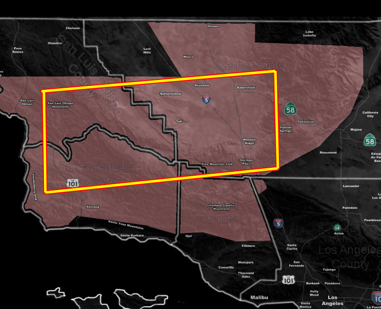
Issued Zones: North and Western Santa Barbara County … Southern half of San Luis Obispo County … Central/West/Southwestern Kern County, including Bakersfield/PMC/Tehachapi/Taft …
Site: Southern California Weather Force has issued a Thunderstorm Watch effective now through Monday …
Date: 4/28/19 at 5:20pm PT
Forecast: Upper Divergence to the north of the upper level low overnight tonight into Monday morning is apparent and will increase the thunderstorm activity as lifting mixes in with more unstable air.
This watch contains a box, and inside the boxed area is where the most concentrated thunderstorm activity is expected, anywhere from the Southern San Luis Obispo County Zones south to the Northern half of Santa Barbara County, and the Central to Southwest portions of Kern County, including Bakersfield and the PMC forecast areas…
Frequent lightning is likely in this boxed region … Enjoy the show …
EMAIL ALERTS: Get these to your e-mail by upgrading to a full member. It pays for itself in just ONE weather event: Click Here To Learn More
Additional Models: Visit the main site to see what was updated in terms of rain/snow/flood risk and more – Click Here
Join A Micro-Climate Group On Facebook For These Alerts – Click Here To Find Your Location Served By SCWF Today!
10 mile rule: These alerts issued on this site means that within your zone and 10 miles from you will see the event forecast for. You may or may not see the event but it means you are in the zone or 10 miles from where someone will.
Forecaster: KM