
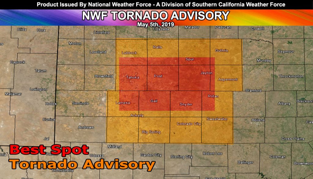
Issued Zones: Western Texas …
Site: National Weather Force has issued a Tornado Advisory effective this afternoon and evening …
Date: 5/5/19 at 12:10pm PT
Forecast: A sharp but potent area of upper divergence will move through Western Texas today across the advisory area. The advisory zone does extend into Lubbock, however, at the surface, convergence is maximized more to the south in a west to east orientation along the central latitude of the tornado advisory zone.
Southeast winds will be on the increase through the later afternoon and into some of the early evening hours and this, with strong instability, will bring the risk of supercells, including tornadoes.
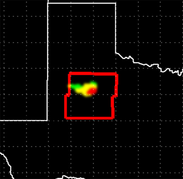
Storm motion will be primarily to the east with some southeast movement. The red-shaded zone above is the most probable zone and the image below this writing is the custom in-house NWF Tornado Forecast Model with computers generated watch zones … Storm chasers can enjoy lunch in Lubbock and then head southeast to Post, TX and chase from there. US-380 is going to be the highway to be on today.
FACEBOOK PAGES TO JOIN!
NATIONAL WEATHER FORCE MAIN PAGE: The National Weather Force is the national forecast alert project in development in what you just read in the articles. It will cover national weather during events only and it will be able to target your newsfeed so you will only get the updates that pertain to your state. Join today!
10-mile rule: These alerts issued on this site means that within your zone and 10 miles from you will see the event forecast for. You may or may not see the event but it means you are in the zone or 10 miles from where someone will.
Forecaster: KM