
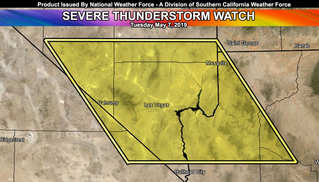
Issued Zones: Southern Nevada, including the Hoover Dam to Las Vegas Metro …
Site: Southern California Weather Force‘s National Weather Force division has issued a Severe Thunderstorm Watch effective now through 11 pm tonight …
Date: 5/7/19 at 12:45pm PT
Forecast: A potent area of upper ascent will move through today across the Las Vegas Metro zones, with a couple of rounds likely. Instability has been noted with over 500 j/kg at the moment in the mid-levels and a forecast over 1000 j/kg likely.
This would be enough to warrant storms coming out of the northwest into the Metro Las Vegas areas. Mid-level shear and steep lapse-rates present support the chance that the hail out there could reach over an inch in diameter.
Along with that, soundings show a classic inverted-V profile which promotes strong sinking for damaging winds with the storms.
Low-level moisture is not abundant but there is some low-level shear for funnels to be sighted from this system through the evening.
Expecting a full cease-fire from mother nature after the 10-11pm hour.
FACEBOOK PAGES TO JOIN!
NATIONAL WEATHER FORCE MAIN PAGE: The National Weather Force is the national forecast alert project in development in what you just read in the articles. It will cover national weather during events only and it will be able to target your newsfeed so you will only get the updates that pertain to your state. Join today!
10-mile rule: These alerts issued on this site means that within your zone and 10 miles from you will see the event forecast for. You may or may not see the event but it means you are in the zone or 10 miles from where someone will.
10-mile rule: These alerts issued on this site means that within your zone and 10 miles from you will see the event forecast for. You may or may not see the event but it means you are in the zone or 10 miles from where someone will.
Forecaster: KM