
Video FOR THE ARTICLE ON FACEBOOK SO CLICK HERE
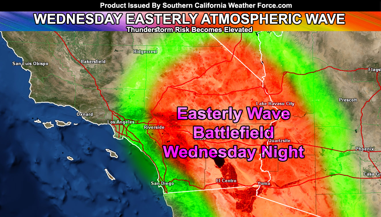
Welcome to Southern California Weather Force. An easterly atmospheric wave is due into the region on Wednesday evening and night. This easterly wave pattern is due to Hurricane Juliette bending the southwest monsoon ridge some and providing a ‘kink’ in the atmosphere. This is similar to what happened a couple days back with the severe thunderstorms in the lower deserts of the forecast area. Southeasterly flow and upper dynamics will be expected then for the Low Desert, possibly making it as far as San Diego County and the Inland Empire. Depending on how strong the outflow will be… it could make it further west. But, for now I will concentrate on the storms for the Low Deserts, including the Colorado River Valley. This will need to be further monitored and premium members will get the alerts as I issue them ahead of time.
We push up the monsoonal moisture after Thursday night and we start to dry out in the mid-levels by end week into the weekend and with that the humid air will be taken northeast and out of the forecast area and we will see an appreciable drop in temperatures for this time of year. It won’t be a true fall cool-down, but it will provide some relief for many people.
For the rest of the month, we have an erratic jet stream up north that looks to drop cutoff lows west of California and if these come further south, tropical moisture from dying hurricanes will be entrained into the northerly flow and into California and this is when we will have the chance at more shower/thunderstorm activity.