
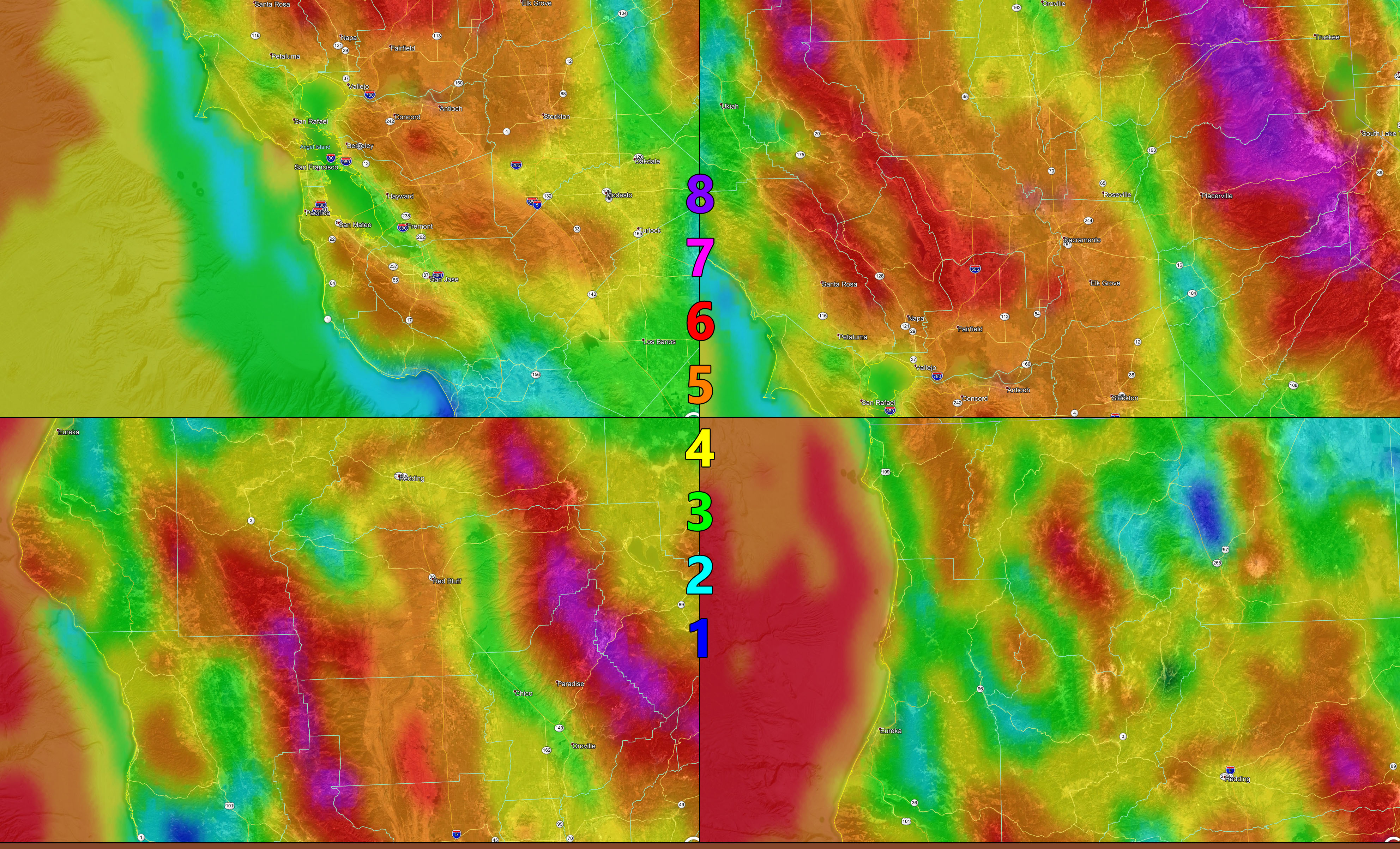
Click the image for a larger version.
A strong weather system will bring gusty winds and low humidity across the Northern half of California, including all metro zones tonight into Sunday, waning on Sunday evening. Use the image below with the Martin Wind Gust Intensity Scale Model for that period –
Martin Wind Gust Intensity Scale –
8. Extensive widespread damage.
7. Trees are broken or uprooted, building damage is considerable.
6. SOME Trees are broken or uprooted, building damage is possible.
5. Slight damage occurs to buildings, shingles are blown off of roofs.
HIGH WIND WARNING CRITERIA
4. Twigs and small branches are broken from trees, walking is difficult.
3. Large trees sway, becoming difficult to walk.
POWER SHUTDOWN THRESHOLD WIND ADVISORY CRITERIA
2. Large tree branches move, telephone wires begin to “whistle”, umbrellas are difficult to keep under control.
1. Small trees sway.
NOTE: This is the SCWF Website but it is being used for national updates until a suitable national website can be developed for you.
Your Facebook Page to join for this update is linked here – https://www.facebook.com/WesternWeatherForce/
Reading for another state? Find your region I serve here – https://www.facebook.com/…/a.6435502791214…/1544547759021716