
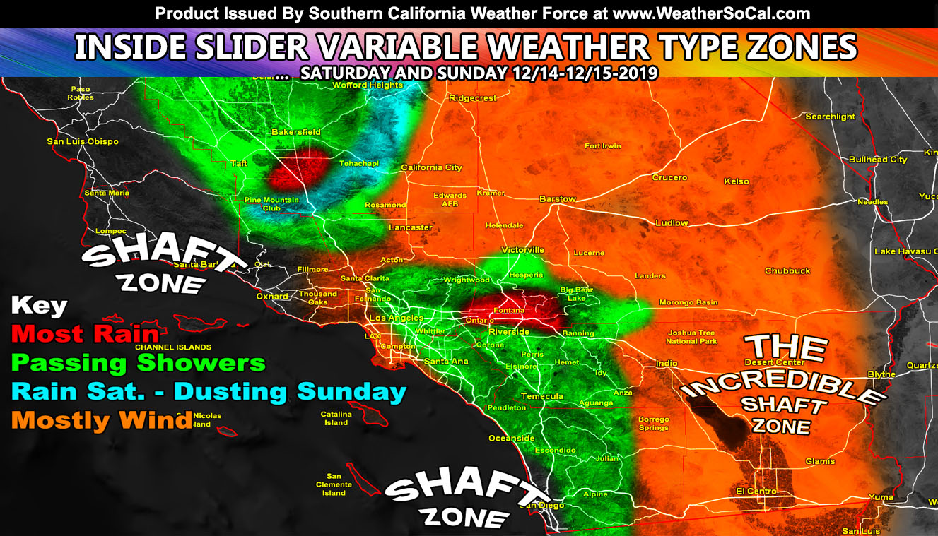
It will depend where you are as to what type of weather you will get because some of you will see rain and wind, others just wind, others just passing showers, and some even rain changing to a dusting of snow, but one major thing is the SCV into the SFV/LA Basin/Coast will be hit with a wind storm so read on for details …
Join Southern California Weather Force main Facebook Page for future updates!
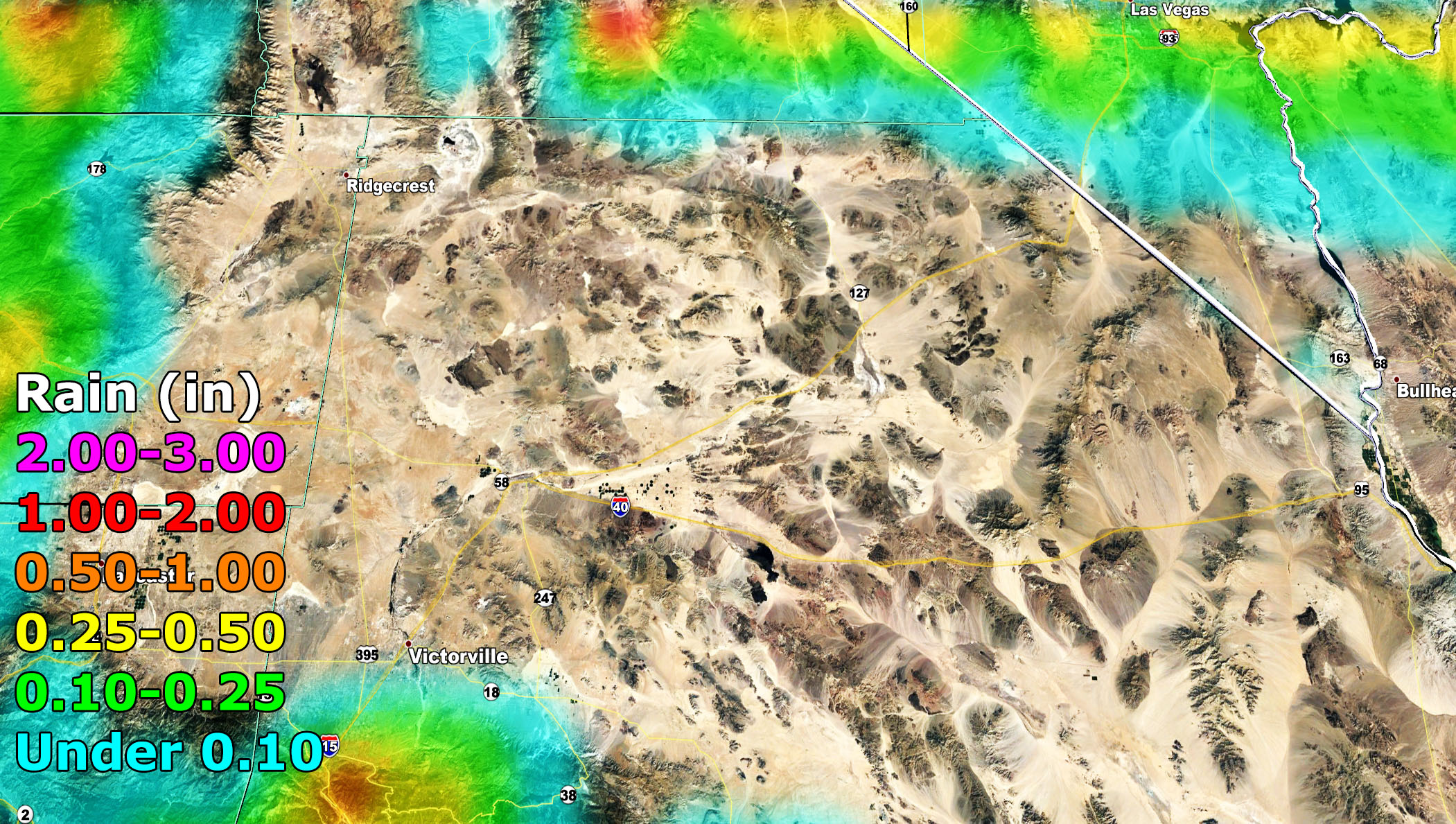
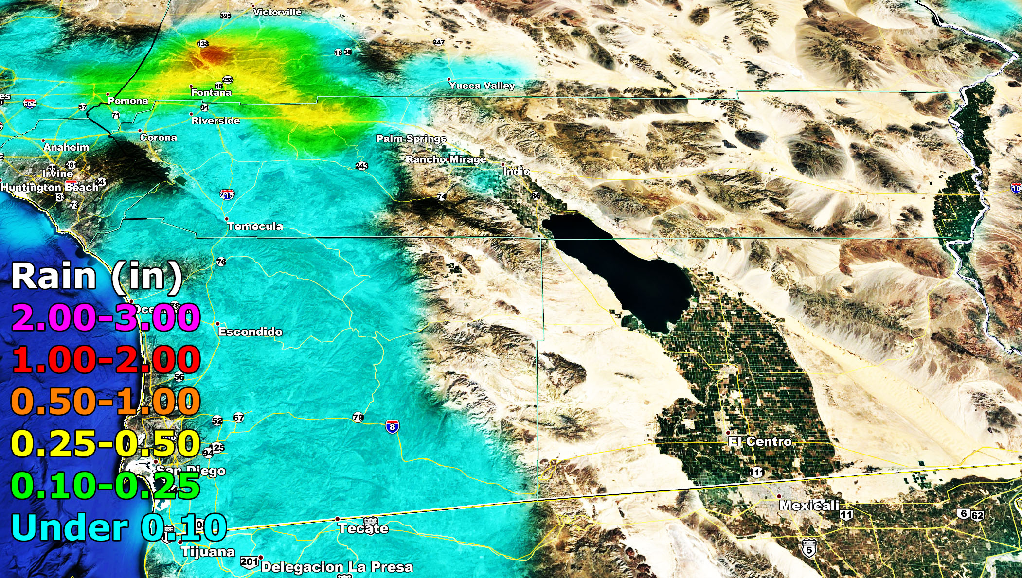
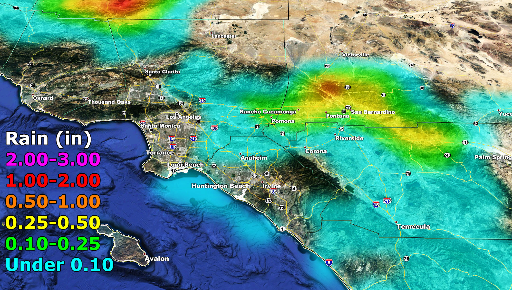
An inside slider system will move in on Saturday, lasting into some of Sunday. This system will have an onshore flow with it that will produce upslope shower activity. Current thinking is Downtown Los Angeles at 50/50 rain chance, same with San Diego Metro, nothing for Ventura, nothing for Santa Barbara, and nothing for most high and low desert regions. You all in the High/Low Desert will see mainly gusty wind conditions, the exception being the top of the Cajon Pass and nearby where leakage out of the pass would give you rainfall there. Pass conditions will be foggy at times so remember that one.
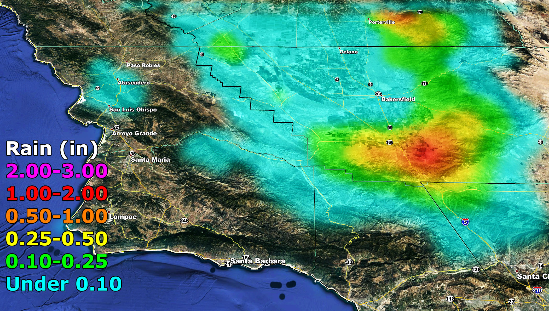
These passing showers will affect some Inland Empire areas as well, mainly south and west of the mountain areas so to put it one way Fontana will see more rain than Perris or Corona. The rainfall maps are below for your viewing out of the SCWF Rainfall Forecast Model and it clearly shows those upslope locations.
Kern County, you were issued a Short Term Forecast for this event. It mentions those showers but also mentions on Sunday morning the dusting of snow below 4,000 FT so don’t be surprised to see it. This is not an I-5 corridor closing snow event, but we could see a dusting up there in the Gorman zones then.
I issued a High Wind Warning for the LA Coast/West-Central Basin … SFV/SCV/Tujunga … Northwest Orange County zones. As Sunday morning moves along, the back-end of it will turn from west to east to more of a northwest to southeast flow and this opens up an I-5 Corridor Northwest Wind Event. Wind gusts along the corridor through the SCV and LA Basin/Coastal zones will be from 35-45 mph with gusts over 50 mph possible. Hang onto those Christmas Decorations on your Sunday morning into the day.
As for the Christmas period. As stated in my December forecast two weeks ago, I still am eying this period so watch for further forecast updates from Southern California Weather Force …
NOTE: ALL Articles AND Videos posted on Southern California Weather Force main Facebook Page are charity events. Anyone sharing will be entered into a list and one person will be randomly selected to get cash for causes. This started on in October 2019 and SCWF has donated $1883.24 to date of this article and counting. … So share away.. the more shares on Facebook, the more help can be done for the community and it costs you nothing just like a lottery ticket. October 2019’s winner was Jessica J Dominguez, and she has claimed the prize. Are you next? – Check the latest amount to win by CLICKING HERE – Remember… that number is going to climb before the contest closes!
MICRO-CLIMATE ALERT FACEBOOK GROUPS: Find yours today!
Click here to join
As always, stay tuned to official forecasts from Southern California Weather Force for updates …
For The Main Weather Facebook Page Click Here and Join.
End Article
FACEBOOK PAGES TO JOIN!
SOUTHERN CALIFORNIA WEATHER FORCE MAIN: Southern California Weather Force Office Main Page
BEHIND THE SCENES FORECASTS/UPDATE PAGE: Southern California Weather Force Meteorologist Page
FOR THE CALIFORNIA FAULT STRESS MODEL PAGE: For SCWF official updates to the California Fault Stress Model and more!
“PONDER THIS” SCIENCE ADVENTURE SHOW: A science adventure show developed here at Southern California Weather Force that is a fun ride!
INSTAGRAM AND TWITTER ACCOUNTS TO JOIN!
Instagram – https://www.instagram.com/socalweatherforce/
Twitter – https://twitter.com/SCweatherforce