
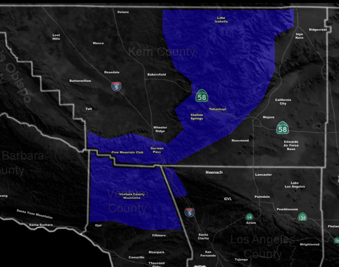
Issued Zones: Kern County Mountains, including the Gorman Pass …
Site: Southern California Weather Force has issued a Blizzard Warning effective Christmas Evening through Thursday evening at 8pm.
Date: 12/24/19 at 11:00pm PT
Forecast: A very strong storm system will move into the region starting Christmas, with light snow over the day. This is not criteria, however between 8pm Christmas Night and 8pm on Thursday, a full 24 hours, we will see the heaviest snowfall arrive.
This system is different than most as it has a wind pattern that the Ventura County Mountains will not block, thus during the period of heavy snow we will have wind gusts over 40+ mph and this means a full blizzard is in my forecast.
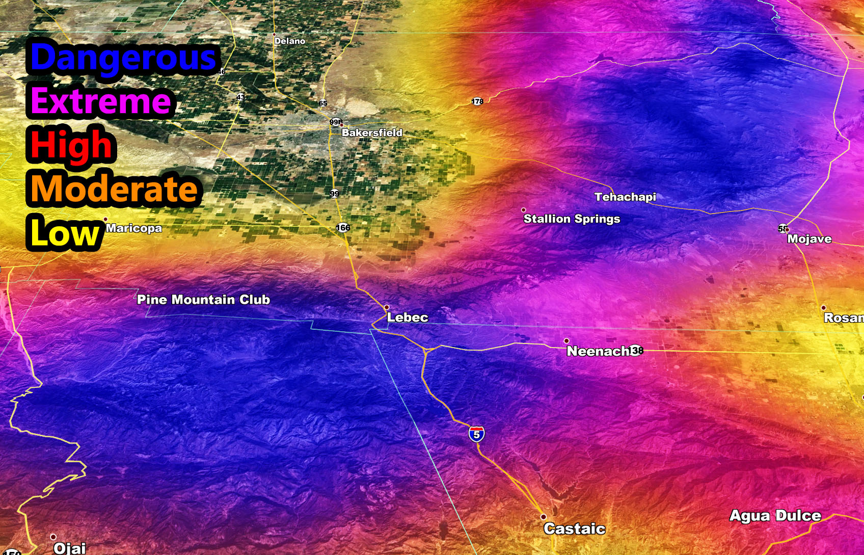
Easily will see over 12″ of snowfall with this in the city locations and the Gorman Pass will certainly be affected as well. Right now this far out my grids cannot calculate snow amounts, but my new snow risk model can and you are painted in dark blue across the area, which means do not travel in it. The map is below.
How to get these alerts with a premium subscription? (100 percent delivery time)
Click Here For Options
Join A Micro-Climate Group On Facebook For These Alerts? (50 percent delivery time)
Click Here To Find Your Location Served By SCWF Today!
10 mile rule: These alerts issued on this site means that within your zone and 10 miles from you will see the event forecast for. You may or may not see the event but it means you are in the zone or 10 miles from where someone will.
Forecaster: KM