
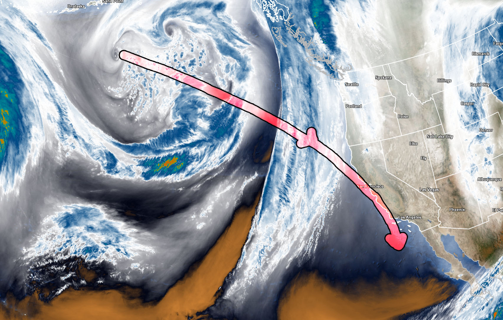
1. If the storm continues the current path it will bring the previous forecast to light. Mostly along and inland of the coast with mountain snow along with the High Desert.
2. If the storm deviates to the west then this is where we will have the problem with the current projection as a closed low like this tends to keep precipitation into it thus keeping everything offshore into the Island Region, missing most of us completely but keeping snow in the I-5 corridor and backside snow to the Morongo Basin area (light).
Agenda: The agenda today is to not touch the current Winter Storm Watch and Winter Weather Watch. These are watches and not final alerts. Pulling the trigger right now on a final forecast would not be good. Watches can be cancelled at anytime before the system’s 24 hour period of arrival.
Most of what I am seeing right now is for the system to hit the metro area BUT there are some 5 out of 20 chances of a miss to the west, which is a 25% chance at the moment.
I will monitor the system and no final alerts will go out until Sunday. I will remain with the current winter weather alerts and work from there. If the system does start veering to the south at anytime within the next 24 hours then it will miss to the west. So just putting that out there this is a crucial track.
What I will say is that either track will affect the Grapevine but the further west it goes will means less activity elsewhere. This is nowhere near the snow amount or track of the Christmas Storm.
Maintain current forecast plans and I’ll be back soon with a final update. And to whoever has a fan out in the Low Desert facing west trying to pushing this away … knock it off, please