

Issued Zones: Ventura Coast/Basin … SCV/SFV … San Gabriel Valley along and north of the 210 … Channel Islands … Orange County Basinand Santa Ana Mountains … I-15 Corridor from Corona to Cajon Pass … Riverside Mountains Idy/Anza/Aguanga … San Diego Mountains … Eastern Imperial County Glamis/Winterhaven … Needles forecast area …
Site: Southern California Weather Force has issued a Santa Ana Wind Advisory effective Monday into Tuesday …
Date: 12/29/19 at 10:50am PT
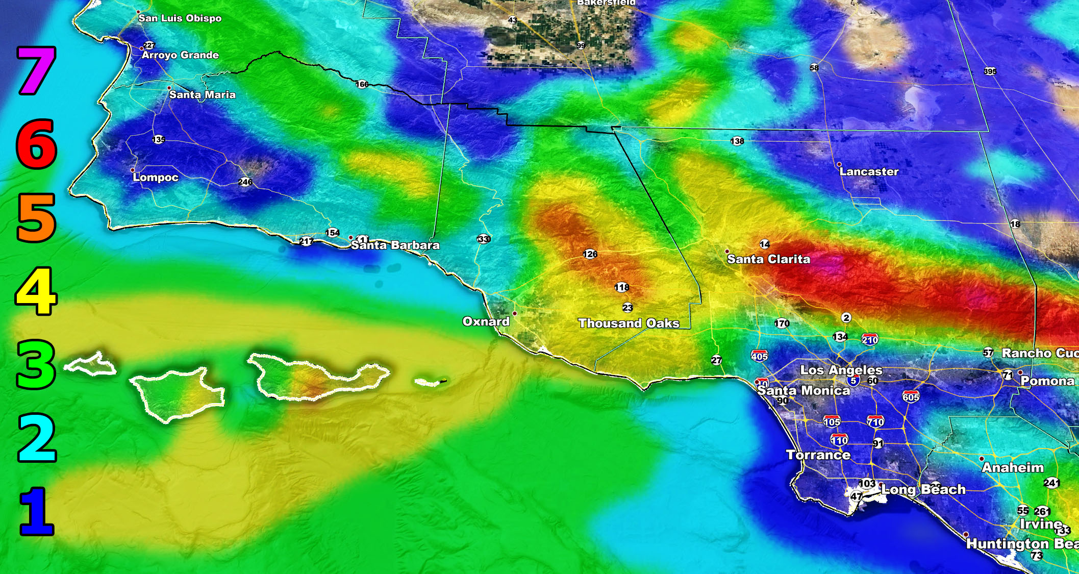
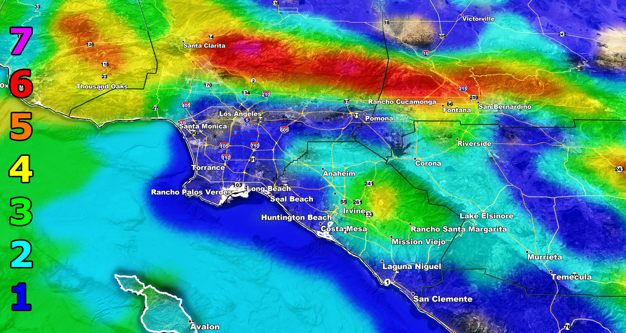
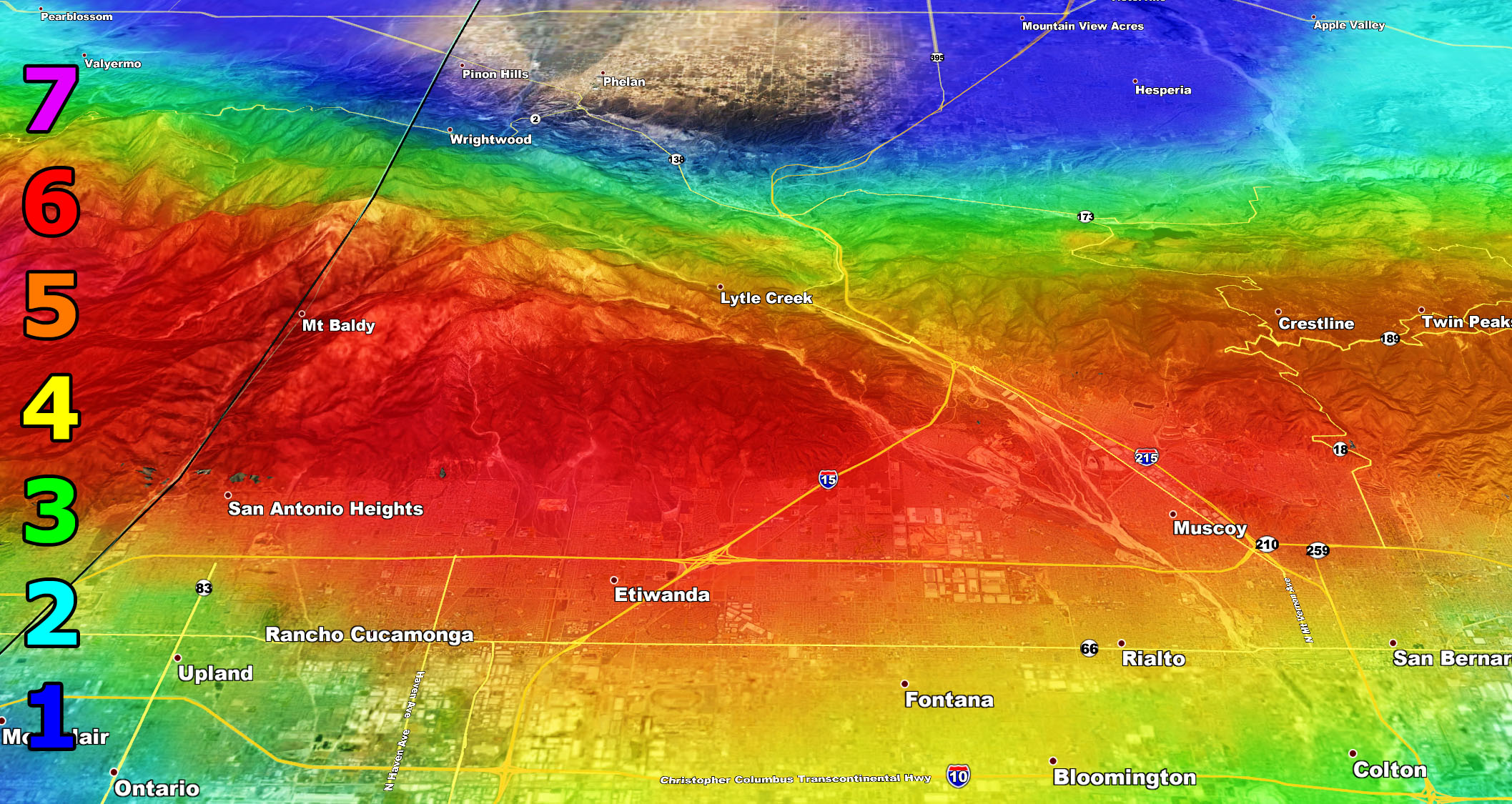
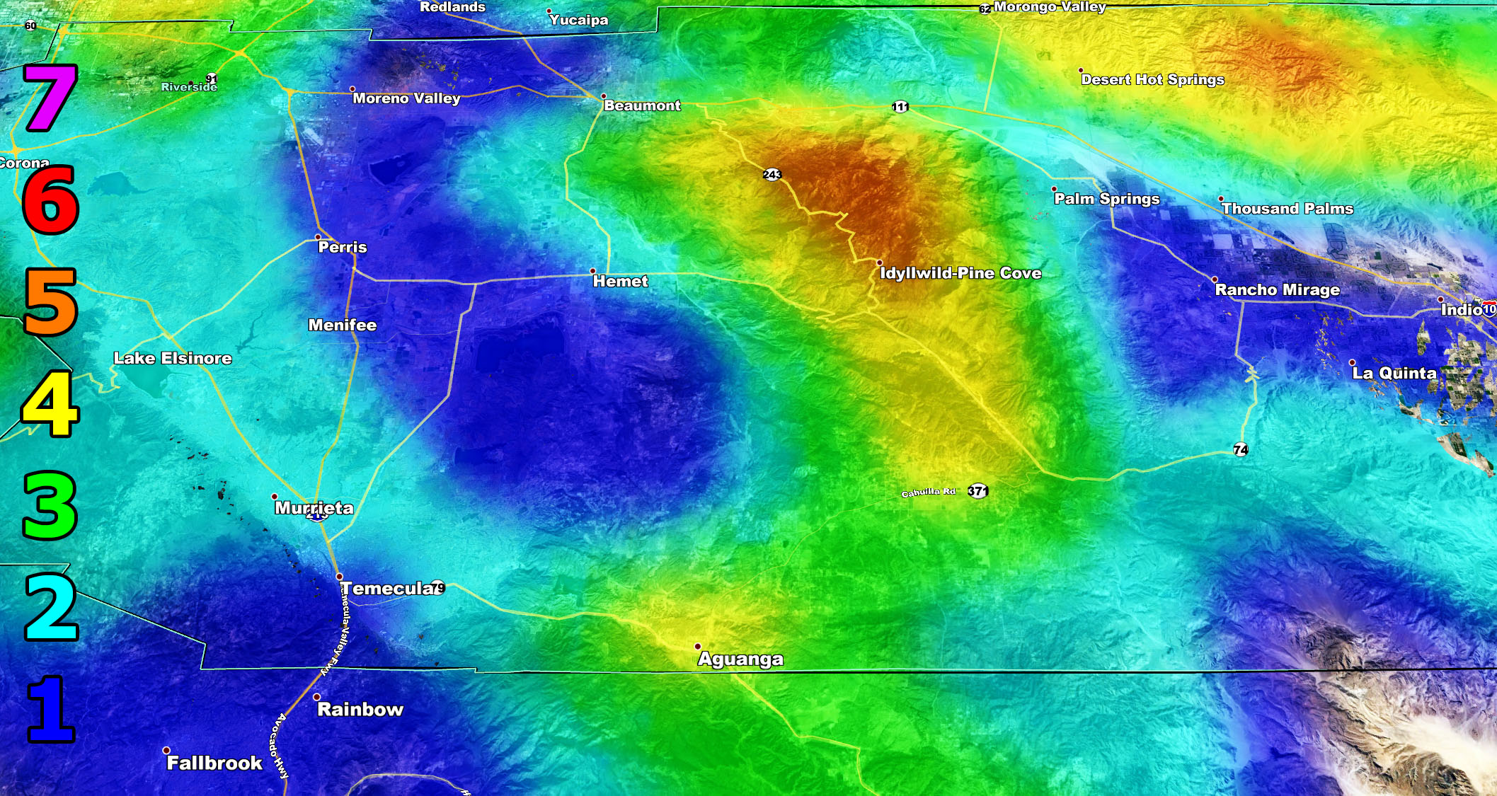
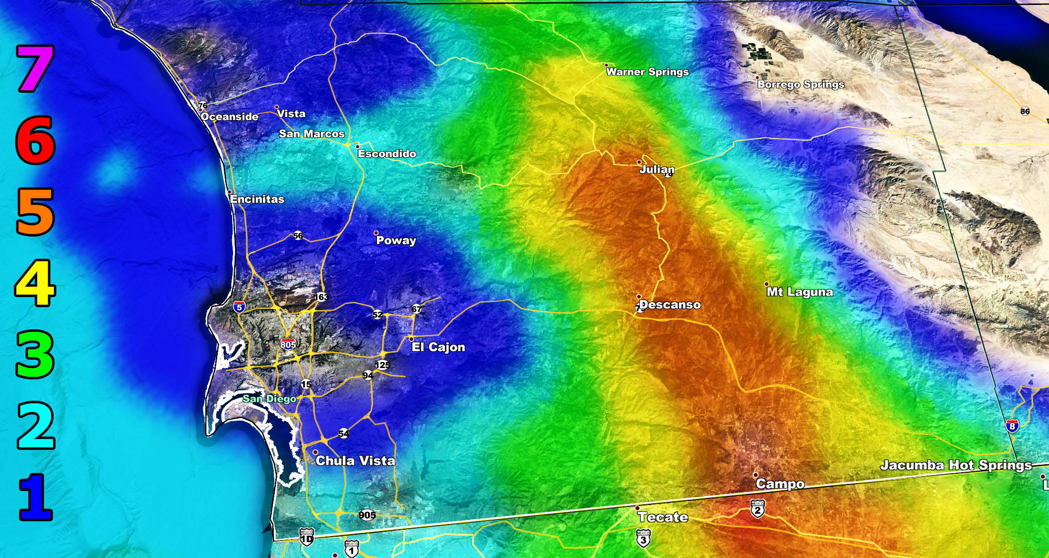
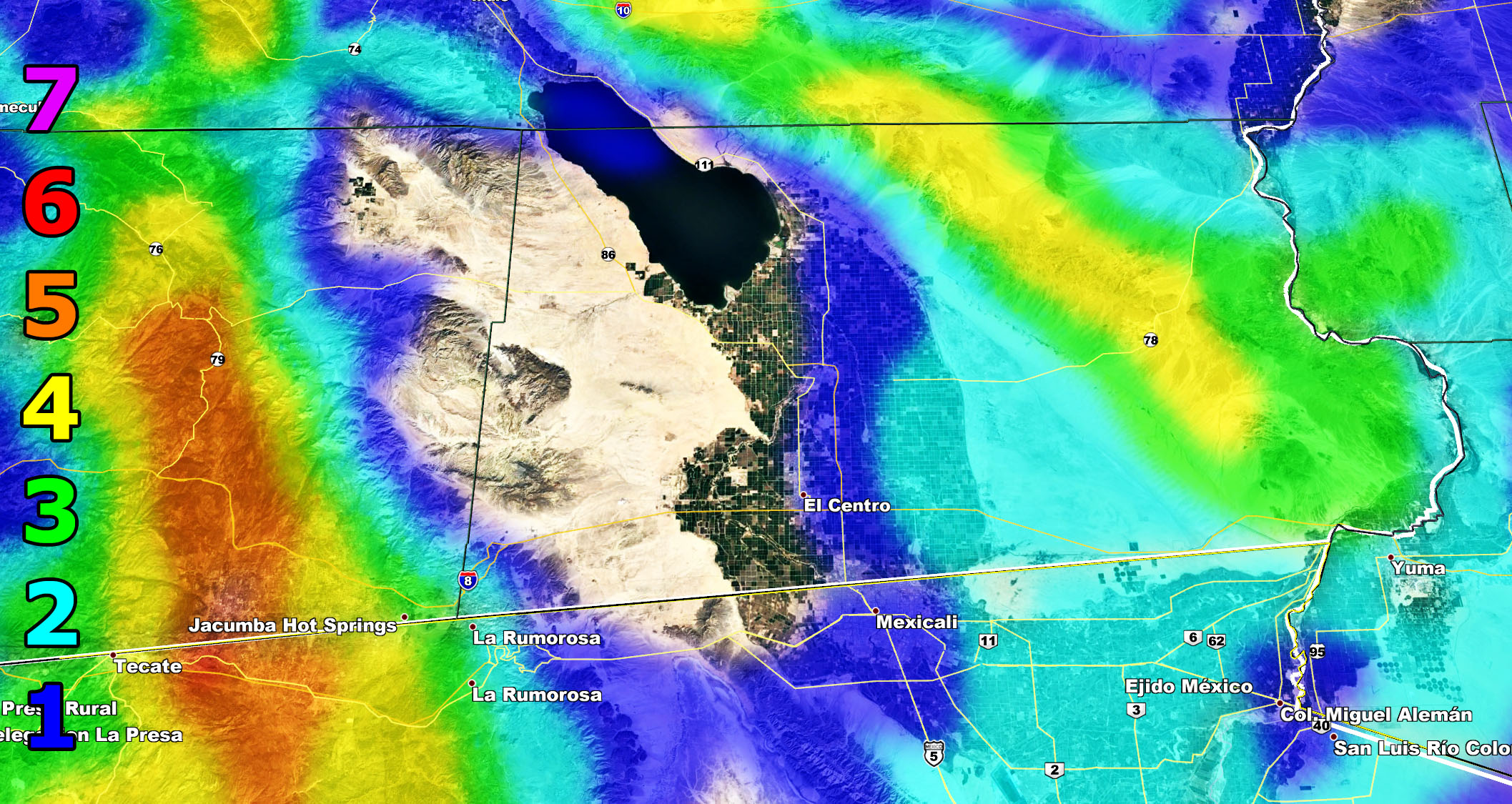
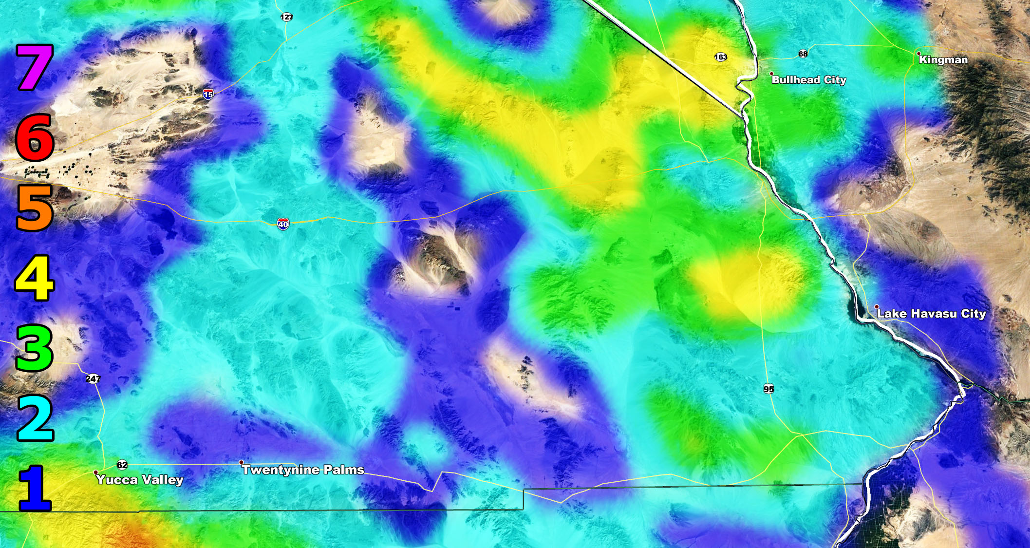
Forecast: A strong storm missing to our west will generate a surface low southwest in the ocean. This surface low will bring strong offshore gradients into the area and Santa Ana Winds will begin on Monday across the region, going through Monday night, and ending over the day on Tuesday. The new style here at SCWF is to not talk about it much, but show you the SCWF wind model with the Martin Wind Gust Scale and those images are below. They are valid Monday through Tuesday, maximizing overnight on Monday.
Trucker Forecast: (Intensity 5 and higher locations for roll-over risks) – Bottom of the Cajon Pass along the 210 – Along the 210 through Tujunga into Santa Clarita – Along the 126 between Fillmore and Santa Paula – I-8 Corridor through the SD Mountains –
Martin Wind Gust Intensity Scale –
8. Extensive widespread damage.
7. Trees are broken or uprooted, building damage is considerable. – High Profile Vehicle Roll-Over CERTAIN.
6. SOME Trees are broken or uprooted, building damage is possible. – High Profile Vehicle Roll-Over Likely, Do NOT recommend Traveling in this zone
5. Slight damage occurs to buildings, shingles are blown off of roofs. HIGH WIND WARNING CRITERIA – High Profile Vehicle Roll-Over Possible if weight is not corrected.
4. Twigs and small branches are broken from trees, walking is difficult.
3. Large trees sway, becoming difficult to walk. POWER SHUTDOWN THRESHOLD WIND ADVISORY CRITERIA
2. Large tree branches move, telephone wires begin to “whistle”, umbrellas are difficult to keep under control.
1. Small trees sway.
How to get these alerts with a premium subscription? (100 percent delivery time)
Click Here For Options
Join A Micro-Climate Group On Facebook For These Alerts? (50 percent delivery time)
Click Here To Find Your Location Served By SCWF Today!
NOTE: If you read this from a SCWF micro-climate Facebook Group, keep in mind that forecast ARTICLES are NOT posted there unless it directly affects you. You will want to go to the MAIN SCWF Facebook Page and to go there you CLICK HERE.
10 mile rule: These alerts issued on this site means that within your zone and 10 miles from you will see the event forecast for. You may or may not see the event but it means you are in the zone or 10 miles from where someone will.
Forecaster: KM