
Issued Zones: Santa Barbara and San Luis Obispo County …
Site: Southern California Weather Force has issued a Special Weather Statement effective tonight through Monday morning at 8am
Date: 12/29/19 at 11:40am PT
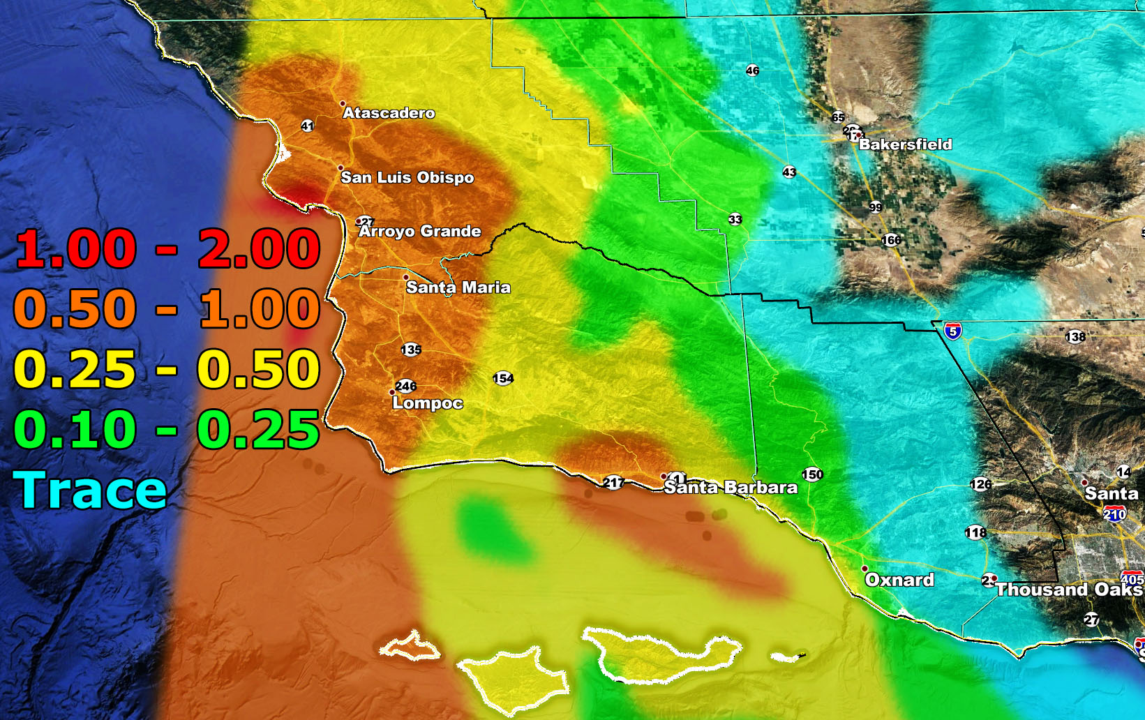
Forecast: A weather system is expected to come into the forecast area and hit the region starting tonight and going into just after 8am on Monday. This quick hitting system will bring a round of rainfall to the statement area and also isolated thunderstorm risks for the Western SLO/SBA County areas.
It is not expected to bring high winds or severe thunderstorm dynamics. There will be a low-moderate risk of flooding along the SBA/SLO Coast with this one but nothing too bad – Use the image below for the SCWF Rainfall Forecast Model to find out your area –
How to get these alerts with a premium subscription? (100 percent delivery time)
Click Here For Options
Join A Micro-Climate Group On Facebook For These Alerts? (50 percent delivery time)
Click Here To Find Your Location Served By SCWF Today!
NOTE: If you read this from a SCWF micro-climate Facebook Group, keep in mind that forecast ARTICLES are NOT posted there unless it directly affects you. You will want to go to the MAIN SCWF Facebook Page and to go there you CLICK HERE.
10 mile rule: These alerts issued on this site means that within your zone and 10 miles from you will see the event forecast for. You may or may not see the event but it means you are in the zone or 10 miles from where someone will.
Forecaster: KM