
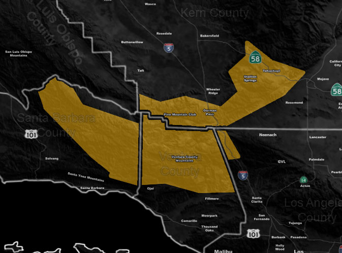
Issued Zones: Kern/Ventura/Santa Barbara County Mountains … Gorman Pass …
Site: Southern California Weather Force has issued a High Wind Watch effective Wednesday into Thursday …
Date: 12/30/19 at 8:50am PT
Forecast: The ridge of high pressure that has brought us the storms the last half of December will move to the east a bit and this will allow storms to miss us to the north and east. This large trough will carve a northwest flow starting Wednesday and going into Thursday across the watch area. Gusty winds will be felt in Tehachapi and some Frazier zones, less in PMC.
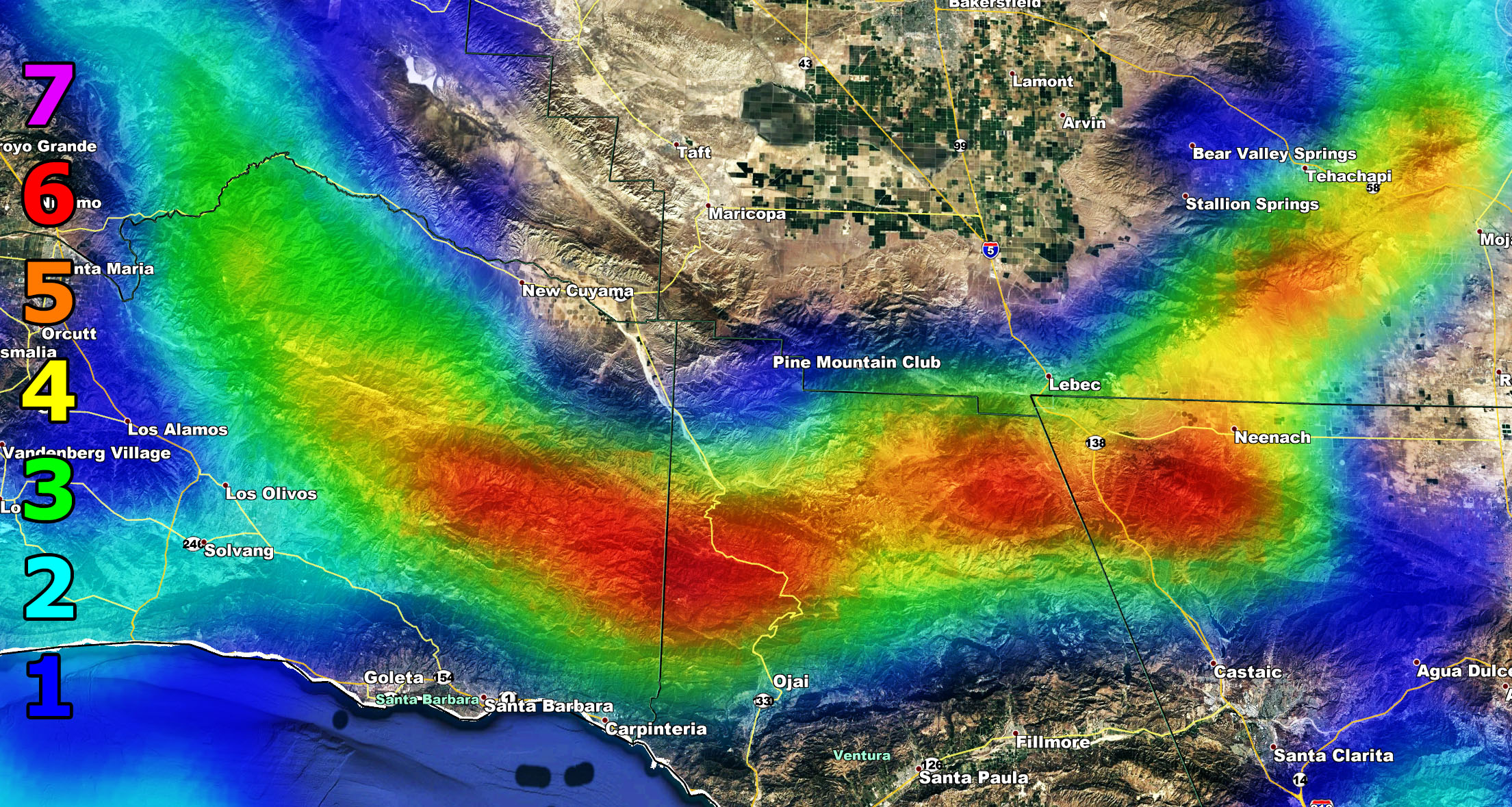
The watch is just south of the Cuddy Valley areas in the VT Mountains, including travels from there down the I-5 corridor between Gorman and the Santa Clarita Valley. The value is an orange value, or 5 on my scale for that area so follow the key below. This will turn into a warning by Tuesday and trends are NOT expected to change. Use the SCWF Wind Model Images below for this alert to find your area …
Martin Wind Gust Intensity Scale –
8. Extensive widespread damage.
7. Trees are broken or uprooted, building damage is considerable. – High Profile Vehicle Roll-Over CERTAIN.
6. SOME Trees are broken or uprooted, building damage is possible. – High Profile Vehicle Roll-Over Likely, Do NOT recommend Traveling in this zone
5. Slight damage occurs to buildings, shingles are blown off of roofs. HIGH WIND WARNING CRITERIA – High Profile Vehicle Roll-Over Possible if weight is not corrected.
4. Twigs and small branches are broken from trees, walking is difficult.
3. Large trees sway, becoming difficult to walk. WIND ADVISORY CRITERIA – Power shutdowns possible ONLY during high fire danger.
2. Large tree branches move, telephone wires begin to “whistle”, umbrellas are difficult to keep under control.
1. Small trees sway.
How to get these alerts with a premium subscription? (100 percent delivery time)
Click Here For Options
Join A Micro-Climate Group On Facebook For These Alerts? (50 percent delivery time)
Click Here To Find Your Location Served By SCWF Today!
NOTE: If you read this from a SCWF micro-climate Facebook Group, keep in mind that forecast ARTICLES are NOT posted there unless it directly affects you. You will want to go to the MAIN SCWF Facebook Page and to go there you CLICK HERE.
10 mile rule: These alerts issued on this site means that within your zone and 10 miles from you will see the event forecast for. You may or may not see the event but it means you are in the zone or 10 miles from where someone will.
Forecaster: KM